
Eagle is a city in Ada County, Idaho, ten miles (16 km) northwest of downtown Boise. The population was 30,346 at the 2020 census.

Garden City is a city in Ada County, Idaho. The population was 12,316 at the time of the 2020 census. Garden City is nearly surrounded by Boise but retains a separate municipal government.
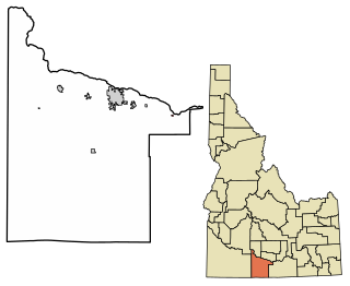
Firth is a town in Bingham County, Idaho, United States. The population was 517 at the 2020 census.

Dover is a city in Bonner County, Idaho. The population was 556 at the 2010 census.
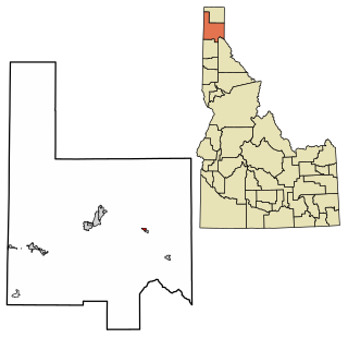
Hope is a city in Bonner County, Idaho, United States. The population was 86 at the 2010 census.

Ponderay is a city in Bonner County, Idaho. The population was 1,137 at the 2010 census, up from 638 in 2000. Ponderay's city motto is "Little City with the Big Future". Its name is an English phonetic spelling of the French words “Pend Oreille”, the name of the lake the city sits upon.
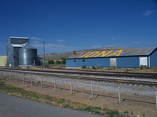
Iona is a city in Bonneville County, Idaho, United States. It is part of the Idaho Falls, Idaho Metropolitan Statistical Area. The population was 1,803 at the 2010 census.

Swan Valley is a city in Bonneville County, Idaho, United States. It is part of the Idaho Falls, Idaho Metropolitan Statistical Area. The population was 204 at the 2010 census.
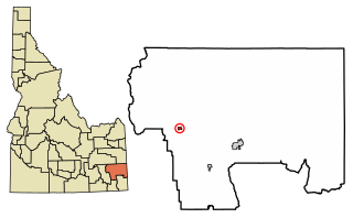
Bancroft is a city in the Gem Valley in Caribou County, Idaho, United States. The population was 299 at the 2020 census, and 377 at the 2010 census.

Dubois is a city in Clark County, Idaho, United States. The population was 511 at the 2020 census. The city is the county seat of Clark County.

Challis is the largest city in Custer County, Idaho, United States. It is the county seat and its population was 1,081 at the 2010 census. The 2020 census showed 902 residents, a 16.6% drop. And as of 2023, the population increased to 924.

Clayton is a city in Custer County, Idaho, United States. The population was 7 at the 2010 census, down from 27 in 2000. It is adjacent to the Salmon River.

Franklin is a city in Franklin County, Idaho, United States. The population was 1,025 at the 2020 census. It is part of the Logan, Utah-Idaho Metropolitan Statistical Area.

Oxford is a city in Franklin County, Idaho, United States. The population was 42 at the 2020 census.

Eden is a city in Jerome County, Idaho, United States. The population was 405 at the 2010 census. It is part of the Twin Falls, Idaho Metropolitan Statistical Area.

Worley is a city in southwestern Kootenai County, Idaho, United States. The population was 257 at the 2010 census, up from 223 in 2000. The city is within the Coeur d'Alene Indian Reservation.

Onaway is a city in Latah County, Idaho, United States. The population was 187 at the 2010 census, down from 230 in 2000.

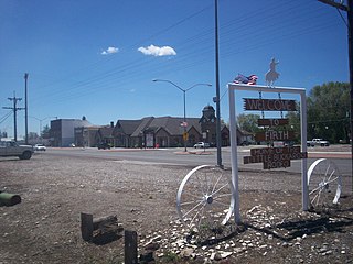
Acequia is a city in Minidoka County, Idaho, United States. The population was 131 at the 2020 census. It is part of the Burley, Idaho Micropolitan Statistical Area. The town is named for the Spanish word for canal.

Smelterville is a city in Shoshone County, Idaho, United States. The population was 627 at the 2010 census.
Murtaugh is a city in Twin Falls County, Idaho, United States. The population was 115 at the 2010 census, down from 139 in 2000. It is part of the Twin Falls, Idaho Micropolitan Statistical Area.


