Rathdrum, Idaho

Last updated

Rathdrum, Idaho
Historic Jail Museum and Community Room.JPG
Old County Jail Museum
Kootenai County Idaho Incorporated and Unincorporated areas Rathdrum Highlighted 1666340.svg
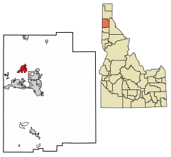
Location of Rathdrum in Kootenai County, Idaho.
Usa edcp location map.svg
Red pog.svg
Rathdrum, Idaho
Location in the United States
Coordinates: 47°48′30″N116°53′35″W / 47.80833°N 116.89306°W / 47.80833; -116.89306
Country United States
State Idaho
County Kootenai
Area
[1]
  Land6.54 sq mi (16.9 km2)
Elevation
[2]
2,215 ft (675 m)
Population
 (2020)
  Total
9,211
  Estimate 
(2023)
11,580
  Density1,408.4/sq mi (543.8/km2)
Time zone UTC-8 (Pacific (PST))
  Summer (DST) UTC-7 (PDT)
ZIP code
83858
Area code 208
FIPS code 16-66340
GNIS feature ID2411521 [2]
Website www.rathdrum.gov

Rathdrum is a city in Kootenai County, Idaho, United States. The population was 9,211 at the 2020 census, up from 6,826 in 2010. [3] It is part of the Coeur d'Alene Metropolitan Statistical Area, which includes the entire county. It is named after Rathdrum, a village in County Wicklow, Ireland.

Contents

According to the United States Census Bureau, the city has a total area of 6.54 square miles (16.94 km2), all land.

Rathdrum is situated at the base of Rathdrum Mountain, which is part of the Selkirk Mountain Range.

History

The intermediate grade wing of Rathdrum's elementary school, John Brown John Brown Elementary, Rathdrum, Idaho.jpg
The intermediate grade wing of Rathdrum's elementary school, John Brown

In the 1800s the town was initially called Westwood in honor of one of the founders of the town, a Pony Express rider and rancher, Charles Wesley Wood, also known as "Wes." But in 1881 the postmaster in the town was informed by the federal government that the town would need to change its name since it was already taken by another town in the territory. A local businessman, Michael M. Cowley, recommended the name "Rathdrum" from County Wicklow in Ireland, his place of birth. [4]

Near the end of the 19th century, the Northern Pacific Railway built its line westwards to Spokane and Rathdrum started to grow slowly. Until today, Rathdrum remains on the only regular railway line in Idaho, now owned by BNSF Railway; the Empire Builder of Amtrak travels through Rathdrum without stopping there.

Demographics

Historical population
CensusPop.Note
1890 218
1900 40786.7%
1910 72578.1%
1920 509−29.8%
1930 496−2.6%
1940 5113.0%
1950 61019.4%
1960 71016.4%
1970 7414.4%
1980 1,36984.8%
1990 2,00046.1%
2000 4,816140.8%
2010 6,82641.7%
2019 (est.)9,150 [5] 34.0%
U.S. Decennial Census [6]

2020 census

As of the census of 2020, there were 9,211 people in the city. The population density was 1,408.4 inhabitants per square mile (543.8/km2). The racial makeup of the city was 87.6% White, 0.0% African American, 0.5% Native American, 1.1% Asian, 1.8% Pacific Islander, 6.5% from two or more races, and 4.8% Hispanic or Latino.

See also

References

  1. "2019 U.S. Gazetteer Files". United States Census Bureau. Retrieved July 9, 2020.
  2. 1 2 U.S. Geological Survey Geographic Names Information System: Rathdrum, Idaho
  3. "U.S. Census Bureau QuickFacts".
  4. How an Irish pioneer named the town of Rathdrum, Idaho after his village Irish Central, 6 Feb 2015
  5. "Population and Housing Unit Estimates". United States Census Bureau. May 24, 2020. Retrieved May 27, 2020.
  6. "Census of Population and Housing". Census.gov. Retrieved June 4, 2015.