
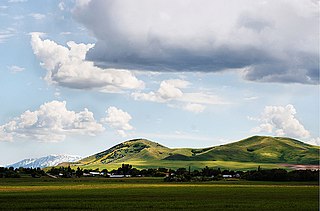
Eagle is a city in Ada County, Idaho, ten miles (16 km) northwest of downtown Boise. The population was 30,346 at the 2020 census.

Chubbuck is a city in Bannock County, Idaho. It is part of the Pocatello Metropolitan Statistical Area. The population was 15,570 at the 2020 census. Chubbuck is located immediately north of Pocatello, Idaho, and has opposed several consolidation proposals since the 1960s.
Plummer is a city in Benewah County, Idaho, United States. The population was 1,044 at the 2010 census, up from 990 in 2000. It is the largest city within the Coeur d'Alene Reservation, and is accessed by U.S. Route 95, the state's primary north–south highway.
Dover is a city in Bonner County, Idaho. The population was 556 at the 2010 census.
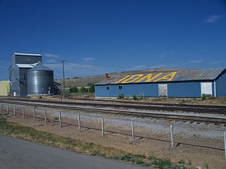
Iona is a city in Bonneville County, Idaho, United States. It is part of the Idaho Falls, Idaho Metropolitan Statistical Area. The population was 1,803 at the 2010 census.

Wilder is a city in Canyon County, Idaho, United States. The population was 1,533 at the 2010 census.
Bancroft is a city in the Gem Valley in Caribou County, Idaho, United States. The population was 299 at the 2020 census, and 377 at the 2010 census.
Weston is a city in Franklin County, Idaho, United States. The population was 511 at the 2020 census. It is part of the Logan, Utah-Idaho Metropolitan Statistical Area. It was first settled in 1865. The community was so named due to its location at the west bank of the Bear River.

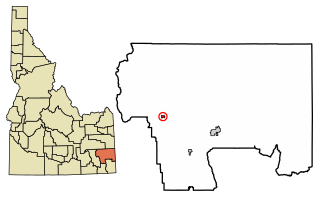
Parker is a city in southeastern Fremont County, Idaho, United States. The population was 305 at the 2010 census. It is part of the Rexburg, Idaho Micropolitan Statistical Area.

Teton is a city in Fremont County, Idaho, United States. The population was 735 at the 2010 census. It is part of the Rexburg, Idaho Micropolitan Statistical Area.

Wendell is a city in southern Gooding County, Idaho, United States. The population was 2,782 at the 2010 census.

Hazelton is a city in Jerome County, Idaho, United States. The population was 807 at the 2020 census. It is part of the Twin Falls, Idaho Micropolitan Statistical Area.

Jerome is a city in and county seat of Jerome County, Idaho, United States. The population was 10,890 at the 2010 census, up from 7,780 in 2000. The city is the county seat of Jerome County, and is part of the Twin Falls Micropolitan Statistical Area. It is the second largest city in Idaho's Magic Valley region, second only to Twin Falls which is located 10 miles (16 km) southeast. Jerome's economy is largely agrarian, with dairy farming being one of the main revenue sources for the local economy.
Dalton Gardens is a city in Kootenai County, Idaho, United States. It is considered a suburb of Coeur d'Alene and borders the city to the north and east. The city of Dalton Gardens is also part of the larger Spokane-Coeur d'Alene Combined Metropolitan Statistical Area which encompasses Kootenai County, Idaho. The population of Dalton Gardens was 2,335 at the time of the 2010 census.

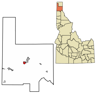
Hauser is a city in Kootenai County, Idaho, United States. The population was 678 at the 2010 census. The city is located on the southern end of Hauser Lake.

Grand View is a city along the Snake River in Owyhee County, Idaho, United States. The population was 440 at the 2020 census. It is part of the Boise City–Nampa, Idaho Metropolitan Statistical Area.

Marsing is a city in Owyhee County, Idaho, United States. The population was 1,031 at the time of the 2010 census. It is part of the Boise metropolitan area.

Fruitland is a city along the Snake and Payette rivers in Payette County, Idaho, United States. It lies along U.S. Route 95 in the Treasure Valley of southwest Idaho, about 50 miles (80 km) west of Boise on the border with Oregon. It is part of the Ontario Micropolitan Area. Fruitland is named after apple orchards that surround the community, and its slogan is "The Big Apple of Idaho."

Osburn is a city in Shoshone County, Idaho, United States. Located in the Silver Valley mining region of northern Idaho, its population was 1,555 at the 2010 census.

Hansen is a city in Twin Falls County, Idaho, United States. The population was 1,086 at the 2020 census, and 1,144 at the 2010 census. It is part of the Twin Falls, Idaho Micropolitan Statistical Area.


