Demography
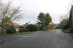
In the 21st century, a lot of building work has been done all over Darras Hall, rendering it largely unrecognisable from its former appearance. In times gone by, Darras Hall was replete with bungalows set in large sprawling and expansive grounds, many of which remain. The large plots are now being used to produce vast mansions, further adding to the exclusivity of Darras Hall.
Many of the gardens in Darras Hall still have evidence of being part of a grand house called Doris Hall. A cursory glance of most gardens will highlight the presence of various apple trees and plum trees, remnants of the old orchards that once sprawled the countryside. [3] Red squirrels, prevalent across the county (Northumberland), make use of and live in trees in gardens of the estate. [4]
The exclusivity of Darras Hall is, in part, regulated by the existence of the Darras Hall Committee. [5] The committee are responsible for disputes among residents and also ensure that all houses are kept in good order, particularly as regard to compliance with minimum plot size, by occupants and third parties. A trust deed and byelaws affect much of the land, the latter explaining that in 1910, a group of landowners and businessmen created the concept of a residential estate to allow people to live in a more rural surrounding rather than in long streets of terraced houses and flats and that it is important to ensure the overall maintenance of the rural ambience. They are a separate regime to planning, which has its own policies. [6]
The 2011 census reveals that the population has seen an increase since 2001 and generally more families. The density of the constituent output areas 33A, 33F, 34A and 34C mirrors urban and suburban areas, with plenty of green spaces and exceptionally in 33A (straying into a small part of the village), a three-year higher median age than in 2001 of 54 and a slightly high dependent dependency ratio of 1.2 and in old age 1.7. [n 1] [7] Most of the estate falls within 34C which has 1,464 people, a density of 580 per km2 and a median age of 48, one year less than 10 years ago.

Throckley is a village in the Newcastle upon Tyne district, in the county of Tyne and Wear, England, approximately 7 miles (11 km) west of Newcastle city centre. Hadrian's Wall passed through the village, its course traced by the village's main road, Hexham Road. Throckley lies within the historic county of Northumberland.

Ponteland is a town and civil parish in Northumberland, England. It is 15 miles (24 km) north of Newcastle upon Tyne. The name means "island in the Pont", after the River Pont which flows from west to east and joins the River Blyth further downstream, before flowing into the North Sea.

Belsay is a village and civil parish in Northumberland, England. The village is about 5 miles (10 km) from Ponteland on the A696, which links the village with Newcastle upon Tyne and Jedburgh. The population of the civil parish was 436 at the 2001 census, increasing to 518 at the 2011 Census.

Berwick Hill is a village and former civil parish, now in the parish of Ponteland, in the county of Northumberland, England. It is situated to the north of Newcastle upon Tyne, near Ponteland. In 1951 the parish had a population of 41.

Elswick is a district and electoral ward of the city and metropolitan borough of Newcastle upon Tyne, in the county of Tyne and Wear, England, 1.9 miles west of the city centre, bordering the River Tyne. Historically in Northumberland, Elswick became part of Newcastle upon Tyne in 1835. Elswick is home to the Newcastle Utilita Arena; and Newcastle College, with approximately 45,000 students.

Backworth is a village in the metropolitan borough of North Tyneside in the county of Tyne and Wear, England, about 3+1⁄2 miles (6 km) west of Whitley Bay on the north east coast. It lies 5 miles (8 km) northeast of Newcastle upon Tyne. Other nearby towns include North Shields to the southeast, Wallsend to the south, and Cramlington to the northwest.

Seaton Delaval is a village and former civil parish, now in the parish of Seaton Valley, in Northumberland, England, with a population of 4,371. The largest of the five villages in Seaton Valley, it is the site of Seaton Delaval Hall, completed by Sir John Vanbrugh in 1727.

Fawdon is an electoral ward of Newcastle upon Tyne, in the county of Tyne and Wear, England. It is also close to the A1 western bypass. The population of the ward is 10,890, reducing to 10,090 at the 2011 Census, 5.7% of the total population of Newcastle upon Tyne. Car ownership in the area is 53.6%, lower than the city average of 54.7%. Until 1974 it was in Northumberland.

Byker is a district in the east of the city and metropolitan borough of Newcastle upon Tyne, in the county of Tyne and Wear, England. Home to the Byker Wall estate, made famous by TV series Byker Grove, Byker's population was recorded at 12,206 in the 2011 census. Byker is bordered by Heaton to the north and by Shieldfield to the north east. Until 1974 it was in Northumberland.

Heaton is a district and suburb in the city of Newcastle upon Tyne, in Tyne and Wear, England, two miles east of the city centre. It is bordered by the neighbouring areas of Walkergate to the east, Jesmond to the north west, Byker to the south, and Sandyford to the west. The name Heaton means high town, referring to the area "being situated on hills above the Ouseburn, a tributary of the River Tyne." The area is divided into South Heaton, and High Heaton, representing the north, respectively. For city council elections, the area is split between three wards: Heaton, Manor Park and Ouseburn. Until 1974 it was in Northumberland.

Great Whittington is a village and former civil parish, now in the parish of Whittington, in Northumberland, England, 7 miles NE of Hexham. In 1951 the parish had a population of 158.

Coxlodge is an area situated between Fawdon, Gosforth and Kenton in Newcastle upon Tyne, in the county of Tyne and Wear, England. Until 1974 it was in Northumberland.

The Ponteland Railway was a 7-mile (11 km) single-track branch line, which linked Gosforth in Tyne and Wear with Ponteland in Northumberland. A 1+1⁄4-mile (2 km) sub-branch line also ran between Ponteland and Darras Hall.

East Denton is an area in the city of Newcastle upon Tyne in the county of Tyne and Wear, England. Until 1974 it was in Northumberland.

Kenton Bank was a railway station on the Ponteland Railway, which ran between South Gosforth and Ponteland, with a sub-branch line to Darras Hall. The station served Kenton in Newcastle upon Tyne.
Callerton was a railway station on the Ponteland Railway, which ran between South Gosforth and Ponteland, with a sub-branch line to Darras Hall. The station served Woolsington in Newcastle upon Tyne.
Coxlodge was a railway station on the Ponteland Railway, which ran between South Gosforth and Ponteland, with a sub-branch line to Darras Hall. The station served Coxlodge and Fawdon in Newcastle upon Tyne.
West Gosforth was a railway station on the Ponteland Railway, which ran between South Gosforth and Ponteland, with a sub-branch line to Darras Hall. The station served Gosforth in Newcastle upon Tyne.

Newton is a village and former civil parish, now the parish of Bywell, in Northumberland, England. It is situated close to the A69 road, 3 miles (5 km) north of Stocksfield and 13 miles (21 km) west of Newcastle upon Tyne. In 1951 the parish had a population of 78. Bywell parish has a population of around 450 and Newton is its most populous settlement. Newton, Newton Hall and Stelling were three separate civil parishes from 1866 to 1 April 1955, when they were merged into the existing Bywell civil parish.

Brenkley is a hamlet and former civil parish about 6 miles from Newcastle upon Tyne, now in the parish of Dinnington, in the Newcastle upon Tyne district, in the county of Tyne and Wear, England. In 1951 the parish had a population of 28.