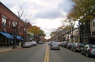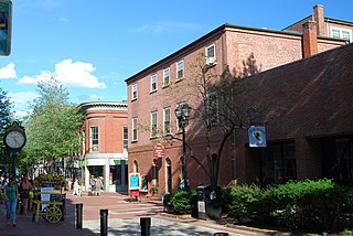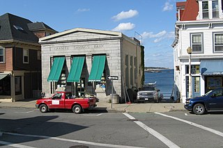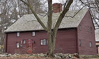
Melrose is a city located in the Greater Boston metropolitan area in Middlesex County, Massachusetts, United States. Its population as of the 2020 census was 29,817. It is a suburb located approximately seven miles north of Boston. It is situated in the center of the triangle created by Interstates 93, 95 and U.S. Route 1.

The Liberty Tree District is a historic district encompassing a collection of six mid-scale commercial buildings between the Downtown Crossing area and the Theater District of Boston, Massachusetts. Located at and near the junction of Washington and Essex Streets, it is a well-preserved collection of mid-19th century commercial architecture, with a history as an important commercial part of Boston dating to the 18th century. The district was added to the National Register of Historic Places in 1980.

The Amherst Central Business District is a historic district encompassing the heart of downtown Amherst, Massachusetts. Centered on the northern section of the long town common, the area has been the civic and commercial heart of the town since the 18th century. The district was listed on the National Register of Historic Places in 1991, and slightly enlarged in 2011.

The First Religious Society Church and Parish Hall is a historic church building at 26 Pleasant Street in Newburyport, Massachusetts. Originally a Reformed congregation, the congregation is currently affiliated with the Unitarian Universalist denomination. The current Minister is Reverend Rebecca M. Bryan. The church's steeple is currently the tallest point in downtown Newburyport, Massachusetts.

Downtown Fall River Historic District is a historic district on North and South Main, Bedford, Granite, Bank, Franklin, and Elm Streets in Fall River, Massachusetts.

The Northampton Downtown Historic District encompasses most of the central business district of Northampton, Massachusetts. This area, which has been a center of commerce and industry in the area since colonial days, extends from the railroad tracks on the east side of the downtown, and west along Main Street to its junction with West Street and Elm Street. When the district was first listed on the National Register of Historic Places, it ended at the railroad tracks, and included properties on a number of other downtown streets; this was extended in 1985 to include a few properties just east of the railroad tracks on and near Bridge Street. The district includes such notable buildings as the 1891 Academy of Music Theatre, and Northampton's castle-like City Hall.

The North High Street Historic District is a historic district encompassing part of the downtown area of Holyoke, Massachusetts. When first added to the National Register of Historic Places in 1986, the district encompassed North High Street, between Dwight and Lyman Streets. This part of High Street was built between 1850 and 1885, and is lined with masonry buildings in Italianate and Second Empire styles. In 1992 the district was extended southward, adding three blocks of High Street between Dwight and Essex Streets. This expansions encompasses the growth of Holyoke during the height of its commercial success, between 1880 and 1930; it also includes the separately-listed Holyoke City Hall. The district was extended a third time, in 2008, adding a complex of three buildings at Dwight and Maple Streets that now houses the Holyoke Health Center.

The Beverly Center Business District encompasses much of the historic 19th century commercial heart of Beverly, Massachusetts. Centered on Cabot and Church Streets between Central Street and the Beverly Common, its architecture reflects the city's growth over 150 years. The district was added to the National Register of Historic Places in 1984.

The Central Gloucester Historic District encompasses the historic commercial, civic, and residential core of the fishing community of Gloucester, Massachusetts. Now largely defined by 19th century architectural trends, it includes the city's commercial downtown, its civic heart on Dale and Prospect Streets, and some adjacent residential areas. It was added to the National Register of Historic Places in 1982.

Downtown Salem District is a historic district roughly bounded by Church, Central, New Derby, and Washington Streets in Salem, Massachusetts. It was added to the National Register of Historic Places in 1983, and represents a major expansion of the Old Town Hall Historic District, which was listed in 1972.

The Essex Institute Historic District is a historic district at 134-132, 128, 126 Essex Street and 13 Washington Square West in Salem, Massachusetts. It consists of a compact group of properties associated with the Essex Institute, founded in 1848 and merged in 1992 into the Peabody Essex Museum. Listed by increasing street number, they are: the Crowninshield-Bentley House, the Gardner-Pingree House, the John Tucker Daland House, and the Phillips Library. The John Ward House, which fronts on Brown Street but shares the 132 Essex Street address, is another National Historic Landmark within the district. The Andrew Safford House at 13 Washington Square West, built in 1819, was said to be the most expensive home in New England at the time.

The Newburyport Historic District encompasses most of the historic downtown area of Newburyport, Massachusetts. It is roughly bounded by the Merrimack River, Marlboro Street, Ashland Street and High Streets. Covering some 750 acres (300 ha) of land and more than 2,500 contributing buildings, it includes the most populous part of the city, and a panoply of architectural styles, dating from the 17th century to the early 20th century. The district was added to the National Register of Historic Places in 1984.

The Rockport Downtown Main Street Historic District encompasses part of the historic center of Rockport, Massachusetts. The district extends along Main Street, from its junction with Beach Street in the west to just east of its junction with School Street. The area is just west of Rockport's noted Bearskin Neck area. Most of the 28 properties in the district are commercial buildings; there are also three churches, a library, and a number of residences. Only a few of these properties front on the side streets adjacent to Main Street; all abut Main Street. The central focal point of the district is the First Congregational Church, built 1803, and the adjacent Federal style Jewett House, a pastor's residence built in 1806. Most of the commercial buildings are modest in scale, and are in a variety of building styles popular in the 19th century.

The Marlborough Center Historic District is a historic district encompassing the civic and commercial heart of Marlborough, Massachusetts. It is centered on a stretch of Main Street between Mechanic Street to the west and Bolton Street to the east, and includes properties on adjacent streets. The center is reflective of the city's prosperity as an industrial center from the mid-19th century to the mid-20th century. The district was listed on the National Register of Historic Places in 1998.

The Phineas Upham House is a historic house at 255 Upham Street in Melrose, Massachusetts. Built in the early 18th century, it is a well preserved example of First Period architecture. Owned by a family association, it is only occasionally open to the public. It was added to the National Register of Historic Places in 1990.

The Central Square Historic District is a historic district encompassing the central town common of the city of Waltham, Massachusetts, and several commercial buildings facing the common or in its immediate vicinity. The common is bounded by Carter, Moody, Main, and Elm Streets; the district includes fourteen buildings, which are located on Main, Elm, Lexington, and Church Streets, on the north and east side of the common. The district was listed on the National Register of Historic Places in 1989.

The Mechanics' Hall District is a historic district encompassing a city block of downtown Worcester, Massachusetts, United States that preserves its late 19th-century appearance. It is located on Main Street between Exchange and Foster Streets, and includes the Worcester Five Cents Savings Bank building and Mechanics Hall. It was added to the National Register of Historic Places in 1980.

The Roswell Butler House is a historic house on Upper Main Street in Essex, Vermont. Built about 1822 with later alterations, it is a good local example of Federal period architecture. It was built for Roswell Butler, a prominent local businessman from whom the surrounding Butler's Corner neighborhood takes its name. The house was listed on the National Register of Historic Places in 2001. It is also known as the 1820 Coffee House and the Kilmoyer House on the Essex Vermont town list of historic sites.

The Downtown Concord Historic District encompasses most of the commercial heart of downtown Concord, New Hampshire, United States. Incorporated in 1734, Concord became the state capital in 1808 and the seat of Merrimack County in 1823. Economic growth followed, due in part to these government institutions and also to the rise of industry along the Merrimack River, which flows through the city east of the downtown area, and the arrival in the 1840s of the railroad. The New Hampshire State House was built in 1819 south of the traditional center of the city, and the commercial heart of the city began to take shape along the First New Hampshire Turnpike south of the State House. The district was listed on the National Register of Historic Places in 2000.

The Downtown Essex Junction Commercial Historic District encompasses the historically railroad-dominated portion of downtown Essex Junction, Vermont. Aligned along the south side of Railroad Avenue and adjacent portions of Main Street, the area underwent most of its development between 1900 and 1940, when Essex Junction served as a major regional railroad hub. The district was listed on the National Register of Historic Places in 2004.


