Dufferin Parish, New Brunswick

Last updated

Dufferin
Charlotte County NB - Dufferin Parish.png
Location within Charlotte County.
Country Flag of Canada (Pantone).svg  Canada
Province Flag of New Brunswick.svg  New Brunswick
County Charlotte County
Erected1873
Area
[1]
  Land12.34 km2 (4.76 sq mi)
Population
 (2021) [1]
  Total565
  Density45.8/km2 (119/sq mi)
  Change 2016-2021
Decrease2.svg 1.4%
  Dwellings
265
Time zone UTC-4 (AST)
  Summer (DST) UTC-3 (ADT)

Dufferin is a geographic parish in Charlotte County, New Brunswick, Canada, [4] located east of St. Stephen.

Contents

For governance purposes, the entire parish is part of the town of the Municipal District of St. Stephen, [5] which is a member of the Southwest New Brunswick Service Commission. [6]

Prior to the 2023 governance reform, it comprised a single local service district (LSD), which was a member of the Southwest New Brunswick Service Commission (SNBSC). [7]

The Census subdivision of the same name shares the parish's boundaries. [1]

Origin of name

The parish was named for the Earl of Dufferin, [lower-alpha 1] who was Governor General of Canada at time. [8]

History

Dufferin was erected in 1873 from Saint Stephen Parish. [9]

Boundaries

Dufferin Parish is bounded: [2] [10] [11]

Local service district

The local service district of the parish of Dufferin comprised the entire parish. [12]

The LSD was established in 1969 to assess for community services, [13] in this case to provide ambulance service after local funeral homes ceased doing so. [14] Fire protection was added in 1970. [15]

In 2021, the LSD assesses for only the basic LSD services of fire protection, police services, land use planning, emergency measures, and dog control. [16] The taxing authority is 509.00 Dufferin.

Communities

Communities at least partly within the parish. [10] [11] [17]

Bodies of water

Bodies of water [lower-alpha 2] at least partly within the parish. [10] [11] [17]

Demographics

Population

Canada census – Dufferin community profile
2021 2016 2011
Population565 (-1.4% from 2016)573 (0.0% from 2011)573 (+7.1% from 2006)
Land area12.34 km2 (4.76 sq mi)12.34 km2 (4.76 sq mi)12.40 km2 (4.79 sq mi)
Population density45.8/km2 (119/sq mi)46.4/km2 (120/sq mi)46.2/km2 (120/sq mi)
Median age50.8 (M: 50.0, F: 52.4)49.6 (M: 48.2, F: 50.2)49.5 (M: 50.5, F: 47.9)
Private dwellings265 (total)  243 (occupied)256 (total) 288 (total) 
Median household income$85,000$73,387$.N/A
Notes: Income data for this area has been suppressed for data quality or confidentiality reasons.
References: 2021 [18] 2016 [19] 2011 [20] earlier [21] [22]
Historical Census Data - Dufferin Parish, New Brunswick
YearPop.±%
1991 480    
1996 451−6.0%
YearPop.±%
2001 548+21.5%
2006 535−2.4%
YearPop.±%
2011 573+7.1%
2016 573+0.0%
[23] [24]

Language

Canada Census Mother Tongue - Dufferin Parish, New Brunswick [23]
CensusTotal
English
French
English & French
Other
YearResponsesCountTrendPop %CountTrendPop %CountTrendPop %CountTrendPop %
2011
575
545Increase2.svg 3.7%94.78%15Increase2.svg 33.3%2.61%0Steady2.svg 0.0%0.00%15Increase2.svg n/a%2.61%
2006
535
525Increase2.svg 1.9%98.13%10Decrease2.svg 60.0%1.87%0Steady2.svg 0.0%0.00%0Decrease2.svg 100.0%0.00%
2001
550
515Increase2.svg 16.5%93.64%25Increase2.svg 20.0%4.54%0Steady2.svg 0.0%0.00%10Increase2.svg n/a%1.82%
1996
450
430n/a95.56%20n/a4.44%0n/a0.00%0n/a0.00%

Access Routes

Highways and numbered routes that run through the parish, including external routes that start or finish at the parish limits: [25]

See also

Notes

  1. Often cited as the 1st Marquess of Dufferin and Ava, a title he didn't hold until 1888.
  2. Not including brooks, ponds or coves.

Related Research Articles

<span class="mw-page-title-main">Dundas Parish, New Brunswick</span> Parish in Canada

Dundas is a geographic parish in Kent County, New Brunswick, Canada.

<span class="mw-page-title-main">Addington Parish, New Brunswick</span> Parish in New Brunswick, Canada

Addington is a geographic parish in Restigouche County, New Brunswick, Canada.

<span class="mw-page-title-main">Balmoral Parish, New Brunswick</span> Parish in New Brunswick, Canada

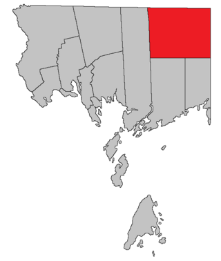
Balmoral is a geographic parish in Restigouche County, New Brunswick, Canada.

<span class="mw-page-title-main">Paquetville Parish, New Brunswick</span> Parish in New Brunswick, Canada

Paquetville is a geographic parish in Gloucester County, New Brunswick, Canada.

<span class="mw-page-title-main">Allardville Parish, New Brunswick</span> Parish in New Brunswick, Canada

Allardville is a geographic parish in Gloucester County, New Brunswick, Canada,

<span class="mw-page-title-main">Saint-Paul Parish, New Brunswick</span> Parish in New Brunswick, Canada

Saint-Paul is a geographic parish in Kent County, New Brunswick, Canada.

<span class="mw-page-title-main">Huskisson Parish, New Brunswick</span> Parish in New Brunswick, Canada

Huskisson is a geographic parish in Kent County, New Brunswick, Canada.

<span class="mw-page-title-main">Saint Andrews Parish, New Brunswick</span> Parish in Canada

Saint Andrews Parish is a geographic parish in Charlotte County, New Brunswick, Canada, located east of St. Stephen.

<span class="mw-page-title-main">Alma Parish, New Brunswick</span> Parish in New Brunswick, Canada

Alma is a geographic parish on the Bay of Fundy in the southwestern corner of Albert County, New Brunswick, Canada.

<span class="mw-page-title-main">Lepreau Parish, New Brunswick</span> Parish in Canada

Lepreau is a geographic parish in Charlotte County, New Brunswick, Canada, west of Saint John.

<span class="mw-page-title-main">Clarendon Parish, New Brunswick</span> Parish in Canada

Clarendon is a geographic parish in Charlotte County, New Brunswick, Canada, located in the interior to the north of Point Lepreau and southwest of CFB Gagetown.

<span class="mw-page-title-main">Pennfield Parish, New Brunswick</span> Parish in Canada

Pennfield is a geographic parish in Charlotte County, New Brunswick, Canada, located west of Saint John located east of St. George and west of Saint John.

<span class="mw-page-title-main">West Isles Parish, New Brunswick</span> Parish in Canada

West Isles is a geographic parish in Charlotte County, New Brunswick, Canada.

<span class="mw-page-title-main">Saint George Parish, New Brunswick</span> Parish in Canada

Saint George is a geographic parish in Charlotte County, New Brunswick, Canada, located between St. Stephen and Saint John.

<span class="mw-page-title-main">Dumbarton Parish, New Brunswick</span> Parish in Canada

Dumbarton is a geographic parish in Charlotte County, New Brunswick, Canada, located inland north of St. George and south of Harvey.

<span class="mw-page-title-main">Saint Patrick Parish, New Brunswick</span> Parish in Canada

Saint Patrick is a geographic parish in Charlotte County, New Brunswick, Canada, located west of St. George and Saint Andrews.

<span class="mw-page-title-main">Saint Croix Parish, New Brunswick</span> Parish in Canada

Saint Croix is a geographic parish in Charlotte County, New Brunswick, Canada, straddling Route 1 to the north of the original town of Saint Andrews.

<span class="mw-page-title-main">Saint Stephen Parish, New Brunswick</span> Parish in Canada

Saint Stephen is a geographic parish in Charlotte County, New Brunswick, Canada, located in the southwestern corner of the province.

<span class="mw-page-title-main">Saint James Parish, New Brunswick</span> Parish in Canada

Saint James is a geographic parish in Charlotte County, New Brunswick, Canada, located north of St. Stephen.

<span class="mw-page-title-main">Saint David Parish, New Brunswick</span> Parish in Canada

Saint David is a geographic parish in Charlotte County, New Brunswick, Canada, located northeast of St. Stephen and northwest of Saint Andrews.

References

  1. 1 2 3 "Census Profile". Statistics Canada. 26 October 2022. Retrieved 29 October 2022.
  2. 1 2 "Chapter T-3 Territorial Division Act". Government of New Brunswick. Retrieved 5 June 2023.
  3. "Chapter I-13 Interpretation Act". Government of New Brunswick. Retrieved 5 June 2023.
  4. The Territorial Division Act [2] divides the province into 152 parishes, the cities of Saint John and Fredericton, and one town of Grand Falls. The Interpretation Act [3] clarifies that parishes include any local government within their borders.
  5. "Southwest Regional Service Commission: RSC 10". Government of New Brunswick. Retrieved 5 June 2023.
  6. "Regions Regulation – Regional Service Delivery Act". Government of New Brunswick. 21 July 2022. Retrieved 5 June 2023.
  7. "Communities in each of the 12 Regional Service Commissions (RSC) / Les communautés dans chacune des 12 Commissions de services régionaux (CSR)" (PDF), Government of New Brunswick, July 2017, retrieved 1 February 2021
  8. Ganong, William F. (1896). A Monograph of the Place-Nomenclature of the Province of New Brunswick. Royal Society of Canada. p. 231. Retrieved 17 March 2021.
  9. "36 Vic. c. 75 An Act to erect a part of the Parish of Saint Stephen, in the County of Charlotte, into a separate Town or Parish.". Acts of the General Assembly of Her Majesty's Province of New Brunswick. Passed in the Months of March & April 1873. Fredericton: Government of New Brunswick. 1873. pp. 253–254. Available as a free ebook from Google Books.
  10. 1 2 3 "No. 160". Provincial Archives of New Brunswick. Department of Natural Resources and Energy Development. Retrieved 3 July 2021. Remainder of parish on map 161 at same site.
  11. 1 2 3 "478" (PDF). Transportation and Infrastructure. Government of New Brunswick. Retrieved 3 July 2021. Remainder of parish on mapbooks 488 and 489 at same site.
  12. "New Brunswick Regulation 84-168 under the Municipalities Act (O.C. 84-582)". Government of New Brunswick. Retrieved 6 February 2021.
  13. "Regulation 69–17 under the Municipalities Act (O. C. 69–161)". The Royal Gazette. 127. Fredericton: 149. 12 March 1969.
  14. "St. Stephen – Milltown Ambulance Brigade". The New Brunswick Municipal Monthly. 25 (3). Fredericton, NB: Department of Municipal Affairs: 5. March 1969.
  15. "Regulation 70–63 under the Municipalities Act (O. C. 70–385)". The Royal Gazette. 128. Fredericton: 343–344. 17 June 1970.
  16. "2020 Local Government Statistics for New Brunswick" (PDF). Department of Environment and Local Government. p. 55. Retrieved 6 February 2021.
  17. 1 2 "Search the Canadian Geographical Names Database (CGNDB)". Government of Canada. Retrieved 4 July 2021.
  18. "2021 Community Profiles". 2021 Canadian Census . Statistics Canada. 4 February 2022. Retrieved 19 October 2023.
  19. "2016 Community Profiles". 2016 Canadian Census . Statistics Canada. 12 August 2021. Retrieved 8 September 2019.
  20. "2011 Community Profiles". 2011 Canadian Census . Statistics Canada. 21 March 2019. Retrieved 15 March 2014.
  21. "2006 Community Profiles". 2006 Canadian Census . Statistics Canada. 20 August 2019.
  22. "2001 Community Profiles". 2001 Canadian Census . Statistics Canada. 18 July 2021.
  23. 1 2 Statistics Canada: 1996, 2001, 2006, 2011 census
  24. "Census Profile, 2016 Census: Dufferin, Parish [Census subdivision], New Brunswick". Statistics Canada. Retrieved 8 September 2019.
  25. Atlantic Canada Back Road Atlas ISBN   978-1-55368-618-7 Pages 4, 12


45°10′46″N67°12′37″W / 45.179496°N 67.210236°W / 45.179496; -67.210236 (Dufferin Parish, New Brunswick)