Dunback

Last updated

Dunback
Waihemo
town
The Highwayman Hotel, Dunback, NZ.JPG
The Highwayman Hotel at Dunback, built from local schist and limestone in 1864.
Dunback
Coordinates: 45°23′S170°38′E / 45.383°S 170.633°E / -45.383; 170.633 Coordinates: 45°23′S170°38′E / 45.383°S 170.633°E / -45.383; 170.633
Country New Zealand
Region Otago
Territorial authority Waitaki District
WardWaihemo Ward
Government
  Local authority Waitaki District Council
  Regional council Otago Regional Council
Time zone UTC+12 (New Zealand Standard Time)
  Summer (DST) UTC+13 (New Zealand Daylight Time)
Postcode
9483

Dunback, formerly Waihemo, is a small town in the Otago region of New Zealand. It is located between Palmerston and Ranfurly on Highway 85. It has a population of about 200 people. Most of these people live in the rural areas near the town.

Contents

The New Zealand Ministry for Culture and Heritage gives a translation of "the finished stream" for Waihemo. [1]

The only remaining buildings now that still stand are the church, the Highwayman Hotel, the coronation hall and the Dunback school. All of these buildings are over 100 years old. There is also the domain which includes a cricket field, camping ground and bowling green. Locals and campers both enjoy the facilities that it has to offer. Along Murphy Street also stands the swing bridge which was built in the early 1900s for pupils to cross the Shag River for easier access to the school.

From 29 August 1885 until 1 January 1968, the town was the terminus of the Dunback Branch, a branch line railway that left the Main South Line in Palmerston. Nowadays, some of the old railway formation, a loading bank at the site of the station yard, and other railway relics can still be found around Dunback.

Demographics

The Waihemo statistical area, which also includes Hampden and Moeraki, and surrounds but does not include Palmerston, covers 1,312.32 km2 (506.69 sq mi). [2] It had an estimated population of 1,430 as of June 2021, [3] with a population density of 1 people per km2.

Historical population for Waihemo
YearPop.±% p.a.
20061,272    
20131,320+0.53%
20181,341+0.32%
Source: [4]

Waihemo had a population of 1,341 at the 2018 New Zealand census, an increase of 21 people (1.6%) since the 2013 census, and an increase of 69 people (5.4%) since the 2006 census. There were 585 households. There were 690 males and 654 females, giving a sex ratio of 1.06 males per female. The median age was 49.9 years (compared with 37.4 years nationally), with 231 people (17.2%) aged under 15 years, 144 (10.7%) aged 15 to 29, 687 (51.2%) aged 30 to 64, and 279 (20.8%) aged 65 or older.

Ethnicities were 92.6% European/Pākehā, 9.4% Māori, 0.7% Pacific peoples, 2.9% Asian, and 0.4% other ethnicities (totals add to more than 100% since people could identify with multiple ethnicities).

The proportion of people born overseas was 13.0%, compared with 27.1% nationally.

Although some people objected to giving their religion, 54.1% had no religion, 34.7% were Christian, 0.2% were Hindu, 0.2% were Buddhist and 1.8% had other religions.

Of those at least 15 years old, 159 (14.3%) people had a bachelor or higher degree, and 267 (24.1%) people had no formal qualifications. The median income was $27,800, compared with $31,800 nationally. 135 people (12.2%) earned over $70,000 compared to 17.2% nationally. The employment status of those at least 15 was that 540 (48.6%) people were employed full-time, 216 (19.5%) were part-time, and 18 (1.6%) were unemployed. [4]

Education

Dunback Public School was established in 1877 [5] and closed in 2001. [6] In the early 20th century, the school had a roll of 63 in a five-room building. [7]

Related Research Articles

Kurow Town in Canterbury, New Zealand

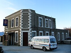
Kurow is a small town in the Waitaki District, New Zealand. It is located on the south bank of the Waitaki River, 60 kilometres (37 mi) northwest of Oamaru.

Waitaki District Territorial authority in New Zealand

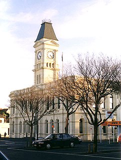
Waitaki District is a territorial authority that is located in the Canterbury and Otago regions of the South Island of New Zealand. It straddles the traditional border between the two regions, the Waitaki River, and its seat is Oamaru.

Central Hawkes Bay District Territorial authority in Hawkes Bay, New Zealand

Central Hawke's Bay District is part of the Hawke's Bay Region in the North Island of New Zealand. Formed in 1989, it has an area of 3,327.92 square kilometres with a population of 15,600. It had a population of 12,717 people as of the 2013 census. This is a decrease of 237 people, or 1.8 percent, since the 2006 census. It covers the area from Pukehou in the north to Takapau in the south, and from the western Ruahine Range to the Pacific coast in the east.

Hampden, New Zealand Town in Otago, New Zealand

Hampden, a small town in North Otago, New Zealand, lies close to the North Otago coast, 35 kilometres south of Oamaru and 80 kilometres north of the city of Dunedin, to both of which it is connected by State Highway 1.

Ashhurst is a town and outlying suburb of Palmerston North, in the Manawatū-Whanganui region of New Zealand's North Island.

Himatangi Place in Manawatū-Whanganui, New Zealand

Himatangi is a small settlement in the Manawatū-Whanganui region of New Zealand's North Island. It is located at the junction of State Highways 1 and 56, 25 kilometres west of Palmerston North, and seven kilometres east of the coastal settlement of Himatangi Beach.

Shannon, New Zealand Town in Manawatū-Whanganui region, New Zealand

Shannon is a small town in the Horowhenua District of New Zealand's North Island. it is located 28 kilometres southwest of Palmerston North and 15 kilometres northeast of Levin.

Linton is a suburb of Palmerston North, situated 11km south-west of the city.

Pukeuri is a settlement to the north of Oamaru in the North Otago region of New Zealand's South Island. It is located near the coast in the Waitaki District that straddles the border of Otago and Canterbury.

Kirwee Minor urban area in Canterbury, New Zealand

Kirwee is a town located west of Christchurch in the Canterbury region of New Zealand's South Island. It was named after Karwi in India by retired British Army colonel De Renzie Brett. Kirwee is also home to the South Island Agricultural Field Days, held biennially.

Hawarden, New Zealand Town in Canterbury, New Zealand

Hawarden is a small town in the Canterbury region of New Zealand's South Island. It is located near Waikari, just off State Highway 7.

Te Horo and Te Horo Beach are two localities on the Kapiti Coast of New Zealand's North Island. Te Horo Beach is the larger of the two settlements and, as its name implies, is located on the Tasman Sea coast. Te Horo is located to the east, a short distance inland. They are situated between Peka Peka and Waikanae to the south and Ōtaki to the north. "Te Horo" in the Māori language means "the landslide".

Aokautere is a suburb of the New Zealand city of Palmerston North. It is situated in the cliffs on the south banks of the Manawatu River.

Cloverlea is a suburb of Palmerston North, New Zealand. The suburb is located north east of Highbury, north west of Palmerston North Hospital Area and north of Takaro.

Ōmokoroa Place in Bay of Plenty, New Zealand

Ōmokoroa is a small urban area in the Western Bay of Plenty District of New Zealand. The suburb is considered part of Greater Tauranga, and is within the Coromandel electorate. Ōmokoroa began as a small rural holiday village, but is expanding to be a commuter town, with a 25-minute drive to Tauranga City.

Mangatainoka Place in Manawatū-Whanganui, New Zealand

Mangatainoka is a small settlement in the Tararua District of New Zealand's North Island. It is located on the banks of the Mangatainoka River, 5 km (3.1 mi) north of Pahiatua.

Waikuku Town in Canterbury, New Zealand

Waikuku is a small town in the Canterbury region of New Zealand, which sits 28 km north of central Christchurch. Waikuku lies 11.8 km south of Leithfield on state highway 1 and 3 km north of Woodend. In 1901 there were 86 people resident in Waikuku according to that year's census. Waikuku settlement had a population of 156 people at the time of the 2018 Census. It is popular with both those that commute into work in Christchurch each day and with owners of holiday houses. Waikuku was home to rope and twine works. This business started off using flax from local swamps. It closed in 1987. The nearby sandy beach and pine forests are popular with surfers, swimmers, campers and horse-riders, and the large estuary of the Ashley River hosts many species of birds.

Maheno, New Zealand Rural settlement in Otago, New Zealand

Maheno is a small North Otago township south of Oamaru in New Zealand. The area has 75 residents. A number of the town's streets are named after places in Tyne and Wear, England, such as Whickham, Felling, Heworth and Jarrow.

Ashley, New Zealand Town in Canterbury, New Zealand

Ashley is a small town in North Canterbury, in the South Island of New Zealand. It used to have a railway station on the Main North Line that runs through the village.

Rongotea Village in Manawatū-Whanganui region, New Zealand

Rongotea is a small rural village in the Manawatū District of the Manawatū-Whanganui region. Located on the western Manawatū Plains, approximately 19 km (12 mi) northwest of the region's main city, Palmerston North.

References

  1. "1000 Māori place names". New Zealand Ministry for Culture and Heritage. 6 August 2019.
  2. "ArcGIS Web Application". statsnz.maps.arcgis.com. Retrieved 1 November 2021.
  3. "Population estimate tables - NZ.Stat". Statistics New Zealand . Retrieved 22 October 2021.
  4. 1 2 "Statistical area 1 dataset for 2018 Census". Statistics New Zealand. March 2020. Waihemo (343600). 2018 Census place summary: Waihemo
  5. Swarbrick, Nancy (24 November 2008). "Dunback School". Te Ara: The Encyclopedia of New Zealand .
  6. "Dunback School (3730) Closure Notice". New Zealand Government. 12 April 2001.
  7. "The Dunback Public School". The Cyclopedia of New Zealand . Otago & Southland Provincial Districts. 1905.