
Little Barford is a hamlet and civil parish in the Borough of Bedford in Bedfordshire, England about 7 miles (11 km) northeast of the county town of Bedford.

Irby is a village on the Wirral Peninsula, in Merseyside, England. The village covers an area of 20 square kilometres. To the north of Irby lies the associated hamlet of Irby Hill. It is part of the Greasby, Frankby and Irby Ward of the Metropolitan Borough of Wirral and is within the parliamentary constituency of Wirral West.
Burghfield is a village and large civil parish in West Berkshire, England, with a boundary with Reading. Burghfield can trace its history back to before the Domesday Book, and was once home to three manors: Burghfield Regis, Burghfield Abbas, and Sheffield. Since the 1980s the population of Burghfield has nearly doubled with the construction of housing estates, making it a dormitory for Reading, Newbury, Basingstoke and the M4 corridor.

Tillingham is a small village and civil parish with 1,015 inhabitants in 2001, increasing to 1,058 at the 2011 Census. Located 8 miles (13 km) from Burnham-on-Crouch and 3 miles (4.8 km) from Bradwell-on-Sea, on the Dengie Peninsula which is a Maldon District part of the ceremonial county of Essex in England. It is one of the villages that make up the ancient Dengie Hundred, which is bounded by the North Sea, River Blackwater and River Crouch.
Ashmansworth is a village and civil parish in the Basingstoke and Deane district of the English county of Hampshire.

Bentworth is a village and civil parish in the East Hampshire district of Hampshire, England. The nearest town is Alton, which lies about 3 miles (5 km) east of the village. It sits within the East Hampshire Hangers, an area of rolling valleys and high downland. The parish covers an area of 3,763 acres (15.23 km2) and at its highest point is the prominent King's Hill, 716 feet (218 m) above sea level. According to the 2011 census, Bentworth had a population of 553.

Stapleford Abbotts is a village and civil parish in the Epping Forest district of Essex, approximately 5.5 mi (9 km) SW of Ongar, 4.5 mi (7 km) N of Romford and 5 mi (8 km) SSE of Epping. The whole parish is within the M25 motorway. The village covers 957 hectares and had a population of 959 in 2001, increasing to 1,008 at the 2011 Census.
Colmworth is a village and civil parish in the Borough of Bedford in the county of Bedfordshire, England about 6.5 miles (10 km) north-east of Bedford.

Bouldon is a hamlet in Shropshire, England. It lies in the civil parish of Diddlebury.

Burstall is a village and civil parish in Suffolk, England. Located around 4 miles (6 km) west of Ipswich, it is part of Babergh district. The parish includes the hamlet of Burstallhill. Recorded in the Domesday Book as Burgestala / Burghestala. It is in the Belstead Brook electoral division of Suffolk County Council.

Dungworth is a hamlet in the civil parish of Bradfield, west of Sheffield in South Yorkshire, England.

Church Preen is a dispersed hamlet and small civil parish in central Shropshire, England. The county town of Shropshire is Shrewsbury, which is located to the North and by road is 12 miles.

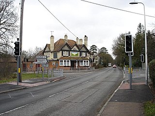
Hastingwood is a hamlet in the North Weald Bassett civil parish of the Epping Forest district of Essex, England. The hamlet is centred on the junction of Hastingwood Road, which runs southwest to the A414 road and the Hastingwood Junction 7 of the M11 motorway, and Mill Street, which runs north to Harlow Common and Potter Street. Nearby settlements include the town of Harlow, North Weald and the hamlet of Foster Street.

Strefford is a historic hamlet in Shropshire, England.

Ettrick Bay is a wide, tidal, sandy coastal embayment with a chord of 1 mile (2 km), on a 218° bearing, located on the west coast of the Isle of Bute in the Firth of Clyde, within council area of Argyll and Bute in Scotland. The bay was used for practice training for the D-Day landings.

Adscombe Chapel: The site and remains of a medieval chapel, located 280 metres (920 ft) east of Adscombe Farm in Somerset, UK, situated on the north-west facing slope of a prominent ridge.

Clifton and Compton is a civil parish within the Derbyshire Dales district, in the county of Derbyshire, England. The parish, despite the name, only includes the villages of Clifton and Hangingbridge; there is a place named Compton nearby in Ashbourne parish. In 2011 the parish had a population of 500. It is 124 miles (200 km) north west of London, 13 miles (21 km) north west of the county city of Derby, and 1+1⁄3 miles south west of the market town of Ashbourne. Clifton and Compton touches the parishes of Ashbourne, Edlaston and Wyaston, Mayfield, Offcote and Underwood, Osmaston, Okeover and Snelston. There are eight listed buildings in Clifton and Compton.

Offcote and Underwood is a civil parish within the Derbyshire Dales district, in the county of Derbyshire, England. Largely rural, in 2011 the parish had a population of 526. It is 125 miles (201 km) north west of London, 13 miles (21 km) north west of the county city of Derby, and 1 mile north east of the market town of Ashbourne. Offcote and Underwood borders the Peak District, and touches the parishes of Ashbourne, Bradley, Clifton and Compton, Fenny Bentley, Kniveton, Mapleton and Okeover. There are 12 listed buildings in Offcote and Underwood.
Highlow is a civil parish within the Derbyshire Dales district, in the county of Derbyshire, England. Largely rural, Highlow's population is reported with the population of neighbouring parishes for a total of 585 residents in 2011. It is 140 miles (230 km) north-west of London, 28 miles (45 km) north-west of the county city of Derby, and 7+1⁄2 miles (12.1 km) north of the nearest market town of Bakewell. Highlow is wholly within the Peak District national park, and shares a border with the parishes of Abney and Abney Grange, Eyam, Foolow, Grindleford, Hathersage as well as Offerton. There are nine listed buildings in Highlow.

Brampton is a civil parish in North East Derbyshire, England, with a population of 1,201 in 2011. Lying 130 miles (210 km) north west of London, 20 miles (32 km) north of Derby, and 2 miles (3.2 km) west of the market town of Chesterfield, Brampton encompasses part of the Peak District national park to the west, and shares a border with the Borough of Chesterfield, Barlow, Baslow and Bubnell, Beeley, and Holymoorside and Walton. The parish contains a number of settlements including the village it was named after, but does not include the nearby built-up suburb of Brampton which is now within the Chesterfield unparished area.


