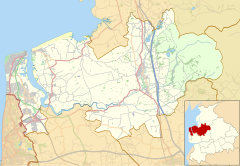
The Borough of Fylde is a local government district with borough status in Lancashire, England. It covers part of the Fylde plain, after which it is named. The council's headquarters are in St Annes. The borough also contains the towns of Kirkham, Lytham and Wesham and surrounding villages and rural areas.

Wyre is a local government district with borough status on the coast of Lancashire, England. The council is based in Poulton-le-Fylde and the borough also contains the towns of Cleveleys, Fleetwood, Garstang, Preesall and Thornton, along with numerous villages and surrounding rural areas. Some of the borough's built-up areas form part of the wider Blackpool urban area. Eastern parts of the borough lie within the Forest of Bowland, a designated Area of Outstanding Natural Beauty.

Poulton-le-Fylde, commonly shortened to Poulton, is a market town in Lancashire, England, situated on the coastal plain called the Fylde. In the 2021 United Kingdom census, it had a population of 18,115.
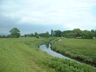
The River Wyre, in Lancashire, England, flows into the Irish Sea at Fleetwood. It is 28 miles (45 km) long and has a sheltered estuary which penetrates deep into the Fylde peninsula.
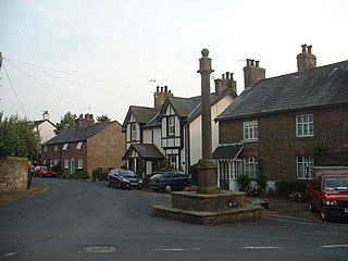
Kirkland is a civil parish, located on the banks of the River Wyre, midway between Preston and Lancaster, in the English county of Lancashire. It is also the historic name of what is now the village of Churchtown, within the parish. It is part of the Wyre district. In 2001 the parish had a population of 343, decreasing to 314 at the 2011 census.

Hambleton is a village and civil parish in the English county of Lancashire. It is situated on a coastal plain called the Fylde and in an area east of the River Wyre known locally as Over Wyre. Hambleton lies approximately 3 miles (4.8 km) north-east of its post town, Poulton-le-Fylde, and about 7 miles (11 km) north-east of the seaside resort of Blackpool. In the 2001 United Kingdom census, the parish had a population of 2,678, increasing to 2,744 at the 2011 census.

Inskip is a small village in the Fylde area of Lancashire, England. It is part of the civil parish of Inskip-with-Sowerby. The village is close to the former RNAS Inskip airfield, which still serves the armed forces as a tri-service communication centre.
The Fylde is a coastal plain in western Lancashire, England. It is roughly a 13-mile-long (21-kilometre) square-shaped peninsula, bounded by Morecambe Bay to the north, the Ribble estuary to the south, the Irish Sea to the west, and the foot of the Bowland hills to the east which approximates to a section of the M6 motorway and West Coast Main Line.
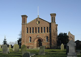
Out Rawcliffe is a village and civil parish on the north bank of the River Wyre in the Over Wyre area of the Fylde in Lancashire, England. The population of the civil parish taken at the 2011 census was 626.

St Michael's on Wyre is a village on the Fylde, in the Borough of Wyre, in Lancashire, England; it lies on the River Wyre. The village is centred on the church of St Michael, which was founded before 640 AD. It is in the civil parish of Upper Rawcliffe with Tarnacre, which had a population in 2001 of 604.

Elswick is a rural village and civil parish on the Fylde coast of Lancashire, England. At the 2011 Census, it had a population of 1,079.

Stalmine-with-Staynall is a civil parish within the Wyre borough of Lancashire, England, in a part of the Fylde known as Over Wyre. The parish contains the village of Stalmine and the hamlets of Staynall and Wardleys. The civil parish had a population of 1,486 at the 2011 Census, of which 1,087 lived in Stalmine village.

Great Eccleston is a village and civil parish in Lancashire, England, situated on a coastal plain called the Fylde. The village lies to the south of the River Wyre and the A586 road, approximately 10 miles (16 km) upstream from Fleetwood. At the 2001 census, the parish had a population of 1,473, rising slightly to 1,486 at the 2011 census.
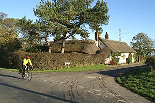
Treales, Roseacre and Wharles is a civil parish in the Borough of Fylde, Lancashire, England. It had a population of 492 at the 2011 Census. It lies two miles east of Kirkham and includes the villages of Bolton Houses, Moor Side, Roseacre, Treales and Wharles.
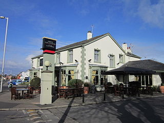
Carleton is a village on the coastal plain of the Fylde in the Borough of Wyre in Lancashire, England. It consists of Great Carleton, Little Carleton, Norcross and Whiteholme and is situated close to Poulton-le-Fylde. Other nearby settlements include Thornton, Bispham and Blackpool. Historically, Carleton was in the parish of Poulton-le-Fylde. It borders the Borough of Blackpool immediately to the west.

Upper Rawcliffe-with-Tarnacre is a civil parish on the Fylde, in the Borough of Wyre, in Lancashire, England. It had a population of 604 in 2001, increasing to 629 at the 2011 Census. The only settlements in the parish are the village of St Michael's on Wyre and the tiny hamlet of Ratten Row. The River Wyre passes through the parish, and the River Brock joins the Wyre on the parish boundary.
Treales, Roseacre and Wharles is a civil parish in the Borough of Fylde, Lancashire, England. It contains six buildings that are recorded in the National Heritage List for England as designated listed buildings, all of which are listed at Grade II. This grade is the lowest of the three gradings given to listed buildings and is applied to "buildings of national importance and special interest". The parish contains small settlements, but is mainly rural. The listed buildings consist of dwellings, a public house, a school, and a converted windmill.
Inskip-with-Sowerby is a civil parish in the Wyre district of Lancashire, England. It contains six listed buildings that are recorded in the National Heritage List for England. All the listed buildings are designated at Grade II, the lowest of the three grades, which is applied to "buildings of national importance and special interest". The parish includes the village of Inskip and surrounding countryside. The listed buildings are two houses, two farmhouses, a former workshop, and a church.
Upper Rawcliffe-with-Tarnacre is a civil parish in the Wyre district of Lancashire, England. It contains nine buildings that are recorded in the National Heritage List for England as designated listed buildings. Of these, one is listed at Grade I, the highest of the three grades, and the others are at Grade II, the lowest grade. The parish includes the village of St Michael's on Wyre and is otherwise rural. The River Wyre passes through the parish, and a bridge crossing it is listed. The other listed buildings are a church and associated mounting block, a country house, a pair of gate piers, a war memorial, two milestones, and a combined milestone and boundary stone.

