Scronkey

Last updated

Scronkey
Scronkey - geograph.org.uk - 1375427.jpg
Scronkey
Location map United Kingdom Borough of Wyre.svg
Red pog.svg
Scronkey
Shown within Wyre Borough
Location map United Kingdom The Fylde.svg
Red pog.svg
Scronkey
Shown on the Fylde
Lancashire UK location map.svg
Red pog.svg
Scronkey
Location within Lancashire
OS grid reference SD410471
Civil parish
District
Shire county
Region
Country England
Sovereign state United Kingdom
Post town PRESTON
Postcode district PR3
Dialling code 01253
Police Lancashire
Fire Lancashire
Ambulance North West
UK Parliament
List of places
UK
England
Lancashire
53°55′01″N2°53′49″W / 53.917°N 2.897°W / 53.917; -2.897

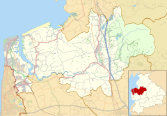
Scronkey is a small rural hamlet in the county of Lancashire, England. It is in the Over Wyre region of the Fylde, west of Garstang near Pilling.

The combined population of Scronkey and Eagland Hill was 272 in 2001. [1]
Related Research Articles

<span class="mw-page-title-main">Pilling</span> Village in Lancashire, England

Pilling is a village and civil parish within the Wyre borough of Lancashire, England. It is 6.5 miles (10.5 km) north-northeast of Poulton-le-Fylde, 9.4 miles (15.1 km) south-southwest of Lancaster and 14.5 miles (23.3 km) northwest of Preston, in a part of the Fylde known as Over Wyre.

References