Scorton | |
---|---|
St. Peter's Church, Scorton | |
Location within Lancashire | |
Population | 297 [1] (2001 Census) |
OS grid reference | SD501488 |
Civil parish | |
District | |
Shire county | |
Region | |
Country | England |
Sovereign state | United Kingdom |
Post town | PRESTON |
Postcode district | PR3 |
Dialling code | 01524 |
Police | Lancashire |
Fire | Lancashire |
Ambulance | North West |
UK Parliament | |
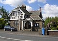
Scorton is a small village near the River Wyre, in the Wyre district of Lancashire, England. It is located north of Garstang. The name means "farmstead near a ditch or ravine." [2]
In the 19th century there was a cotton mill in the village [3] and also a railway station on the West Coast Main Line which ran from 1841 until 1939. [4] The village has three churches, a primary school, village hall, the Priory Hotel, Daisy Clough Nurseries and Wyresdale Park, and is home to The Barn garden centre, gift shop, cafe and restaurant. The annual Scorton Steam show takes place on Fathers' Day weekend in June each year [5] and the Lancashire Game and Country Festival which takes place at the same purpose-built showground. [6]
The hills around include the much walked Nicky Nook on the edge of the Forest of Bowland area.
St. Peters Church, built 1878–79, one of three churches in the village, has a special family grave set up for the Farnworth and Metcalfe family, by James Metcalfe in the late 1950s.
Wyresdale Hall, built 1856–58, is one mile north-east and was built for the Ormrod family of Bolton.
Scorton Village Hall, built 1926, gifted by the Ormrod family to the people of the village.
Wyresdale Hall, a grade II listed country house and estate with licensed wedding barns, fishing lake and host to the Apple Store Cafe is located near the village. [7]
The Forest of Bowland, also known as the Bowland Fells and formerly the Chase of Bowland, is an area of gritstone fells, deep valleys and peat moorland, mostly in north-east Lancashire, England, with a small part in North Yorkshire. It is a western outlier of the Pennines.
Lytham St Annes is a seaside town in the Borough of Fylde in Lancashire, England. It is on the Fylde coast, directly south of Blackpool on the Ribble Estuary. The population at the 2011 census was 42,954. The town is almost contiguous with Blackpool but is separated from it by Blackpool Airport. The town is made up of the four areas of Lytham, Ansdell, Fairhaven and St Annes-on-Sea.
Poulton-le-Fylde, commonly shortened to Poulton, is a market town in Lancashire, England, situated on the coastal plain called the Fylde. In the 2001 United Kingdom census, it had a population of 18,264. There is evidence of human habitation in the area from 12,000 years ago and several archaeological finds from Roman settlement in England have been found in the area. At the time of the Norman conquest, Poulton was a small agricultural settlement in the hundred of Amounderness. The church of St Chad was recorded in 1094 when it was endowed to Lancaster Priory. By the post-Medieval period the town had become an important commercial centre for the region with weekly and triannual markets. Goods were imported and exported through two harbours on the River Wyre. In 1837, the town was described as the "metropolis of the Fylde", but its commercial importance waned from the mid-19th century with the development of the nearby coastal towns of Fleetwood and Blackpool.
Sutton Cheney is a village and civil parish in the borough of Hinckley and Bosworth in the county of Leicestershire, England, near the county border with Warwickshire. In addition to the village of Sutton Cheney itself, the civil parish also contains the villages of Dadlington and Shenton, a number of farms, and the location of the Battle of Bosworth. Its closest large towns are Nuneaton and Hinckley. Its closest market town is Market Bosworth.
Fleetwood is a coastal town in the Borough of Wyre in Lancashire, England, at the northwest corner of the Fylde. It had a population of 25,939 at the 2011 census.
The River Wyre is a river in Lancashire, England, United Kingdom, which flows into the Irish Sea at Fleetwood. It is approximately 28 miles (45 km) in length. The river is a County Biological Heritage Site and has a sheltered estuary which, from its northwest corner, penetrates deep into the almost square peninsula of the Fylde.
Nelson is a town and civil parish in the Borough of Pendle in Lancashire, England, with a population of 29,135 in 2011. It is 4 miles (6.4 km) north of Burnley and 2.5 miles southwest of Colne.
Bleasdale is a village and civil parish in the Wyre district of Lancashire, England, in the Forest of Bowland Area of Outstanding Natural Beauty. The two sources of the River Brock lie within the parish. According to the 2001 census, it had a population of 147, increasing to 167 at the 2011 Census.
Eccleston is a civil parish in the Metropolitan Borough of St Helens, Merseyside, England. At the 2011 census, it had a population of 10,433.
Preesall is a town, civil parish and electoral ward in Lancashire, England. The parish covers the eastern bank of the estuary of the River Wyre, including Knott End-on-Sea, Pilling Lane and the village of Preesall itself. The parish of Preesall had a population of 5,314 recorded in the 2001 census, rising to 5,694 at the 2011 census.
Scorton is a village and civil parish in the Richmondshire district of North Yorkshire, England. It is approximately 8 miles (13 km) north-west of the county town of Northallerton.
Hambleton is a village and civil parish in the English county of Lancashire. It is situated on a coastal plain called the Fylde and in an area east of the River Wyre known locally as Over Wyre. Hambleton lies approximately 3 miles (4.8 km) north-east of its post town, Poulton-le-Fylde, and about 7 miles (11 km) north-east of the seaside resort of Blackpool. In the 2001 United Kingdom census, the parish had a population of 2,678, increasing to 2,744 at the 2011 census.
Stalmine is a village in the civil parish of Stalmine-with-Staynall, in the Wyre borough of Lancashire, England, in a part of the Fylde known as Over Wyre. The village is located on a small hill on the A588, the main road between Hambleton and Lancaster, with the highest level 75 ft above sea level. The village name has been spelled Stalmin and Stalemynne. The village had a population of 1,087 at the 2011 Census.
Calder Vale is an English village, located on the edge of the Forest of Bowland in Lancashire. It lies on the River Calder in a deep valley with only a single road providing vehicular access. The name Calder is thought to be derived from the Old Norse kaldr ("cold").
Sir Peter Hesketh-Fleetwood, 1st Baronet, was an English landowner, developer and Member of Parliament, who founded the town of Fleetwood, in Lancashire, England. Born Peter Hesketh, he changed his name by Royal assent to Hesketh-Fleetwood, incorporating the name of his ancestors, and was later created Baronet Fleetwood. Predeceased by an older brother, he inherited estates in west Lancashire in 1824. Inspired by the transport developments of the early 19th century, he decided to bring the railway to the Lancashire coast and develop a holiday resort and port. He hired architect Decimus Burton to design his new town, which he named Fleetwood; construction began in 1836. Hesketh-Fleetwood was instrumental in the formation of the Preston and Wyre Railway Company and with his financial support, a railway line was built between Preston and Fleetwood which opened in 1840.
Nether Wyresdale is a civil parish in Lancashire, England. In the 2001 United Kingdom census, it had a population of 613, rising to 655 at the 2011 Census.
Wyresdale Park is an English country house and licensed wedding ceremony venue located within the Forest of Bowland to the northeast of Scorton, Lancashire, England.
St Peter's Church is in the village of Scorton, Lancashire, England. It is an active Anglican parish church in the deanery of Garstang, the archdeaconry of Lancaster and the diocese of Blackburn. Its benefice is united with those of All Saints, Barnacre, and St John the Evangelist, Calder Vale. The church is recorded in the National Heritage List for England as a designated Grade II listed building. Its spire is a landmark near the M6 motorway.
Nether Wyresdale is a civil parish in the Wyre district of Lancashire, England. It contains 23 listed buildings that are recorded in the National Heritage List for England. All the listed buildings are designated at Grade II, the lowest of the three grades, which is applied to "buildings of national importance and special interest". The parish includes the villages of Scorton, the southern part of the village of Dolphinholme, and the countryside between and around them. Most of the listed buildings are houses, cottages, country houses and associated structures, and farmhouses. Also listed are a medieval cross base, a milestone, bridges, and churches and associated structures.
Wardleys Pub was a public house on Wardley's Lane in the civil parish of Stalmine-with-Staynall, near the village of Hambleton, Lancashire. The building dated to the 18th century and occupied a location, on the eastern banks of the River Wyre and beside Wardleys Creek, believed to have been used since Roman times. Prior to nearby Fleetwood's emergence as a harbour, people emigrated to the Americas from the creek, including aboard the Quebec-bound Six Sisters on 3 April 1833. The harbour's foundation rocks are still visible beneath today's wooden jetty. A ferry used to run from Cockle Hall, on the western side of the river, to Wardleys Creek. Parts of the pier are still visible in the marsh in front of where Cockle Hall once stood.