Eagle Butte, South Dakota

Last updated

Eagle Butte, South Dakota
Eagle Butte, South Dakota - panoramio.jpg
Entering Eagle Butte on US-212
Dewey County South Dakota Incorporated and Unincorporated areas Eagle Butte Highlighted.svg
Location in Dewey County and the state of South Dakota
Coordinates: 44°59′38″N101°13′52″W / 44.99389°N 101.23111°W / 44.99389; -101.23111
CountryUnited States
State South Dakota
Counties Dewey, Ziebach
Incorporated1911 [1]
Area
[2]
  Total1.47 sq mi (3.80 km2)
  Land1.36 sq mi (3.53 km2)
  Water0.10 sq mi (0.27 km2)
Elevation
[3]
2,421 ft (738 m)
Population
 (2020) [4]
  Total1,258
  Density923.64/sq mi (356.73/km2)
Time zone UTC−7 (Mountain (MST))
  Summer (DST) UTC−6 (MDT)
ZIP code
57625
Area code 605
FIPS code 46-17620 [5]
GNIS feature ID1267361 [3]

Eagle Butte is a city in Dewey and Ziebach counties in South Dakota, United States. The population was 1,258 at the 2020 census. [6] It is adjacent to the North Eagle Butte CDP.

Contents

Description

Eagle Butte is the tribal headquarters of the Cheyenne River Sioux Tribe on the Cheyenne River Indian Reservation. [7]

The city takes its name from Eagle Butte. [8]

Geography

According to the United States Census Bureau, the city has a total area of 1.17 square miles (3.03 km2), all land. [9]

Demographics

Historical population
CensusPop.Note
1920 210
1930 38784.3%
1940 374−3.4%
1950 3750.3%
1960 49532.0%
1970 5307.1%
1980 435−17.9%
1990 48912.4%
2000 61926.6%
2010 1,318112.9%
2020 1,258−4.6%
U.S. Decennial Census [10] [4]

2010 census

As of the census [11] of 2010, there were 1,318 people, 384 households, and 279 families living in the city. The population density was 1,126.5 inhabitants per square mile (434.9/km2). There were 414 housing units at an average density of 353.8 units per square mile (136.6 units/km2). The racial makeup of the city was 6.8% White, 0.3% African American, 89.2% Native American, 0.2% Asian, 0.2% from other races, and 3.3% from two or more races. Hispanic or Latino of any race were 4.3% of the population.

There were 384 households, of which 59.6% had children under the age of 18 living with them, 19.3% were married couples living together, 44.5% had a female householder with no husband present, 8.9% had a male householder with no wife present, and 27.3% were non-families. 24.2% of all households were made up of individuals, and 7.8% had someone living alone who was 65 years of age or older. The average household size was 3.43 and the average family size was 3.90.

The median age in the city was 22.8 years. 41.3% of residents were under the age of 18; 12.1% were between the ages of 18 and 24; 25.5% were from 25 to 44; 16.1% were from 45 to 64; and 4.9% were 65 years of age or older. The gender makeup of the city was 47.3% male and 52.7% female.

2000 census

As of the census [5] of 2000, there were 619 people, 227 households, and 140 families living in the city. The population density was 675.4 inhabitants per square mile (260.8/km2). There were 262 housing units at an average density of 285.9 units per square mile (110.4 units/km2). The racial makeup of the city was 18.26% White, 80.29% Native American, and 1.45% from two or more races. Hispanic or Latino of any race were 1.29% of the population.

There were 227 households, out of which 43.2% had children under the age of 18 living with them, 29.1% were married couples living together, 26.9% had a female householder with no husband present, and 37.9% were non-families. 33.5% of all households were made up of individuals, and 12.3% had someone living alone who was 65 years of age or older. The average household size was 2.72 and the average family size was 3.49.

In the city, the population was spread out, with 38.8% under the age of 18, 12.8% from 18 to 24, 25.8% from 25 to 44, 14.1% from 45 to 64, and 8.6% who were 65 years of age or older. The median age was 24 years. For every 100 females, there were 93.4 males. For every 100 females age 18 and over, there were 77.1 males.

As of 2000 the median income for a household in the city was $18,611, and the median income for a family was $20,313. Males had a median income of $23,125 versus $24,167 for females. The per capita income for the city was $9,192. About 41.6% of families and 47.9% of the population were below the poverty line, including 58.9% of those under age 18 and 21.6% of those age 65 or over.

Education

It is in the Eagle Butte School District, [12] which jointly operates Cheyenne-Eagle Butte School with the Bureau of Indian Education (BIE). [13]

Until 2014 there was also a branch of Presentation College located in the town. [14]

Notable people

See also

Related Research Articles

<span class="mw-page-title-main">Ziebach County, South Dakota</span> County in South Dakota, United States

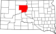
Ziebach County is a county in the U.S. state of South Dakota. As of the 2020 census, the population was 2,413. Its county seat is Dupree. It is the last county in the United States alphabetically.
<span class="mw-page-title-main">Meade County, South Dakota</span> County in South Dakota, United States

Meade County is a county in the U.S. state of South Dakota. As of the 2020 census, the population was 29,852, making it the 6th most populous county in South Dakota. Its county seat is Sturgis. The county was created in 1889 and named for Fort Meade, which was garrisoned as a United States military post in the area in 1878 and itself named for General George Meade.

<span class="mw-page-title-main">Dewey County, South Dakota</span> County in South Dakota, United States

Dewey County is a county in the U.S. state of South Dakota. As of the 2020 census, the population was 5,239. Its county seat is Timber Lake. The county was created in 1883 and organized in 1910. It was named for William P. Dewey, Territorial surveyor-general from 1873 to 1877.

<span class="mw-page-title-main">Bucyrus, North Dakota</span> City in North Dakota, United States

Bucyrus is a city in Adams County, North Dakota, United States. The population was 18 at the 2020 census.

<span class="mw-page-title-main">Sentinel Butte, North Dakota</span> City in North Dakota, United States

Sentinel Butte is a city in Golden Valley County, North Dakota, United States. The population was 61 at the 2020 census.

<span class="mw-page-title-main">Butte, North Dakota</span> City in North Dakota, United States

Butte is a city in McLean County, North Dakota, United States. The population was 70 at the 2020 census. Butte was founded in 1906.

<span class="mw-page-title-main">Eagle Point, Oregon</span> City in Oregon, United States

Eagle Point is a city in Jackson County, Oregon, United States. The population was 8,469 at the 2010 census, up from 4,798 at the 2000 census. As of 2018, the estimated population was 9,408.

<span class="mw-page-title-main">Newell, South Dakota</span> City in South Dakota, United States

Newell is a city in Butte County, South Dakota, United States. The population was 584 at the 2020 census.

<span class="mw-page-title-main">Nisland, South Dakota</span> Town in South Dakota, United States

Nisland is a town in Butte County, South Dakota, United States. The population was 206 at the 2020 census.

<span class="mw-page-title-main">Green Grass, South Dakota</span> CDP in South Dakota, United States

Green Grass is a census-designated place (CDP) in Dewey County, South Dakota, United States. The population was 21 at the 2020 census.

<span class="mw-page-title-main">La Plant, South Dakota</span> Census-designated place in South Dakota, United States

La Plant is a census-designated place (CDP) in Dewey County, South Dakota, United States. The population was 167 at the 2020 census. It is within the Cheyenne River Indian Reservation.

<span class="mw-page-title-main">North Eagle Butte, South Dakota</span> Census-designated place in South Dakota, United States

North Eagle Butte is a census-designated place (CDP) in Dewey County, South Dakota, United States, along the 45th parallel. The population was 1,879 at the 2020 census.

<span class="mw-page-title-main">Wanblee, South Dakota</span> Census-designated place in South Dakota, United States

Wanblee is a census-designated place on the Pine Ridge Indian Reservation, located in Jackson County, South Dakota, United States. The population was 674 at the 2020 census, virtually all of whom are members of the Oglala band of Lakota Sioux. Wanbli is the Lakota word for eagle, and the town was named for its proximity to Wanbli hohpi paha. Wanblee is a few miles directly northeast of the North American continental pole of inaccessibility.
<span class="mw-page-title-main">Reliance, South Dakota</span> Town in South Dakota, United States

Reliance is a town in Lyman County, South Dakota, United States. The population was 128 at the 2020 census.

<span class="mw-page-title-main">Britton, South Dakota</span> City in South Dakota, United States

Britton is a city in and the county seat of Marshall County, South Dakota, United States. The population was 1,215 at the 2020 census.
<span class="mw-page-title-main">Faith, South Dakota</span> City in South Dakota, United States

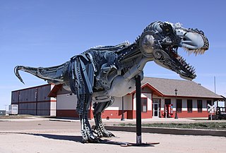
Faith is a city in the northeastern corner of Meade County, South Dakota, United States. The population was 367 at the 2020 census. The most complete Tyrannosaurus rex skeleton known, Sue, was discovered approximately 15 miles (24 km) northeast of Faith in August 1990.

<span class="mw-page-title-main">Sturgis, South Dakota</span> City in South Dakota, United States

Sturgis is a city in Meade County, South Dakota, United States. The population was 7,020 as of the 2020 census. It is the county seat of Meade County and is named after Samuel D. Sturgis, a Union general during the Civil War.

<span class="mw-page-title-main">Crooks, South Dakota</span> City in South Dakota, United States

Crooks is a city in Minnehaha County, South Dakota, United States and is a suburb of Sioux Falls. The population was 1,362 at the 2020 census. Crooks was named New Hope until 1904. The town's present name honors W. A. Crooks, a local politician.
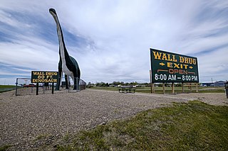
<span class="mw-page-title-main">Wall, South Dakota</span> Town in South Dakota, United States

Wall is a town in Pennington County, South Dakota, United States. The population was 699 at the 2020 census.
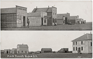
<span class="mw-page-title-main">Bison, South Dakota</span> Town in South Dakota, United States

Bison is a town in and the county seat of Perkins County, South Dakota, United States. The population was 302 at the 2020 census.

References

  1. "SD Towns" (PDF). South Dakota State Historical Society. Archived from the original (PDF) on February 10, 2010. Retrieved February 11, 2010.
  2. "ArcGIS REST Services Directory". United States Census Bureau. Retrieved October 15, 2022.
  3. 1 2 U.S. Geological Survey Geographic Names Information System: Eagle Butte, South Dakota
  4. 1 2 "Census Population API". United States Census Bureau. Retrieved October 15, 2022.
  5. 1 2 "U.S. Census website". United States Census Bureau . Retrieved January 31, 2008.
  6. "U.S. Census Bureau: Eagle Butte city, South Dakota". www.census.gov. United States Census Bureau. Retrieved February 13, 2022.
  7. South Dakota Office of Tribal Government Relations Archived 2009-02-08 at the Wayback Machine Retrieved on 2009-02-08.
  8. Federal Writers' Project (1940). South Dakota place-names, v.1-3. University of South Dakota. p. 36.
  9. "US Gazetteer files 2010". United States Census Bureau. Archived from the original on July 2, 2012. Retrieved June 21, 2012.
  10. United States Census Bureau. "Census of Population and Housing" . Retrieved July 15, 2014.
  11. "U.S. Census website". United States Census Bureau . Retrieved June 21, 2012.
  12. "2020 CENSUS - SCHOOL DISTRICT REFERENCE MAP: Dewey County, SD" (PDF). U.S. Census Bureau . Retrieved August 6, 2021.
  13. "About". Eagle Butte School District 20-1. Retrieved August 6, 2021.
  14. "Eagle-Butte - Presentation College". Archived from the original on 2 April 2016. Retrieved 18 April 2016.
  15. Dart, Bob. "Squaring off in South Dakota." Austin American-Statesman . October 22, 2004. Retrieved on October 18, 2009.
  16. Official Website - "Josh was born in Eagle Butte, South Dakota. He grew up in New Jersey and lives in New York."
  17. Martin, Douglas (May 2, 2012). "Earl Rose, Coroner When Kennedy Was Shot, Dies at 85". The New York Times. New York. Retrieved April 1, 2013.