East Swanzey, New Hampshire | |
|---|---|
 Community House | |
 East Swanzey  East Swanzey | |
| Coordinates: 42°51′5″N72°15′32″W / 42.85139°N 72.25889°W | |
| Country | United States |
| State | New Hampshire |
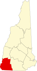
| County | Cheshire |
| Town | Swanzey |
| Elevation | 558 ft (170 m) |
| Time zone | UTC-5 (Eastern (EST)) |
| • Summer (DST) | UTC-4 (EDT) |
| ZIP code | 03446 (Swanzey) |
| Area code | 603 |
| GNIS feature ID | 866729 [1] |
East Swanzey is an unincorporated community in the town of Swanzey in Cheshire County, New Hampshire, United States.
The village is located in the eastern portion of Swanzey, along the South Branch Ashuelot River, between New Hampshire Route 32 to the west and New Hampshire Route 12 to the northeast.
East Swanzey has a separate ZIP code (03446) from other areas, such as West Swanzey, in the town of Swanzey.