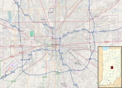
Emerson Avenue Addition Historic District | |
 Walnut east of Leland in Indianapolis, January 2013 | |
| Location | Roughly bounded by E. Michigan and E. St Clair Sts., N. Emerson Ave., and Ellenberger Park, Indianapolis, Indiana |
|---|---|
| Coordinates | 39°46′37″N86°04′52″W / 39.77694°N 86.08111°W |
| Area | 143 acres (58 ha) |
| Architect | Sears, Roebuck & Co.; Montgomery Ward; Alladin; et al. |
| Architectural style | Tudor Revival, Colonial Revival, Bungalow/craftsman |
| MPS | Historic Residential Suburbs in the United States, 1830-1960 MPS |
| NRHP reference No. | 12001063 [1] |
| Added to NRHP | December 19, 2012 |
Emerson Avenue Addition Historic District, also known as Emerson Heights Addition and Charles M. Cross Trust Clifford Avenue Addition, is a national historic district located at Indianapolis, Indiana. It encompasses 1,000 contributing buildings and 9 contributing objects in a planned residential section of Indianapolis. The district developed between about 1910 and 1949, and includes representative examples of Tudor Revival, Colonial Revival, and Bungalow / American Craftsman style residential architecture. [2]
It was listed on the National Register of Historic Places in 2012. [1]


