Tee Pee Restaurant

Last updated

Tee Pee Restaurant
Location map Indianapolis.png
Red pog.svg
USA Indiana location map.svg
Red pog.svg
Usa edcp location map.svg
Red pog.svg
Location3820 Fall Creek Blvd., Indianapolis, Indiana
Coordinates 39°49′33″N86°07′54″W / 39.82583°N 86.13167°W / 39.82583; -86.13167
Area1 acre (0.40 ha)
Built1939 (1939), 1952
ArchitectThornton, Maurice; Et al.
Architectural styleModerne
NRHP reference No. 86003374 [1]
Significant dates
Added to NRHP1986
Removed from NRHPFebruary 21, 1989

Tee Pee Restaurant was a drive-in restaurant in Indianapolis, Indiana, that began business in 1932. In 1939, the original building on Fall Creek Boulevard (now Parkway) was replaced with one having a central stuccoed teepee-shaped section with identical flanking wings. A cantilevered canopy extended around the building. Additions were made to the wings in 1952. [2] :2

Contents

A second restaurant was opened in 1954 on the southside of the city, and a third one in 1964 on the far northside. All three closed (in reverse order of their openings) and were subsequently demolished at different times between 1968 and 1988.

The building on Fall Creek was listed on the National Register of Historic Places (NRHP) in 1986 and delisted in 1989. [1]

History

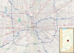
In July 1932, Albert Ray McComb and his wife Dorothy, along with Ethel Hughes, filed papers to incorporate Tee Pee, Inc. and opened a drive-in restaurant at 3820 Fall Creek Boulevard (now Fall Creek Parkway North Drive) at the intersection with 38th Street, on land leased from Indiana State Fair Board in the southeast section of the fairgrounds. The restaurant was in the shape of a teepee sitting directly on the ground. It was open only during the summer and had no indoor seating. Originally listed in the city directory as "Albert R. McComb restaurant", it took the name "Tee Pee Cone Shop" in 1936. Besides serving ice cream, it was the first Indianapolis drive-in to offer sandwiches and other items on its menu. [2]

In 1939, McComb replaced the original building with a larger one that offered indoor dining. Maurice Thornton was the architect. The new building had a stuccoed teepee on the roof over the central portion of the restaurant and two identical wings to the north and the south. Native American motifs were painted on the teepee and interior walls, and were featured on the menus and advertising. The name "Tee Pee Restaurant" was officially adopted in 1940. [2]

The restaurant served breakfast, lunch, and dinner seven days a week. In the 1940s, the Tee Pee became popular with Butler University students and with high school students, especially those from Arlington, Broad Ripple, Cathedral, Park, St. Agnes, Shortridge, and Tudor Hall. [3] The increased business led to expansion of the kitchen and additions on the rear of each building wing in 1952, The architect for the additions was Frank Schroeder, assisted by Thornton. The basement was also enlarged at that time to provide more storage and work space. [2]

The success of the first location led McComb to build a second restaurant in 1954 on the southside of Indianapolis at 2830 Madison Avenue, a mile south of Manual High School and a couple of miles north of Southport High School. The building was similar to the northside one, but smaller. In 1964, he opened a third Tee Pee restaurant at 1365 East 86th Street in the Nora neighborhood, but it closed in 1968, perhaps a result of McComb's death just as it was opening in June 1964. [3]

The Tee Pee was known for its "Big Chief" and "Big Teep" hamburgers, as well as for its seafood, special salad dressing, and freshly baked pies. [3]

By the 1970s, the drive-in craze was dying as more fast food restaurants were established and teenagers had more money at their disposal. Dorothy McComb died in 1974, and ownership of the restaurants passed to the couple's son, Charles. In 1978, he sold the Madison Avenue location to McDonald's, and within a few weeks the old building had been torn down and a new McDonald's had been erected. [3]

State Fair parking lots where the original restaurant stood Parking lots at the site of the Tee Pee Restaurant.jpg
State Fair parking lots where the original restaurant stood

McComb sold the Fall Creek Tee Pee to Richard P. Turner in 1979. Turner had plans to reinvigorate the restaurant, but the Indiana State Fair Board, on whose land the restaurant was located, voted on February 12, 1982, to cancel the five-year lease in order to tear the building down and expand parking for the fair. Historic Landmarks Foundation of Indiana and other preservationists fought for six years to prevent the destruction, and were able to have the Tee Pee added to the National Register of Historic Places in 1986. Nevertheless, the restaurant was razed in June 1988 and removed from the NHRP on February 21, 1989. [3]

In May 2007, the Indianapolis Business Journal reported that Turner, who still owned the rights to the Tee Pee trademark, was looking at locations for a new Tee Pee, including one somewhere on Madison Avenue. However, nothing came of that effort. [3]

See also

Related Research Articles

<span class="mw-page-title-main">Rock Creek and Potomac Parkway</span> Parkway in Washington D.C.

The Rock Creek and Potomac Parkway, informally called the Rock Creek Parkway, is a parkway maintained by the National Park Service as part of Rock Creek Park in Washington, D.C. It runs next to the Potomac River and Rock Creek in a generally north–south direction, carrying four lanes of traffic from the Lincoln Memorial and Arlington Memorial Bridge north to a junction with Beach Drive near Connecticut Avenue at Calvert Street, N.W., just south of the National Zoological Park.

<span class="mw-page-title-main">Garfield Park (Indianapolis)</span> Municipal park in Indianapolis, Indiana, U.S.

Garfield Park is a 128-acre (52 ha) urban park in Indianapolis, Indiana, United States. Established in the late 19th century, it is the oldest city park in Indianapolis and is on the National Register of Historic Places. The park is located at the confluence of Pleasant Run and Bean Creeks on the near Southside of Indianapolis. The 10,000-square-foot (930 m2) Conservatory and Sunken Gardens are located in the eastern portion of the park. The noted landscape architect George Edward Kessler designed the Sunken Gardens along with many of the other features of the park as part of his Park and Boulevard Plan for the city.

<span class="mw-page-title-main">Indiana State Road 431</span> State highway in Indiana, United States

State Road 431 was a state road connecting U.S. Route 31 with Interstate 465 at Exit 33. It passed through the Indianapolis suburb of Carmel, allowing traffic on U.S. 31 north of Carmel a shorter route to I-465 and the east side of Indianapolis. Until the 1990s, the SR 431 designation extended south of I-465 to 86th Street. Prior to that, it also continued south along N. Keystone Avenue to State Road 37 at Fall Creek Parkway, North Drive in Indianapolis. A second section of SR 431 followed the old route of U.S. 31 between Greenwood and the south side of Indianapolis.

<span class="mw-page-title-main">Neighborhoods of Jacksonville</span>

There are more than 500 neighborhoods within the area of Jacksonville, Florida, the largest city in the contiguous United States by area. These include Downtown Jacksonville and surrounding neighborhoods. Additionally, greater Jacksonville is traditionally divided into several major sections with amorphous boundaries: Northside, Westside, Southside, and Arlington, as well as the Jacksonville Beaches.

<span class="mw-page-title-main">Wigwam Motel</span> United States historic place

The Wigwam Motels, also known as the "Wigwam Villages," is a motel chain in the United States built during the 1930s and 1940s. The rooms are built in the form of tipis, mistakenly referred to as wigwams. It originally had seven different locations: two locations in Kentucky and one each in Alabama, Florida, Arizona, Louisiana, and California.

<span class="mw-page-title-main">Morris–Butler House</span> Historic house in Indiana, United States

The Morris–Butler House is a Second Empire-style house built about 1864 in the Old Northside Historic District of Indianapolis, Indiana. Restored as a museum home by Indiana Landmarks between 1964 and 1969, the American Civil War-era residence was the non-profit organization's first preservation project. Restoration work retained some of its original architectural features, and the home was furnished in Victorian and Post-Victorian styles. Its use was changed to a venue for Indiana Landmarks programs, special events, and private rentals following a refurbishment in 2013. Regular daily tours of the property have been discontinued.

<span class="mw-page-title-main">Madam Walker Legacy Center</span> National Historic Landmark in Indianapolis, Indiana, U.S.

The Madam C. J. Walker Building, which houses the Madam Walker Legacy Center, was built in 1927 in the city of Indianapolis, in the U.S. state of Indiana, and as Madam C. J. Walker Manufacturing Company, it was designated a National Historic Landmark in 1991. The four-story, multi-purpose Walker Building was named in honor of Madam C. J. Walker, the African American hair care and beauty products entrepreneur who founded the Madam C. J. Walker Manufacturing Company, and designed by the Indianapolis architectural firm of Rubush & Hunter. The building served as the world headquarters for Walker's company, as well as entertainment, business, and commercial hub along Indiana Avenue for the city's African American community from the 1920s to the 1950s. The historic gathering place and venue for community events and arts and cultural programs were saved from demolition in the 1970s. The restored building, which includes African, Egyptian, and Moorish designs, is one of the few remaining African-Art Deco buildings in the United States. The Walker Building was added to the National Register of Historic Places in 1980.

<span class="mw-page-title-main">Fountain Square, Indianapolis</span> Neighborhood and cultural district in Indianapolis, Indiana, U.S.

Fountain Square is one of seven designated cultural districts in Indianapolis, Indiana. Located just outside the city's downtown district, Fountain Square is home to three designated national historic districts, the Laurel and Prospect, the State and Prospect, and the Virginia Avenue districts, all of which were listed on the National Register of Historic Places in 1983. The neighborhood derives its name from the successive fountains that have been prominently featured at the intersection of Virginia Avenue, East Prospect Street, and Shelby Street.

The Bates–Hendricks neighborhood is situated just south and east of the downtown commercial district of Indianapolis, Indiana. The Fountain Square business district is just to the east.

Tipi is a dwelling used by North American Indians of the Great Plains.

<span class="mw-page-title-main">Old Northside Historic District</span> Historic district in Indiana, United States

Old Northside is a residential neighborhood near downtown in Indianapolis, Indiana. It is bordered by 16th Street on the north, Pennsylvania Street on the west, Interstate I-65 on the south, and Bellefontaine Street on the east. The Monon Trail runs along the eastern edge of The Frank and Judy O'Bannon Old Northside Soccer Park.

<span class="mw-page-title-main">North Irvington Gardens Historic District</span> Historic district in Indiana, United States

The North Irvington Gardens Historic District is a neighborhood and national historic district in Indianapolis, Indiana. It was placed on the National Register of Historic Places on June 27, 2008. It is immediately to the north of the Irvington Historic District, which has been on the National Register since 1987, sharing the same east and west boundaries of the older district, and extending north to 10th and 11th streets. It is a neighborhood of mostly residential buildings dating primarily from 1910 to 1950, with no one distinctive architectural style, including a house associated with the historic Osborn Farm. Except for one church, the only buildings contributing to the historic nature of the district are 843 houses and 551 garages. Most fences in the district mark the perimeter of the individual properties; very few are along the streets.

<span class="mw-page-title-main">Athenæum (Das Deutsche Haus)</span> National Historic Landmark in Indianapolis, Indiana, U.S.

The Athenæum, originally named Das Deutsche Haus, is the most ornate and best-preserved building affiliated with the German American community of Indianapolis. Once used as a German American Turnverein and clubhouse, it currently houses many groups, organizations, and businesses. The Athenæum is located across Massachusetts Avenue from the Old National Centre. It was placed on the National Register of Historic Places on February 21, 1973. On October 31, 2016, it was named the 41st National Historic Landmark in Indiana.

<span class="mw-page-title-main">Fall Creek (Indiana)</span> Waterway in Indiana, U.S.

Fall Creek is a navigable in law waterway in the U.S. state of Indiana, and a tributary of the White River. It is 57.5 miles (92.5 km) long and has a watershed drainage area of 318 square miles (820 km2) in central Indiana before flowing into the White River in Indianapolis. As it flows southwest, Fall Creek is the namesake of three townships in Indiana, in Henry County, Madison County, and then Hamilton County.

The Pleasant Run Greenway, also known as the Pleasant Run Trail, is a shared-use path in Indianapolis, Indiana. It runs for 6.9 miles (11.1 km) from Ellenberger Park, through Christian Park, to Garfield Park. It follows the general course of Pleasant Run Creek as it flows to the south and west. Most of the greenway is located within the parkway on one side or the other of the creek; the parkway itself is part of the historic Indianapolis Park and Boulevard System. In several places, the greenway is routed on sidewalks of city streets due to existing structures and facilities that make the parkway itself discontinuous.

<span class="mw-page-title-main">Central Court Historic District</span> Historic district of Indianapolis, Indiana

The Central Court Historic District is a historic district and neighborhood of the city of Indianapolis in northern Center Township, Marion County, Indiana, United States. Built around Central Court near the intersection of 36th Street and Central Avenue, the neighborhood consists of seventy-five buildings over an area of 7.6 acres (3.1 ha).

<span class="mw-page-title-main">Homecroft Historic District</span> Historic district in Indiana, United States

The Homecroft Historic District is a national historic district bounded roughly by Madison Avenue, Southview Drive, Orinoco Avenue, and Banta Road in Homecroft, Perry Township, Marion County, Indiana. It was listed on the National Register of Historic Places in 1996.

<span class="mw-page-title-main">Indianapolis Park and Boulevard System</span> United States historic place

The Indianapolis Park and Boulevard System is a group of parks, parkways, and boulevards in Indianapolis, Indiana, that was designed by landscape architect George Edward Kessler in the early part of the twentieth century. Also known as the Kessler System, the district includes 3,474 acres (1,406 ha) and has shaped the city through the present day. This historic district was added to the National Register of Historic Places in 2003.

<span class="mw-page-title-main">Virginia Avenue District</span> Historic district in Indiana, United States

Virginia Avenue District is a national historic district located at Indianapolis, Indiana. The district encompasses 43 contributing buildings and 1 contributing structure in the Fountain Square Commercial Areas of Indianapolis. It developed between about 1871 and 1932, and notable buildings include the Sanders (Apex) Theater (1913), Southside Wagon and Carriage Works / Saffel Chair Company, Fountain Square Theater (1928), Woessner Building, Granada Theater (1928), Southside Theater (1911), Schreiber Block (1895), Fountain Square State Bank (1922), and Fountain Bank (1902).

<span class="mw-page-title-main">South Side Turnverein Hall</span> Historic structure in Indianapolis, Indiana

South Side Turnverein Hall is a historic social club and gymnasium in the Bates-Hendricks neighborhood of Indianapolis, Indiana, affiliated with the city's German-American community. It was built in 1900 by prominent architects Vonnegut & Bohn, whose managing partners Bernard Vonnegut, Sr. and Arthur Bohn were members of the burgeoning German-American community in Indianapolis. The architects were also known for designing the Athenæum, another German-American social club in the city. The South Side Turnverein was an important gathering place for Indianapolis' south side German community until its decline in the 1940s. It was sold to investors in 1978 to be used as an athletic club.

References

  1. 1 2 "National Register Information System". National Register of Historic Places . National Park Service. July 9, 2010.
  2. 1 2 3 4 "Indiana State Historic Architectural and Archaeological Research Database (SHAARD)" (Searchable database). Department of Natural Resources, Division of Historic Preservation and Archaeology. Retrieved August 1, 2016.Note: This includes F. Eric Utz and Susanne T. Rollins. (April 1986). "National Register of Historic Places Inventory Nomination Form: Tee Pee Restaurant" (PDF). Retrieved August 1, 2016.
  3. 1 2 3 4 5 6 Freeland, Sharon Butsch (October 27, 2015). "HI Mailbag: Tee Pee Restaurants". Historic Indianapolis | All Things Indianapolis History. Retrieved September 5, 2022.