Ransom Place Historic District

Last updated

Ransom Place Historic District
Ransom Place Historical Marker.jpg
Section of the Ransom Place historical marker at the corner of St. Clair and Camp streets in Indianapolis
Location map Indianapolis central.png
Red pog.svg
Location map Indianapolis.png
Red pog.svg
USA Indiana location map.svg
Red pog.svg
Usa edcp location map.svg
Red pog.svg
LocationRoughly bounded by 10th, St. Clair, West and Paca Sts., Indianapolis, Indiana
Coordinates 39°46′44″N86°10′11″W / 39.77889°N 86.16972°W / 39.77889; -86.16972
Area6 acres (2.4 ha)
Architectural styleQueen Anne, L-Plan Cottage
NRHP reference No. 92001650 [1]
Added to NRHPDecember 10, 1992

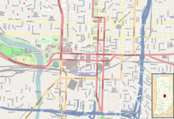
Ransom Place Historic District is a national historic district in Indianapolis, Indiana, United States. The district consists mainly of a six-square block in a historically Black residential section of Indianapolis, located just one block from Indiana Avenue. It was originally developed during the 1880s and 1890s, coinciding with the growth of Indiana Avenue as the central commercial district for Indianapolis's Black population at that time. It was listed on the National Register of Historic Places in 1992. [2] [1]

Contents

Historical significance

Panel of Ransom Place Historic Marker featuring Second Christian Church (photo taken in 1913) Panel of Ransom Place Historic Marker featuring Second Christian Church.jpg
Panel of Ransom Place Historic Marker featuring Second Christian Church (photo taken in 1913)

At its peak, Ransom Place (although not known as "Ransom Place" at that time) was the site of numerous Black-owned businesses, including churches, clubs, community centers, restaurants, shops, and theaters. Many residents had prominent careers as well. [3] The best-known resident of this area was Freeman Ransom, a lawyer, businessman, and civil rights activist who also worked with Madame C. J. Walker as her legal counsel and the general manager of her company. [2] His son, Willard Ransom also lived in the neighborhood, and he worked as a local chapter president of the NAACP in the 1940s and 1950s. [2] [4]

The district was officially renamed to Ransom Place in 1992 in Freeman Ransom's honor. [5] This district was designated as "most intact neighborhood associated with [the] city's African-American population" by the Indiana Historical Bureau in Ransom Place's historical marker. [6]

Decline and restoration

By the 1950s, when the Indiana Avenue community began to decline as other opportunities drew Black residents away, the area became a target for razing by the city of Indianapolis. Starting in the 1960s and continuing into the 1980s, city leaders worked with Indiana University–Purdue University Indianapolis (IUPUI) to clear land for the expansion of the university.

Houses along Camp Street in Ransom Place, taken in 2011 Camp Street in Ransom Place.jpg
Houses along Camp Street in Ransom Place, taken in 2011

Due to community worry about the possibility of continued growth of IUPUI, residents Lathan Frayser, Addie Jones, Wilma Bailey, Mary Frisby, Jean Spears, and Teresa Crawford-Cottingham formed the Ransom Place Neighborhood Association (RPNA) in August 1991. [7] This was the first recorded use of "Ransom Place" as the name of the district. [3]

This nonprofit focused on encouraging preservation of Ransom Place homes and promoting the neighborhood's history. After gaining recognition on the National Register of Historic Places in 1992, the neighborhood experienced a revitalization effort throughout the rest of the decade. [3] Today, the association hosts many community events, helps fund property improvements, and operates a community garden. [8]

Architecture

The architecture of the district includes many representative examples of Queen Anne style architecture. A notable building in this district is the former Second Christian Church, which was used from 1910 to 2003 until the congregation relocated to a new building near the Butler University campus. [9]

See also

Related Research Articles

<span class="mw-page-title-main">Haughville, Indianapolis</span> United States historic place

Haughville is a neighborhood west of downtown Indianapolis. Its borders are roughly White River Parkway to the east, Tibbs Avenue to the west, 16th Street to the north, and Michigan Street to the south. It was first settled in the 1830s and grew after a bridge over White River was built connecting to Indianapolis, which annexed the town in 1897. The modern version of the bridge is also the connection between Haughville on the west side of the river and the Sidney & Lois Eskenazi Hospital and Indiana University - Purdue University Indianapolis on the east. The population in the late 1890s included Slovenian, German, and Irish immigrants, among other European immigrants. In the 21st century, the neighborhood suffers from a high crime rate and low property values.

<span class="mw-page-title-main">Irvington Historic District (Indianapolis)</span> Historic district in Indiana, United States

The neighborhood of Irvington, named after Washington Irving, includes Irvington Historic District, a historic district in Indianapolis, Indiana. The historic district is a 545-acre (221 ha) area that was listed on the National Register of Historic Places in 1987. That year, the district included 2,373 contributing buildings, 5 other contributing structures, and 2 contributing sites.

<span class="mw-page-title-main">Indiana Avenue</span> Historic and cultural district in Indianapolis, Indiana, U.S.

Indiana Avenue is a historic area in downtown and is one of seven designated cultural districts in Indianapolis, Indiana. Indiana Avenue was, during its glory days, an African American cultural center of the area. The Indiana Avenue Historic District within the area was designated a United States national historic district in 1987.

<span class="mw-page-title-main">Downtown Indianapolis</span> Central business district in Indiana, US

Downtown Indianapolis is a neighborhood area and the central business district of Indianapolis, Indiana, United States. Downtown is bordered by Interstate 65, Interstate 70, and the White River, and is situated near the geographic center of Marion County. Downtown has grown from the original 1821 town plat—often referred to as the Mile Square—to encompass a broader geographic area of central Indianapolis, containing several smaller historic neighborhoods.

<span class="mw-page-title-main">Golden Hill Historic District (Indianapolis, Indiana)</span> Historic district in Indiana, United States

Golden Hill is an affluent and historic neighborhood overlooking the White River on the west side of Indianapolis's Center Township, in Marion County, Indiana. The district is bounded on the east by Clifton Street, which is west of Martin Luther King Jr. Boulevard ; on the west by the White River and the Central Canal; on the south by Thirty-sixth Street; and on the north by Woodstock Country Club, immediately south of Thirty-eighth Street. Golden Hill is noted for its collection of homes designed by several of the city's prominent architects. The estate homes reflect several styles of period revival architecture. The district is known as for its community planning and remains an exclusive enclave for the city's prominent families. Golden Hill was added to the National Register of Historic Places in 1991.

<span class="mw-page-title-main">Madam Walker Legacy Center</span> National Historic Landmark in Indianapolis, Indiana, U.S.

The Madam C. J. Walker Building, which houses the Madam Walker Legacy Center, was built in 1927 in the city of Indianapolis, in the U.S. state of Indiana, and as Madam C. J. Walker Manufacturing Company, it was designated a National Historic Landmark in 1991. The four-story, multi-purpose Walker Building was named in honor of Madam C. J. Walker, the African American hair care and beauty products entrepreneur who founded the Madam C. J. Walker Manufacturing Company, and designed by the Indianapolis architectural firm of Rubush & Hunter. The building served as the world headquarters for Walker's company, as well as entertainment, business, and commercial hub along Indiana Avenue for the city's African American community from the 1920s to the 1950s. The historic gathering place and venue for community events and arts and cultural programs were saved from demolition in the 1970s. The restored building, which includes African, Egyptian, and Moorish designs, is one of the few remaining African-Art Deco buildings in the United States. The Walker Building was added to the National Register of Historic Places in 1980.

<span class="mw-page-title-main">Fountain Square, Indianapolis</span> Neighborhood and cultural district in Indianapolis, Indiana, U.S.

Fountain Square is one of seven designated cultural districts in Indianapolis, Indiana. Located just outside the city's downtown district, Fountain Square is home to three designated national historic districts, the Laurel and Prospect, the State and Prospect, and the Virginia Avenue districts, all of which were listed on the National Register of Historic Places in 1983. The neighborhood derives its name from the successive fountains that have been prominently featured at the intersection of Virginia Avenue, East Prospect Street, and Shelby Street.

<span class="mw-page-title-main">Lockefield Gardens</span> United States historic place

Lockefield Gardens was the first public housing built in Indianapolis. Constructed during the years 1935 to 1938, it was built exclusively for low income African-Americans in Indianapolis. The complex was closed in 1976, and a number of structures were demolished in the early 1980s. The only original structures remaining are those along Blake Street.

<span class="mw-page-title-main">Herron–Morton Place Historic District</span> Historic district in Indiana, United States

Herron–Morton Place is a historic district in Indianapolis, Indiana, United States. The boundaries of the neighborhood are East 16th Street on the south, East 22nd Street on the north, North Pennsylvania Street on the west, and Central Avenue on the east.

<span class="mw-page-title-main">Old Northside Historic District</span> Historic district in Indiana, United States

Old Northside is a residential neighborhood near downtown in Indianapolis, Indiana. It is bordered by 16th Street on the north, Pennsylvania Street on the west, Interstate I-65 on the south, and Bellefontaine Street on the east. The Monon Trail runs along the eastern edge of The Frank and Judy O'Bannon Old Northside Soccer Park.

<span class="mw-page-title-main">Roberts Chapel (Atlanta, Indiana)</span> Historic church in Indiana, United States

Roberts Chapel, is a non-denominational church that was originally built in 1847 at Roberts Settlement, one of Indiana's early black pioneer communities. The rural church, whose main building dates from 1858, is located near the present-day town of Atlanta in rural Jackson Township, Hamilton County, Indiana. The chapel was listed on the National Register of Historic Places in 1996.

<span class="mw-page-title-main">Oliver Johnson's Woods Historic District</span> Historic district in Indiana, United States

Oliver Johnson's Woods is a historic district and neighborhood on the northern side of Indianapolis, Indiana, United States. Located in southern Washington Township, the district occupies the site of what was once the family farm of Oliver Johnson. Born on the present site of the Indiana State Fairgrounds, Johnson grew up in a pioneer family that lived on the edge of the state capital city. Upon attaining adulthood, he bought property a short distance to the west, to which he moved in 1846. Here, he built a larger farmhouse in 1862, and he tilled the soil for most of the rest of his life. As Indianapolis grew northward, it reached the Johnson farm in the early twentieth century; the aged farmer and his sons saw the city's growth as an opportunity for financial gain, and in 1905 they announced the platting of 0.25 square miles (0.65 km2) of their property into individual lots. They chose an advantageous time to sell their property; as the new residents began to build their homes, an interurban railway was built along College Avenue on the district's western side that connected downtown with Broad Ripple. Many prosperous businessmen were attracted by the development's large lots and wooded streets; the city annexed Oliver Johnson's Woods in 1912, and by the outbreak of World War II, the streets were filled with large houses built in a wide variety of architectural styles. These early residents came from many different ethnicities: European immigrants were becoming more prosperous and leaving their ethnic enclaves, and new neighborhoods such as Oliver Johnson's Woods appealed to them. Among the neighborhood's leading residents was a colony of Jews of German descent.

<span class="mw-page-title-main">Cottage Home Historic District</span> Historic district in Indiana, United States

The Cottage Home Historic District is a historic district and neighborhood located on the near east side of Indianapolis, Indiana. A small portion of Cottage Home is listed on the National Register of Historic Places while a larger area is listed on the state and local levels. Known for its preponderance of "cottage-style" homes built with strong Victorian influences, Cottage Home has historically been a working class neighborhood. Numerous industrial buildings are also scattered throughout the district, providing a base of economic activity. Today, however, many of these buildings are vacant, providing a special challenge to preservation and urban renewal efforts.

<span class="mw-page-title-main">Bethel A.M.E. Church (Indianapolis, Indiana)</span> Historic church in Indiana, United States

The Bethel A.M.E. Church, known in its early years as Indianapolis Station or the Vermont Street Church, is a historic African Methodist Episcopal Church in Indianapolis, Indiana. Organized in 1836, it is the city's oldest African-American congregation. The three-story church on West Vermont Street dates to 1869 and was added to the National Register in 1991. The surrounding neighborhood, once the heart of downtown Indianapolis's African American community, significantly changed with post-World War II urban development that included new hotels, apartments, office space, museums, and the Indiana University–Purdue University at Indianapolis campus. In 2016 the congregation sold their deteriorating church, which will be used in a future commercial development. The congregation built a new worship center at 6417 Zionsville Road in Pike Township in northwest Indianapolis.

Freeman Briley Ransom (1880–1947) was an American lawyer, businessman and civic activist in Indianapolis, Indiana. From 1911 until his death he served as legal counsel and general manager for the Madame C.J. Walker Manufacturing Company as well as Madame C.J. Walker's personal attorney. Robert Brokenburr was his law partner.

Roberts Settlement was an early rural settlement in Jackson Township, Hamilton County, Indiana. Dating from the 1830s, its first settlers were free people of color, most of whom migrated from Beech Settlement, located 40 miles (64 km) southeast in rural Rush County, Indiana. Many of Roberts Settlement's early pioneers were born in eastern North Carolina and Virginia. Some of its settlers were ex-slaves. The neighborhood received its name from the large contingent of its residents who had the surname of Roberts. By the 1870s the farming community had a population of approximately 300 residents. In the late nineteenth and early twentieth centuries, the settlement's population began to decline, largely due to changing economic conditions that included rising costs of farming. Fewer than six families remained at the settlement by the mid-1920s. Most of Indiana's early black rural settlements, including Roberts Settlement, no longer exist. Roberts Chapel, listed on the National Register of Historic Places, serves as the site for the community's annual reunions of its friends and the descendants of former residents.

<span class="mw-page-title-main">Indiana State Federation of Colored Women's Clubs</span> United States historic place

Indiana State Federation of Colored Women's Clubs, also known as the Minor House, is a historic National Association of Colored Women's Clubs clubhouse in Indianapolis, Indiana. The two-and-one-half-story "T"-plan building was originally constructed in 1897 as a private dwelling for John and Sarah Minor; however, since 1927 it has served as the headquarters of the Indiana State Federation of Colored Women's Clubs, a nonprofit group of African American women. The Indiana federation was formally organized on April 27, 1904, in Indianapolis and incorporated in 1927. The group's Colonial Revival style frame building sits on a brick foundation and has a gable roof with hipped dormers. It was listed on the National Register of Historic Places in 1987.

Willard "Mike" Blystone Ransom (1916–1995) was an American lawyer, businessman, community civic leader, and a civil rights activist in Indianapolis, Indiana. He was a leader within the National Association for the Advancement of Colored People (NAACP) in Indiana during the early years of the civil rights movement.

References

  1. 1 2 "National Register Information System". National Register of Historic Places . National Park Service. July 9, 2010.
  2. 1 2 3 "National Register of Historic Places Inventory/Nomination: Ransom Place Historic District". National Park Service. December 10, 1992. Retrieved April 10, 2023. With accompanying pictures
  3. 1 2 3 "Ransom Place". indyencyclopedia.org. January 5, 2022. Retrieved March 5, 2023.
  4. "Willard B. (Mike) Ransom". Encyclopedia of Indianapolis. February 5, 2021. Retrieved April 11, 2023.
  5. "Ransom Place Historic District". National Park Service. Retrieved 3 June 2012.
  6. IHB (December 7, 2020). "Ransom Place Historic District". IHB. Retrieved March 5, 2023.
  7. "Ransom Place recognized as Neighborhood of the Month". Indianapolis Recorder. February 6, 2017. Retrieved March 5, 2023.
  8. "Ransom.Place". Ransom.Place. Retrieved March 5, 2023.
  9. "Light of the World Christian Church". www.lovelwcc.org. Retrieved March 9, 2023.