Homecroft Historic District

Last updated

Homecroft Historic District
Maynard Drive in Homecroft.jpg
Houses on Maynard Drive
Location map Indianapolis.png
Red pog.svg
USA Indiana location map.svg
Red pog.svg
Usa edcp location map.svg
Red pog.svg
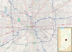
LocationRoughly bounded by Madison Ave., Southview Dr., Orinoco Ave., and Banta Rd., Homecroft, Perry Township, Marion County, Indiana
Coordinates 39°40′12″N86°7′55″W / 39.67000°N 86.13194°W / 39.67000; -86.13194
Area70 acres (28 ha)
Built byGates, Frank
Architectural style Bungalow/American Craftsman, Colonial Revival, Tudor Revival
NRHP reference No. 95001536 [1]
Added to NRHPJanuary 11, 1996

The Homecroft Historic District is a national historic district bounded roughly by Madison Avenue, Southview Drive, Orinoco Avenue, and Banta Road in Homecroft, Perry Township, Marion County, Indiana. It was listed on the National Register of Historic Places in 1996. [1]

Contents

History

In 1900, the Indianapolis, Columbus & Southern Interurban Company began service on an interurban rail line extending from downtown Indianapolis to several nearby towns. [2] The line ran along Madison Avenue. In the late 1910s and early 1920s, increasing use of the automobile and public transportation led people to relocate farther from urban centers. The Homecroft site, located 4+12 miles (7.2 km) from downtown alongside the Madison Avenue interurban, was a desirable location for relocation. [2]

In 1923, the Frank E. Gates Real Estate Company bought the land and named the area "Homecroft". [2] The firm consisted of Frank Gates and his son Oliver, and they had already developed several subdivisions in Indiana, Ohio, and Michigan. [2]

Description

The Homecroft Historic District is typical of 1920s suburbs built for middle-class families. [2] It consists of 63 structures spread over 70 acres (28 ha). [1] Some of the homes are patterned after model houses built by the Gates Company, while others are based on designs chosen by the original lot buyers. The houses are single-family homes; most are of modest size, one or one-and-a-half stories covered with brick or stone veneer. [2] Architectural styles include Bungalow, American Craftsman, Colonial Revival, and Tudor Revival. [1]

Sidewalks were run through the area in the 1930s by the Works Progress Administration, and the Gates Company planted maples along the streets, which are now mature. [2]

The district has remained cohesive despite the later encroachment of commercial strips along Madison Avenue, and has maintained the feel of a small satellite town. [2]

Related Research Articles

<span class="mw-page-title-main">Fletcher Place</span> United States historic place

Fletcher Place is a historic district and neighborhood in the city of Indianapolis, Indiana named after Calvin Fletcher, a prominent local banker, farmer and state senator.

<span class="mw-page-title-main">Chatham–Arch, Indianapolis</span> United States historic place

Chatham–Arch is a neighborhood located immediately east of Downtown Indianapolis, Indiana, United States. This neighborhood is one of the oldest in Indianapolis, dating back to the mid 19th century. Chatham–Arch contains many of Indianapolis's historic homes.

<span class="mw-page-title-main">Golden Hill Historic District (Indianapolis, Indiana)</span> Historic district in Indiana, United States

Golden Hill is an affluent and historic neighborhood overlooking the White River on the west side of Indianapolis's Center Township, in Marion County, Indiana. The district is bounded on the east by Clifton Street, which is west of Martin Luther King Jr. Boulevard ; on the west by the White River and the Central Canal; on the south by Thirty-sixth Street; and on the north by Woodstock Country Club, immediately south of Thirty-eighth Street. Golden Hill is noted for its collection of homes designed by several of the city's prominent architects. The estate homes reflect several styles of period revival architecture. The district is known as for its community planning and remains an exclusive enclave for the city's prominent families. Golden Hill was added to the National Register of Historic Places in 1991.

<span class="mw-page-title-main">Beverly Shores station</span>

Beverly Shores is a train station in Beverly Shores, Indiana, served by the South Shore Line interurban commuter railroad. The station serves the town of Beverly Shores as well as the nearby Town of Pines. It is a flag stop.

The Bates–Hendricks neighborhood is situated just south and east of the downtown commercial district of Indianapolis, Indiana. The Fountain Square business district is just to the east.

<span class="mw-page-title-main">Old Northside Historic District</span> Historic district in Indiana, United States

Old Northside is a residential neighborhood near downtown in Indianapolis, Indiana. It is bordered by 16th Street on the north, Pennsylvania Street on the west, Interstate I-65 on the south, and Bellefontaine Street on the east. The Monon Trail runs along the eastern edge of The Frank and Judy O'Bannon Old Northside Soccer Park.

<span class="mw-page-title-main">DePauw Avenue Historic District</span> National historic district in New Albany, Indiana

The DePauw Avenue Historic District is a national historic district just northeast of downtown New Albany, Indiana, across the Ohio River from Louisville, Kentucky. The district consists mostly of Depauw Avenue from Vincennes Street in the west to Aebersold Drive to the east, and includes portions of the 1200 block of Beechwood Avenue and two residences on Vance Street. New Albany High School is located on the southern edge of the district.

<span class="mw-page-title-main">Washington Park Historic District (Indianapolis, Indiana)</span> Historic district in Indiana, United States

The Washington Park Historic District is a national historic district located in Indianapolis, Indiana. It was listed on the National Register of Historic Places on June 24, 2008. It comprises nearly 60 acres (240,000 m2) and is located 4 miles (6.4 km) north of downtown Indianapolis, in the south-central part of the Meridian-Kessler neighborhood. The district includes all properties south of 43rd Street and north of 40th Street, and west of Central Avenue and east of the alley running north and south between Pennsylvania and Meridian Streets; Washington Boulevard runs north-south through the center of the district. It includes 110 contributing buildings, ranging mostly from mansions to small bungalows, and three non-contributing buildings.

<span class="mw-page-title-main">Terminal Arcade</span> United States historic place

The Terminal Arcade, located on Wabash Avenue in downtown Terre Haute, Indiana, is a Beaux-Arts building on the National Register of Historic Places since June 30, 1983.

<span class="mw-page-title-main">Washington Avenue Historic District (Evansville, Indiana)</span> Historic district in Indiana, United States

Washington Avenue Historic District is a national historic district located at Evansville, Indiana. It was listed on the National Register of Historic Places in 1980. The district, bounded roughly by Madison and Grand Avenues and East Gum and Parrett Streets, sprang up in the late 19th century, during an economic boom when the city's population went from 29,200 in 1880 to more than 59,000 by 1900.

<span class="mw-page-title-main">The Baker (Indianapolis, Indiana)</span> United States historic place

The Baker, also known as Massala, is a historic apartment building located at Indianapolis, Indiana. It was built in 1905, and is a three-story, 10-bay by 12 bay, Classical Revival style brick building with Queen Anne style design elements. It has limestone detailing and features paired two-story bay windows on the upper floors.

<span class="mw-page-title-main">Oliver Johnson's Woods Historic District</span> Historic district in Indiana, United States

Oliver Johnson's Woods is a historic district and neighborhood on the northern side of Indianapolis, Indiana, United States. Located in southern Washington Township, the district occupies the site of what was once the family farm of Oliver Johnson. Born on the present site of the Indiana State Fairgrounds, Johnson grew up in a pioneer family that lived on the edge of the state capital city. Upon attaining adulthood, he bought property a short distance to the west, to which he moved in 1846. Here, he built a larger farmhouse in 1862, and he tilled the soil for most of the rest of his life. As Indianapolis grew northward, it reached the Johnson farm in the early twentieth century; the aged farmer and his sons saw the city's growth as an opportunity for financial gain, and in 1905 they announced the platting of 0.25 square miles (0.65 km2) of their property into individual lots. They chose an advantageous time to sell their property; as the new residents began to build their homes, an interurban railway was built along College Avenue on the district's western side that connected downtown with Broad Ripple. Many prosperous businessmen were attracted by the development's large lots and wooded streets; the city annexed Oliver Johnson's Woods in 1912, and by the outbreak of World War II, the streets were filled with large houses built in a wide variety of architectural styles. These early residents came from many different ethnicities: European immigrants were becoming more prosperous and leaving their ethnic enclaves, and new neighborhoods such as Oliver Johnson's Woods appealed to them. Among the neighborhood's leading residents was a colony of Jews of German descent.

<span class="mw-page-title-main">Homecroft, Indiana</span> Town in Indiana, United States

Homecroft is a town in Perry Township, Marion County, Indiana, United States. The population was 752 at the 2020 census. Incorporated in 1949, it has existed as an included town since 1970, when it was incorporated into Indianapolis as part of Unigov. It is part of Indianapolis, but retains a functioning town government under IC 36-3-1-11.

<span class="mw-page-title-main">Downtown Auburn Historic District</span> Historic district in Indiana, United States

Downtown Auburn Historic District is a national historic district located at Auburn, DeKalb County, Indiana. The district encompasses 52 contributing buildings in the central business district of Auburn. The district developed between about 1870 and 1935, and includes notable examples of Victorian, Classical Revival, Romanesque Revival, and Colonial Revival style architecture. Notable buildings include the DeKalb County Courthouse (1911-1914), Henry Opera House (1917), DeKalb County Jail (1918), Commercial Club (1917), Auburn City Hall (1913), South Interurban Station, Dilgard Building, Y.M.C.A. Building (193-1914), Auburn Hotel (1922), U.S. Post Office (1934), and Masonic Temple.

<span class="mw-page-title-main">Amo THI & E Interurban Depot/Substation</span> United States historic place

Amo THI & E Interurban Depot/Substation, also known as Amo Interurban Depot, is a historic interurban train station located at Amo, Hendricks County, Indiana.

<span class="mw-page-title-main">Plymouth Downtown Historic District</span> Historic district in Indiana, United States

Plymouth Downtown Historic District is a national historic district located in Plymouth, Marshall County, Indiana, United States. The district encompasses 47 contributing buildings and one contributing structure in the central business district of Plymouth. It developed between about 1870 and 1940, and includes examples of Italianate, Romanesque Revival, and Colonial Revival style architecture. Located in the district is the separately listed Plymouth Fire Station. Other notable buildings include the Montgomery Ward Building (1929), Metsker Block, Rentschler Building (1910), Early Plymouth Post Office (1884), First National Bank-Plymouth City Hall, Packard Bank Block (1879), Simons Building (1895), Wheeler Block, Bank Block, Bank Block-Masonic Temple (1901), Plymouth Post Office (1935), and Plymouth Motor Sales (1929).

<span class="mw-page-title-main">Emerson Avenue Addition Historic District</span> Historic district in Indiana, United States

Emerson Avenue Addition Historic District, also known as Emerson Heights Addition and Charles M. Cross Trust Clifford Avenue Addition, is a national historic district located at Indianapolis, Indiana. It encompasses 1,000 contributing buildings and 9 contributing objects in a planned residential section of Indianapolis. The district developed between about 1910 and 1949, and includes representative examples of Tudor Revival, Colonial Revival, and Bungalow / American Craftsman style residential architecture.

<span class="mw-page-title-main">The Sylvania</span> United States historic place

The Sylvania is a historic apartment building located at Indianapolis, Indiana. It was built in 1906, and consists of two three-story, detached glazed brick and grey limestone buildings. It features Renaissance Revival style door and window surrounds and Classical Revival style design elements.

<span class="mw-page-title-main">The Burton</span> United States historic place

The Burton is a historic apartment building located at Indianapolis, Indiana. It was built in 1920, and is a two-story, Spanish Colonial Revival style stuccoed building on a raised basement. It features a semicircular metal arched entrance hood, stepped gables, and a red tile roof.

<span class="mw-page-title-main">Mt. Pisgah Lutheran Church</span> Historic church in Indiana, United States

Mount Pisgah Lutheran Church, also known in its early years as the First Lutheran Church and First English Lutheran Church and more recently as The Sanctuary on Penn, is located at 701 North Pennsylvania Street in downtown Indianapolis, Indiana. The historic church was built by the city's first Lutheran congregation, which organized in 1837, and was its third house of worship. The former church, whose present-day name is The Sanctuary on Penn, is operated as a for-profit event venue.

References

  1. 1 2 3 4 "National Register Information System". National Register of Historic Places . National Park Service. July 9, 2010.
  2. 1 2 3 4 5 6 7 8 "Indiana State Historic Architectural and Archaeological Research Database (SHAARD)" (Searchable database). Department of Natural Resources, Division of Historic Preservation and Archaeology. Retrieved August 1, 2016.Note: This includes Jane Nolan (September 1995). "National Register of Historic Places Inventory Nomination Form: Homecroft Historic District" (PDF). Retrieved August 1, 2016. and Accompanying photographs