Emery, Wisconsin | |
---|---|
Coordinates: 45°42′0″N90°10′38″W / 45.70000°N 90.17722°W | |
Country | United States |
State | Wisconsin |
County | Price |
Area | |
• Total | 108.2 sq mi (280.3 km2) |
• Land | 108.1 sq mi (280.0 km2) |
• Water | 0.1 sq mi (0.2 km2) |
Elevation | 1,650 ft (503 m) |
Population (2000) | |
• Total | 325 |
• Density | 3.0/sq mi (1.2/km2) |
Time zone | UTC-6 (Central (CST)) |
• Summer (DST) | UTC-5 (CDT) |
Area code(s) | 715 & 534 |
FIPS code | 55-23975 [2] |
GNIS feature ID | 1583164 [1] |
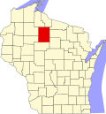
Emery is a town in Price County, Wisconsin, United States. The population was 325 at the 2000 census. The unincorporated community of Dover is located in the town.
According to the United States Census Bureau, the town has a total area of 108.2 square miles (280.3 km2), of which, 108.1 square miles (280.0 km2) is land and 0.1 square miles (0.3 km2) (0.09%) is water.
As of the census [2] of 2000, there were 325 people, 125 households, and 93 families residing in the town. The population density was 3.0 people per square mile (1.2/km2). There were 206 housing units at an average density of 1.9 per square mile (0.7/km2). The racial makeup of the town was 98.46% White, 0.31% Native American, 0.62% from other races, and 0.62% from two or more races. Hispanic or Latino people of any race were 1.54% of the population.
There were 125 households, out of which 30.4% had children under the age of 18 living with them, 61.6% were married couples living together, 5.6% had a female householder with no husband present, and 25.6% were non-families. 21.6% of all households were made up of individuals, and 9.6% had someone living alone who was 65 years of age or older. The average household size was 2.60 and the average family size was 3.08.
In the town, the population was spread out, with 25.2% under the age of 18, 8.9% from 18 to 24, 24.3% from 25 to 44, 26.5% from 45 to 64, and 15.1% who were 65 years of age or older. The median age was 40 years. For every 100 females, there were 119.6 males. For every 100 females age 18 and over, there were 115.0 males.
The median income for a household in the town was $39,250, and the median income for a family was $43,333. Males had a median income of $30,156 versus $25,833 for females. The per capita income for the town was $17,100. About 2.1% of families and 5.1% of the population were below the poverty line, including 5.2% of those under age 18 and 10.4% of those age 65 or over.
Milltown is a town in Whiskey Run Township in Crawford County, Indiana and in Blue River and Spencer townships in Harrison County. The population was 818 at the time of the 2010 census.
Dublin is a town in Jackson Township, Wayne County, in the U.S. state of Indiana. The population was 679 at the 2020 census.
New Vineyard is a town in Franklin County, Maine, United States. The population was 721 at the 2020 census.
Pittsville is a town in Wicomico County, Maryland, United States. The population was 1,417 at the 2010 census. It is included in the Salisbury, Maryland-Delaware Metropolitan Statistical Area.
Pickering is a city in Nodaway County, Missouri, United States. The population was 160 at the 2010 census.
Gauley Bridge is a town in Fayette County, West Virginia, United States. The population was 614 at the 2010 census. The Kanawha River is formed at Gauley Bridge by the confluence of the New and Gauley Rivers. Two miles to the southwest of Gauley Bridge, in Glen Ferris, is Kanawha Falls, a popular stopping point on Midland Trail Scenic Highway.
Anmoore is a town in Harrison County, West Virginia, United States. It is located at the intersection of WV 58 and Interstate 79. The population was 514 at the 2020 census.
Pratt is a town in Kanawha County, West Virginia, United States, along the Kanawha River. The population was 482 at the 2020 census.
Henderson is an unincorporated community and former town in Mason County, West Virginia, United States, at the confluence of the Ohio and Kanawha Rivers. The population was 231 at the 2020 census. It is part of the Point Pleasant, WV–OH Micropolitan Statistical Area. The town was incorporated in 1893 and named for Samuel Bruce Henderson, who owned the townsite at the time. The town was unincorporated following a public hearing on August 11, 2022.
Masontown is a town in western Preston County, West Virginia, United States. The population was 510 at the 2020 census. It is part of the Morgantown metropolitan area.
Mill Creek is a town in Randolph County, West Virginia, United States, along the Tygart Valley River. The population was 563 at the 2020 census.
Chippewa is a town in Ashland County in the U.S. state of Wisconsin. The population was 374 at the 2010 census.
Fort Winnebago is a town in Columbia County, Wisconsin, United States. The population was 855 at the 2000 census. The unincorporated community of Anacker is located in the town.
Franklin is a town in Jackson County, Wisconsin, United States. The population was 325 at the 2000 census. The unincorporated community of Franklin is located in the town. The ghost town of Rogneys was also located in the town.
Sterling is a town in Polk County, Wisconsin, United States. The population was 724 at the 2000 census. The unincorporated communities of Cushing and Wolf Creek are located partially in the town.
Alban is a town in Portage County, Wisconsin, United States. The population was 897 at the 2000 census. The unincorporated community of Alban is located within the town. The town was named after Civil War Colonel James S. Alban, a state senator in the early 1850s lost in the Battle of Shiloh. The Township is Town 25 North, Range 10 East, 4th Principal Meridian.
Green Valley is a town in Shawano County, Wisconsin, United States. The population was 1,024 at the 2000 census. The census-designated place of Green Valley and unincorporated communities of Advance and Pulcifer are located in the town.
Hartland is a town in Shawano County, Wisconsin, United States. The population was 825 at the 2000 census. The unincorporated community of Slab City is located within the town. The unincorporated communities of Frazer Corners and Zachow are also located partially in the town. Hartland was established in 1859.
Beaver Brook is a town in Washburn County, Wisconsin, United States. The population was 643 at the 2000 census. The unincorporated communities of Beaver Brook and Chicago Junction are located in the town.
North Crows Nest is a town in Washington Township, Marion County, Indiana, United States. It is approximately 7 miles (11 km) north of downtown Indianapolis. The population was 44 at the 2020 census. It has existed as an "included town" since 1970, when it was incorporated into Indianapolis as part of Unigov. It is part of Indianapolis, but retains town governmental powers under IC 36-3-1-11.