Fairview Crossroads, South Carolina | |
|---|---|
 Fairview Crossroads  Fairview Crossroads | |
| Coordinates: 33°45′31″N81°21′59″W / 33.75861°N 81.36639°W | |
| Country | United States |
| State | South Carolina |
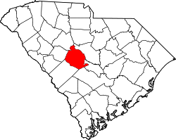
| County | Lexington |
| Area | |
• Total | 5.72 sq mi (14.81 km2) |
| • Land | 5.71 sq mi (14.79 km2) |
| • Water | 0.01 sq mi (0.01 km2) |
| Elevation | 469 ft (143 m) |
| Population | |
• Total | 540 |
| • Density | 94.55/sq mi (36.51/km2) |
| Time zone | UTC-5 (Eastern (EST)) |
| • Summer (DST) | UTC-4 (EDT) |
| ZIP Code | 29070 (Leesville) |
| Area codes | 803/839 |
| FIPS code | 45-24865 |
| GNIS feature ID | 2807070 [2] |
Fairview Crossroads is an unincorporated community and census-designated place (CDP) in Lexington County, South Carolina, United States. It was first listed as a CDP prior to the 2020 census [2] with a population of 540. [4]
Contents
The CDP is in southern Lexington County, centered on the junction of U.S. Route 178 and South Carolina Highway 113. US 178 leads northwest 15 miles (24 km) to Batesburg-Leesville and southeast 7 miles (11 km) to Pelion, while Highway 113 leads south 7 miles (11 km) to Wagener.