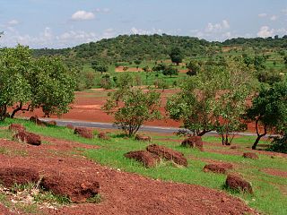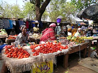
Kayes Cercle is an administrative subdivision of the Kayes Region of Mali. Its seat is the city of Kayes, which is also the capital of its Region and its largest city. The Cercle is further divided into Communes. The city of Kayes is subdivided into Urban Communes and Wards. Kayes Cercle's population in 2009 was 513,362.

Nara Cercle is an administrative subdivision of the Koulikoro Region of Mali. Its seat is the town of Nara.

Bougouni Cercle is an administrative subdivision of the Sikasso Region of Mali. The administrative center (chef-lieu) is the town of Bougouni.

Kadiolo Cercle is an administrative subdivision of the Sikasso Region of southern Mali. The administrative center (chef-lieu) is the town of Kadiolo.

Sikasso Cercle is one of seven administrative subdivision of the Sikasso Region of southern Mali. The capital is the town of Sikasso.

Barouéli Cercle is an administrative subdivision of the Ségou Region of Mali. The administrative center (chef-lieu) is the town of Barouéli.

Tominian Cercle is an administrative subdivision of the Ségou Region of Mali. The administrative center of the local government is in the town of Tominian. The Cercle is divided into Communes, and below this, quarters/villages. In the 2009 census the cercle had a population of 219,853 people.

Gourma-Rharous Cercle is an administrative subdivision of the Tombouctou Region of Mali. The administrative center is the town of Gourma-Rharous.
Yinindougou is a small town and commune in the Cercle of Bougouni in the Sikasso Region of southern Mali. In 1998 the commune had a population of 4,104. The commune consists of 11 villages.
Defina is a small town and commune in the Cercle of Bougouni in the Sikasso Region of southern Mali. In 1998 the commune had a population of 6,109.
Bladié-Tiémala is a rural commune and village in the Cercle of Bougouni in the Sikasso Region of southern Mali.
Faragouaran is a small town and commune in the Cercle of Bougouni in the Sikasso Region of southern Mali. In 1998 the commune had a population of 6,971.
Sido is a small town and commune in the Cercle of Bougouni in the Sikasso Region of southern Mali. In 1998 the commune had a population of 13,877.
Kokele is a small town and commune in the Cercle of Bougouni in the Sikasso Region of southern Mali. In 1998 the commune had a population of 5,753.
Sibirila is a commune in the Cercle of Bougouni in the Sikasso Region of southern Mali. The principal town lies at Manankoro. In 1998 the commune had a population of 14,012.
Kouroulamini is a commune in the Cercle of Bougouni in the Sikasso Region of southern Mali. The principal town lies at N'Tentou. In 1998 the commune had a population of 3,128.
Diallassagou is a small town and commune in the Cercle of Bankass in the Mopti Region of Mali. In 1998 the commune had a population of 18,799.
Kirchamba is a village and commune of the Cercle of Diré in the Tombouctou Region of Mali. As of 1998 the commune had a population of 2,305.
Tindirma is a village and commune of the Cercle of Diré in the Tombouctou Region of Mali. As of 1998 the commune had a population of 3,419.
Bagaroua is a village and rural commune in Niger.


