
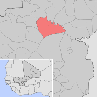
Sikasso Cercle is one of seven administrative subdivision of the Sikasso Region of southern Mali. The capital is the town of Sikasso.
Nimbougou is a village and rural commune in the Cercle of Kadiolo in the Sikasso Region of southern Mali. The commune covers an area of 238 square kilometers and includes 5 villages. In the 2009 census it had a population of 9,992. The village of Nimbougou, the administrative center (chef-lieu) of the commune, is 43 km northeast of Kadiolo and 8 km from the border with Burkina Faso The primary language is Senufo, specifically Suppire.
Sorobasso is a village and commune in the Cercle of Koutiala in the Sikasso Region of southern Mali. The commune covers an area of 133 square kilometers and includes 5 villages. In the 2009 census it had a population of 4,884. The village of Sorobasso, the administrative centre (chef-lieu) of the commune, is 30 km northeast of Koutiala on the Route Nationale 13 that links Koutiala with San.
N'Goutjina is a village and rural commune in the Cercle of Koutiala in the Sikasso Region of southern Mali. The commune covers an area of 236 square kilometers and includes 8 villages. In the 2009 census it had a population of 18,667. The village of N'Goutjina, the administrative centre (chef-lieu) of the commune, is 10 km south of Koutiala.
Zaniéna is a village and rural commune in the Cercle of Sikasso in the Sikasso Region of southern Mali. The commune covers an area of 174 square kilometers and includes ten villages. In the 2009 census it had a population of 10,038. The village of Zaniéna, the administrative center (chef-lieu) of the commune, is 83 km west of Sikasso.
Farakala is a village and commune in the Cercle of Sikasso in the Sikasso Region of southern Mali. The commune covers an area of 280 square kilometers (110 sq mi) and includes 11 villages. In the 2009 census it had a population of 7,960. The village of Farakala lies 40 km (25 mi) west of Sikasso on the RN7 highway linking Sikasso and Bougouni.
Koumankou is a village and rural commune in the Cercle of Sikasso in the Sikasso Region of southern Mali. The commune covers an area of 243 square kilometers and includes 4 villages. In the 2009 census it had a population of 4,227. The village of Koumankou, the chef-lieu of the commune, is 101 km northwest of Sikasso.
Dialakoro is a village and rural commune in the Cercle of Sikasso in the Sikasso Region of southern Mali. The commune covers an area of 83 square kilometers and includes four villages. In the 2009 census it had a population of 6,893. The village of Dialakoro, the chef-lieu of the commune, is 98 km northwest of Sikasso.
Kouoro is a small town and rural commune in the Cercle of Sikasso in the Sikasso Region of southern Mali. The commune covers an area of 472 square kilometers and includes the town and five villages. In the 2009 census it had a population of 11,315. The town of Kouoro, the chef-lieu of the commune, is 75 km north of Sikasso, on the RN11, the main road linking Sikasso and Koutiala. It is also about 30 km west of the border with Burkina Faso.
Pimperna is a village and rural commune in the Cercle of Sikasso in the Sikasso Region of southern Mali. The commune covers an area of 161 square kilometers and includes 10 villages. In the 2009 census it had a population of 11,329. The village of Pimperna, the administrative center (chef-lieu) of the commune, is 16 km northwest of Sikasso on the RN11, the main road between Sikasso and Koutiala.
Natien is a village and rural commune in the Cercle of Sikasso in the Sikasso Region of southern Mali. The commune covers an area of 207 square kilometers and includes 9 villages. In the 2009 census it had a population of 7,404. The village of Natien, the administrative center (chef-lieu) of the commune, is 18 km west of Sikasso on the RN7, the main road linking Sikasso and Bougouni.
Kapala is a village and rural commune in the Cercle of Sikasso in the Sikasso Region of southern Mali. The commune covers an area of 175 square kilometers and includes eight villages. In the 2009 census it had a population of 10,200. The village of Kapala is about 25 km south of Sikasso.
Fama is a small town and rural commune in the Cercle of Sikasso in the Sikasso Region of southern Mali. The commune covers an area of 222 square kilometers and includes the town and five villages. In the 2009 census it had a population of 7,960. The town of Fama, the chef-lieu of the commune, is 24 km north of Sikasso.
Kafouziéla is a village and rural commune in the Cercle of Sikasso in the Sikasso Region of southern Mali. The commune covers an area of 59 square kilometers and includes six villages. In the 2009 census it had a population of 4,589. The village of Kafouziéla, the chef-lieu of the commune, is 14 km north of Sikasso.
Diomaténé is a village and rural commune in the Cercle of Sikasso in the Sikasso Region of southern Mali. The commune covers an area of 96 square kilometers and includes four villages. In the 2009 census it had a population of 4,274. The village of Diomaténé, the chef-lieu of the commune, is 11 km north of Sikasso.
Koumbia is a village and commune in the Cercle of Yorosso in the Sikasso Region of southern Mali. The commune covers an area of 719 square kilometers and includes 11 villages. In the 2009 census it had a population of 24,915. The village of Koumbia, the administrative center (chef-lieu) of the commune, is 28 km north-northeast of Yorosso.
Zanfigué is a commune in the Cercle of Koutiala in the Sikasso Region of southern Mali. The commune covers an area of 226 square kilometers and includes 11 villages. In the 2009 census it had a population of 14,841. The village of Bobola Zangasso, the administrative centre (chef-lieu) of the commune, is 55 km east-northeast of Koutiala.
Songoua is a commune in the Cercle of Koutiala in the Sikasso Region of southern Mali. The commune covers an area of 107 square kilometers and includes the villages of Sirakélé and Kilé. In the 2009 census it had a population of 6,918. The village of Sirakélé, the administrative centre (chef-lieu) of the commune, is 15 km north of Koutiala.
Kapolondougou is a rural commune in the Cercle of Sikasso in the Sikasso Region of southern Mali. The commune covers an area of 526 square kilometers and includes 19 villages. In the 2009 census it had a population of 12,605. The main village (chef-lieu) is N'Kourala. It lies 50 km west of Sikasso on the main road, the RN7, linking Sikasso and Bougouni.
Finkolo Ganadougou is a rural commune in the Cercle of Sikasso in the Sikasso Region of southern Mali. The commune covers an area of 464 square kilometers and includes the 16 villages. In the 2009 census it had a population of 8,498. The main village (chef-lieu) is the village of Finkolo. The village of Finkolo, the chef-lieu of the commune, is 59 km west of Sikasso.

