
Bamako is the capital and largest city of Mali, with a 2009 population of 1,810,366 and an estimated 2022 population of 2.81 million. It is located on the Niger River, near the rapids that divide the upper and middle Niger valleys in the southwestern part of the country.
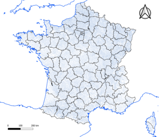
The commune is a level of administrative division in the French Republic. French communes are analogous to civil townships and incorporated municipalities in the United States and Canada, Gemeinden in Germany, comuni in Italy, or municipios in Spain. The UK's equivalent are civil parishes. Communes are based on historical geographic communities or villages and are vested with significant powers to manage the populations and land of the geographic area covered. The communes are the fourth-level administrative divisions of France.

Mopti is the fifth administrative region of Mali, covering 79,017 km2. Its capital is the city of Mopti. During the 2012 Northern Mali conflict, the frontier between Southern Mali which is controlled by the central government and the rebel-held North ran through Mopti Region.

Mopti is a town and an urban commune in the Inner Niger Delta region of Mali. The town is the capital of the Mopti Cercle and the Mopti Region. Situated 630 km northeast of Bamako, the town lies at the confluence of the Niger and the Bani Rivers and is linked by an elevated causeway to the town of Sévaré. The urban commune, which includes both Mopti and Sévaré, had a population of 114,296 in the 2009 census.

Brive-la-Gaillarde is a commune of France. It is a sub-prefecture and the largest city of the Corrèze department. It has around 46,000 inhabitants, while the population of the agglomeration was 75,579 in 2019.

Ségou is a town and an urban commune in south-central Mali that lies 235 kilometres (146 mi) northeast of Bamako on the right bank of the River Niger. The town is the capital of the Ségou Cercle and the Ségou Region. With 130,690 inhabitants in 2009, it is the fifth-largest town in Mali.

Sikasso is a city in the south of Mali and the capital of the Sikasso Cercle and the Sikasso Region. It is Mali's second largest city with 225,753 residents in the 2009 census.

Ségou Region is an administrative region in Mali, situated in the centre of the country with an area of 64,821 km2 (25,028 sq mi), around 5% of Mali. The region is bordered by Sikasso Region on the south, Tombouctou and Mopti on the east, Burkina Faso to the southeast and the Koulikoro Region to the west. In 2009 it had 2,336,255 inhabitants, making it the second most populous region of Mali. Its administrative capital is the town of Ségou.

Mali Iđoš is a village and municipality located in the North Bačka District of the autonomous province Vojvodina, Serbia. The municipality comprises three local communities and has a population of 12,031, of whom 6,486 (53.91%) are ethnic Hungarians, 2,388 are Serbs (19.85%) and 1,956 are Montenegrins (16.26%). Mali Iđoš village has a population of 4,830.

Plaisir is a commune located in the heart of the Yvelines department in the Île-de-France region in Northern France. It is located in the western outer suburbs of Paris, 29.5 km (18.3 mi) from the centre of Paris.

Les Clayes-sous-Bois is a commune in the Yvelines department in the Île-de-France region in north-central France. It is located in the western suburbs of Paris 26.7 km (16.6 mi) from the center. The Clayes-sous-Bois inhabitants are called "Clétiens".

Lampaul-Guimiliau is a commune in the Finistère department and administrative region of Brittany in north-western France. It is noted for its parish close.

Ainay-le-Château is a commune in the Allier department in the Auvergne-Rhône-Alpes region of central France.
Ballans is a commune in the department of Charente-Maritime, southwestern France.
Vouvant is a commune in the department of Vendée, in the Pays de la Loire region in western France.
Tomora is a commune in the Cercle of Bafoulabé in the Kayes Region of south-western Mali. The administrative centre (chef-lieu) is Oussoubidiagna, a small town with around 4,000 inhabitants. The commune contains over thirty small villages. In the 2009 census it had a population of 32,527. Most of the inhabitants of Tomora are Khassonkés, with a minority of Soninke, Fulani and Malinke engaged mostly in farming.
Bongosso is a village and seat (chef-lieu) of the commune of Koromo in the Cercle of Koutiala in the Sikasso Region of southern Mali. The village is 45 km (28 mi) northeast of Koutiala.
Sirakélé is a village and seat of the commune of Songoua in the Cercle of Koutiala in the Sikasso Region of southern Mali. The village is 15 km north of Koutiala.
Sansanding is a small town and rural commune in the Cercle of Ségou in the Ségou Region of southern-central Mali. The commune includes the town and 17 of the surrounding villages in an area of 315 square kilometers. In the 2009 census it had a population of 23,109. The town sits on the left (north) bank of the River Niger about 50 km downstream from Ségou.

Ten Hamadi or Tenhemad is a village and rural commune in southern Mauritania, in the Aïoun El Atrouss department of the Hodh El Gharbi region. In 2000, the commune had a population of 2,264, of which 155 lived in the village of Ten Hamadi itself, approximately 17 kilometres (11 mi) southwest of the main town and departmental capital of Aïoun El Atrouss. The population estimate in 2007 was 3,686, spread over 16 villages.


