Franklin Knolls (Silver Spring, Maryland)

Last updated
Franklin Knolls
Neighborhood
Franklin Knolls, a neighborhood of Silver Spring, Montgomery County, Maryland. 05.jpg
Franklin Knolls neighborhood
USA Maryland location map.svg
Red pog.svg
Franklin Knolls
Location in Maryland
Coordinates: 39°00′53″N76°59′52″W / 39.014832°N 76.997754°W / 39.014832; -76.997754 Coordinates: 39°00′53″N76°59′52″W / 39.014832°N 76.997754°W / 39.014832; -76.997754 [1]
CountryFlag of the United States.svg United States
StateFlag of Maryland.svg  Maryland
County Flag of Montgomery County, Maryland.svg Montgomery
Unincorporated community Silver Spring
ZIP Code
20901
Area codes 301, 240
GNIS feature ID 590246

Franklin Knolls is a residential neighborhood located in Silver Spring, a census-designated place in Montgomery County.

Contents

Location

Eastern Middle School in Franklin Knolls, March 2019. Franklin Knolls, a neighborhood of Silver Spring, Montgomery County, Maryland. 08.jpg
Eastern Middle School in Franklin Knolls, March 2019.

Franklin Knolls is bounded by the Capital Beltway to the north, University Boulevard to the west, the Northwest Branch of the Anacostia River to the east, and the neighborhood of Montgomery Knolls to the south which begins where East Melbourne Avenue intersects with Greer Avenue. Across University Boulevard to the west lies the neighborhoods of Indian Spring Terrace and Long Branch, while the neighborhoods of Oakview and Hillandale lie east across the Northwest Branch Anacostia River.

Landmarks

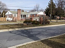
Franklin Knolls is home to Eastern Middle School, located at the intersection of University Boulevard and East Franklin Avenue. Franklin Knolls is situated between the neighborhoods of Four Corners/Woodmoor to the northwest and the neighborhoods of Montgomery Knolls, Clifton Park Village, New Hampshire Estates, and Langley Park to the southeast.

The Franklin Knolls River Trail is a 4,625 feet long foot trail that passes through the neighborhood. The trail runs from East Franklin Avenue near the Franklin Knolls Swimming Pool along a tributary of the Northwest Branch of the Anacostia River and then follows alongside the Northwest Branch until it reaches the Montgomery Knolls neighborhood and turns into the Clifton Park River Trail. The Clifton Park River Trail continues through the neighborhoods of Montgomery Knolls and Clifton Park Village along the Northwest Branch until it reaches Montgomery Knolls Elementary School. [2] [3]

History

Prior to the arrival of European colonizers, the land that Franklin Knolls was built on was inhabited by the Piscataway people. During the early and mid-19th century, the land that Franklin Knolls is located on was once a rural, agricultural area. In the 1930s, developers created the nearby neighborhoods of Four Corners, Woodmoor, Northwood Park, Indian Spring Village, Indian Spring Terrace, North Hills of Sligo, and Fairway. These neighborhoods were located near the intersection of Colesville Road and Old Bladensburg Road (now University Boulevard). Between 1945 and 1955, these subdivisions were expanded while the newer neighborhoods of Franklin Knolls and Northwood were created. [4] Franklin Knolls was created as a residential development in the 1950s and early 1960s. [5] The community was subdivided by Adam May Brady, Fred Bashwitz, and Elizabeth Bashwitz of Franklin Knolls Inc., as well as the Cafritz Construction Company, headed by Morris Cafritz and with Martin Atlas serving as secretary. The Cafritz Construction Company was the primary building/developer in the neighborhood. [6] Cafritz was an influential developer who, prior to the passage of the 1968 Fair Housing Act, used racially restrictive covenants to exclude African Americans and other racial minorities from all-white suburban communities. [7] Franklin Knolls was once entirely white and mostly Jewish or Catholic, in part due to proximity to two Jewish and Catholic institutions nearby: Temple Israel, a Conservative synagogue, and Saint Bernadette, a Roman Catholic school and church. The Jewish community has largely left the area, due to Temple Israel on University Boulevard closing and merging with Beth Tikva of Rockville (now the Tikvat Israel Congregation). [8] Temple Israel was first founded in 1952 as the Langley Park Hebrew Congregation in order to serve the then growing Jewish population in Langley Park, Montgomery Knolls, and Franklin Knolls. [9] The Temple's former building is now occupied by Mount Jezreel Baptist, a predominantly black church. Over time, the community has become more ethnically and racially diverse and has a mix of whites, African-Americans, Latinos, Asians, and others. In 2003, the Franklin Knolls Civic Association's newsletter was translated into Spanish and Vietnamese. [10]

Transportation

Franklin Knolls is serviced by Metrobus numbers C2 and C4, as well as by Ride On numbers 14 and 19. Washington Metro service is available on the Red Line in nearby Silver Spring, Wheaton, and Takoma. By 2022, Purple Line service will be available at the nearby Piney Branch Road and Long Branch stations.

Notable people

See also

Related Research Articles

<span class="mw-page-title-main">Silver Spring, Maryland</span> Census-designated place in Maryland, United States

Silver Spring is a census-designated place (CDP) in southeastern Montgomery County, Maryland, United States, near Washington, D.C. Although officially unincorporated, in practice it is an edge city, with a population of 81,015 at the 2020 census, making it the fifth-most populous place in Maryland after Baltimore, Columbia, Germantown, and Waldorf.

<span class="mw-page-title-main">Kemp Mill, Maryland</span> Census-designated place in Maryland, United States

Kemp Mill is a census-designated place and an unincorporated census area in Montgomery County, Maryland, United States. The population was 13,378 at the 2020 census.

<span class="mw-page-title-main">Chillum, Maryland</span> Census-designated place in Maryland

Chillum is an unincorporated area and census-designated place in Prince George's County, Maryland, United States, bordering Washington, D.C. and Montgomery County.

<span class="mw-page-title-main">Langley Park, Maryland</span> Census-designated place in Maryland

Langley Park is an unincorporated area and census-designated place (CDP) in Prince George's County, Maryland, United States. It is located inside the Capital Beltway, on the northwest edge of Prince George's County, bordering Montgomery County. Per the 2020 census, the population was 20,126.

<span class="mw-page-title-main">Anacostia River</span> River in Maryland and the District of Columbia, United States

The Anacostia River is a river in the Mid Atlantic region of the United States. It flows from Prince George's County in Maryland into Washington, D.C., where it joins with the Washington Channel to empty into the Potomac River at Buzzard Point. It is about 8.7 miles (14.0 km) long. The name "Anacostia" derives from the area's early history as Nacotchtank, a settlement of Necostan or Anacostan Native Americans on the banks of the Anacostia River.

<span class="mw-page-title-main">Sligo Creek</span> Stream in Maryland, United States of America

Sligo Creek is a free-flowing tributary of the Northwest Branch of the Anacostia River in Maryland. The creek is approximately 9.1 miles (14.6 km) long, with a drainage area of about 11.6 square miles (30 km2).

Carole Highlands is an unincorporated community located in Prince George's County, Maryland, United States. Carole Highlands is contained between East West Highway to the south, University Boulevard to the north, Larch Avenue, Hopewell Avenue, and 15th Avenue to the west, and Riggs Road to the east. Carole Highlands borders the adjacent neighborhoods of Chillum, Green Meadows, Lewisdale, and Langley Park in Prince George's County, while bordering the city of Takoma Park in Montgomery County, MD. For statistical purposes, it is part of the Chillum census-designated place (CDP).

<span class="mw-page-title-main">Sligo Creek Trail</span> Paved hiker/biker trail along Sligo Creek in Maryland

Sligo Creek Trail is a paved hiker-biker trail running along Sligo Creek in the suburbs of Washington, D.C. Most of the trail passes through tree-filled parkland. The trail and surrounding park is a popular place for locals to jog, walk, bicycle, roller-skate, and take their children to the playground. Many local families enjoy picnicking at one of the 15 picnic areas along the trail.

<span class="mw-page-title-main">Greenway (Washington, D.C.)</span> Neighborhood in Ward 7, United States

Greenway is a residential neighborhood in Southeast Washington, D.C., in the United States. The neighborhood is bounded by East Capitol Street to the north, Pennsylvania Avenue SE to the south, Interstate 295 to the west, and Minnesota Avenue to the east.

<span class="mw-page-title-main">Little Falls Branch (Potomac River tributary)</span> Stream in Maryland, United States of America

Little Falls Branch, a 3.8-mile-long (6.1 km) tributary stream of the Potomac River, is located in Montgomery County, Maryland. In the 19th century, the stream was also called Powder Mill Branch. It drains portions of Bethesda, Somerset, Friendship Heights, and the District of Columbia, flows under the Chesapeake and Ohio Canal (C&O), and empties into the Potomac at Little Falls rapids, which marks the upper end of the tidal Potomac.

<span class="mw-page-title-main">Paint Branch</span> Stream in Maryland, US

Paint Branch is a 17.0-mile-long (27.4 km) tributary stream of the Anacostia River that flows Southeastwards through Montgomery County and Prince George's County, Maryland. Specifically, its primary tributary is of the Northeast Branch, which flows to the Anacostia River, Potomac River and the Chesapeake Bay. The beginning elevation of the stream is 480 feet above sea level and it subsequently drops to 30 feet when its flows meet the Indian Creek in College Park, Maryland.

<span class="mw-page-title-main">Metropolitan Branch Trail</span>

The Metropolitan Branch Trail is an American rail trail that, when completed, will run eight miles from the transit center in Silver Spring, Maryland, to Union Station in the District of Columbia. It serves to extend the Capital Crescent Trail where it merges with the active WMATA and CSX railroad tracks into the National Capital. At Fort Totten, a connector trail to the Northwest Branch Trail of the Anacostia Tributary Trail System at Hyattsville, Maryland, will be constructed; and an on-street connection to the National Mall will be constructed from Union Station. When completed, the Metropolitan Branch Trail will serve as part of the East Coast Greenway.

Woodmoor is a neighborhood in the northern section of Silver Spring, Maryland in southeastern Montgomery County, in the U.S. state of Maryland. Its borders extend from U.S. 29 to the west, Northwest Branch Park to the north, the Capital Beltway (I-95) to the east, and University Boulevard to the south. It lies on one of the "Four Corners" at the northeastern corner of the intersection of Colesville Road, and University Boulevard.

Lewisdale is an unincorporated community in Prince George's County, Maryland, United States. For statistical purposes, it is considered part of the Chillum census-designated place (CDP). Lewisdale is a neighborhood contained between the Northwest Branch Anacostia River to the east, East West Highway to the south, University Boulevard to the north, and Riggs Road to the west.

<span class="mw-page-title-main">Northwest Branch Anacostia River</span> Anacostia River tributary in Maryland, U.S.

Northwest Branch Anacostia River is a 21.5-mile-long (34.6 km) free-flowing stream in Montgomery County and Prince George's County, Maryland. It is a tributary of the Anacostia River, which flows to the Potomac River and the Chesapeake Bay.

<span class="mw-page-title-main">Anacostia Tributary Trail System</span> Hiking trail in Maryland

The Anacostia Tributary Trail System (ATTS) is a unified and signed system of stream valley trails joining trails along the Anacostia tributaries of Northwest Branch, Northeast Branch, Indian Creek and Paint Branch with a trail along the Anacostia River, set aside and maintained by the Maryland-National Capital Park and Planning Commission (M-NCPPC) in the Maryland suburbs of Washington, D.C.

<span class="mw-page-title-main">Four Corners, Maryland</span> Neighborhood in Montgomery County, Maryland, United States

Four Corners is a neighborhood located in Montgomery County, Maryland, United States. Many residents of Four Corners consider the neighborhood to be a part of Silver Spring. The United States Census Bureau defines Four Corners as a distinct census-designated place (CDP). Prior to 2010, it was defined as a part of the Silver Spring CDP. Four Corners has a population of 8,316 as of the 2020 census.

<span class="mw-page-title-main">Northwest Branch Trail</span> Hiking trail in Maryland

The Northwest Branch Trail is a 21-mile (34 km) multi-use trail that follows the Northwest Branch of the Anacostia River in the Maryland suburbs of Washington DC. It is part of the Rachel Carson Greenway and the Anacostia Tributary Trail System. It runs between the Layhill neighborhood of Silver Spring and Bladensburg in Montgomery and Prince George's County, Maryland, USA.

<span class="mw-page-title-main">Indian Spring</span> Neighborhood

Indian Spring is a mostly residential neighborhood of Silver Spring, Maryland. Located within the Silver Spring CDP, it is sometimes considered a southeastern neighborhood of Four Corners. It is one of the oldest established neighborhoods in Silver Spring.

<span class="mw-page-title-main">Temple Israel (Silver Spring, Maryland)</span> Former synagogue

Temple Israel was once the largest synagogue in Silver Spring, Maryland. Located on University Boulevard in the neighborhood of Montgomery Knolls, it was an egalitarian synagogue associated with the Conservative branch of Judaism.

References

  1. "Franklin Knolls". Geographic Names Information System . United States Geological Survey, United States Department of the Interior . Retrieved October 5, 2019.
  2. "Franklin Knolls River Trail". Trails.com. Retrieved 2019-06-17.
  3. "Clifton Park River Trail". Trails.com. Retrieved 2019-06-17.
  4. "The Suburbanization Historic Context and Survey Methodology" (PDF). Maryland State Highway Administration . Retrieved 2021-05-05.
  5. "The Suburbanization Historic Context and Survey Methodology" (PDF). Maryland State Highway Administration . Retrieved 2019-05-25.
  6. "CAPSULE SUMMARY SHEET" (PDF). Maryland Historical Trust . Retrieved 2021-05-04.
  7. "5 marks Jewish developers made on Montgomery County". Washington Jewish Week . Retrieved 2021-05-04.
  8. "Temple Israel". Jewish Historical Society of Great Washington. Retrieved 2019-05-25.
  9. "Flower Theater and Flower Shopping Center; Flower Avenue Shopping Center" (PDF). Maryland Historical Trust. Retrieved 2019-05-25.
  10. "In Silver Spring, the Road to Affordability". The Washington Post . Retrieved 2019-05-25.
  11. "Washington, D.C" Huang's World . Viceland. Season 2, Episode 1. June 28, 2017.