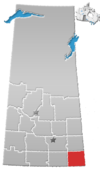
Alida is a village within the Rural Municipality of Reciprocity No. 32, in the province of Saskatchewan, Canada. The village is approximately 85 km east of the City of Estevan. Farming and oil are the major local industries. Several ghost towns are in the vicinity, including Nottingham to the east, Auburnton, to the west, and Cantal to the northwest. With the investment of oil and other industries the area continues to grow.
Argyle No. 1, Saskatchewan is a rural municipality in south-eastern Saskatchewan, Canada along Highway 18. The Local Improvement District number 1 became Rural Municipality of Argyle No. 1, Saskatchewan on December 19, 1912.

Hallonquist is a hamlet in Coulee Rural Municipality No. 136, Saskatchewan, Canada. The hamlet is located on Highway 363 about 21 km (13 mi) west of Hodgeville.

Expanse, Saskatchewan is an unincorporated area in the rural municipality of Lake Johnston No. 102, in the Canadian province of Saskatchewan. Expanse is located just to the south of Old Wives Lake on a grid road. The grid connects to Highway 2 near Ardill in south central Saskatchewan. Just to the south of Highway 2 is Lake of the Rivers. Expanse is too small to be enumerated as a separate entity during the census taking, so it was a part of the population given for rural municipality Lake Johnston No. 102.

Arena was once a hamlet in the southwestern part of the province of Saskatchewan, Canada.

Brooking, Saskatchewan was once a community in the province of Saskatchewan, Canada. It was named after Brookings, South Dakota.
Key West No. 70 is a rural municipality in the Canadian province of Saskatchewan. There are 309 people who live there. The total area of Key West No. 70 is 825.26 square kilometres (318.6 sq mi). The population density is 0.4 people per square kilometer. There are 133 private dwellings in Key West No. 70 occupied by usual residents and 152 private dwellings total. Key West No. 70 is in SARM Division No. 2 in southwest Saskatchewan.

Piapot is a hamlet within the Rural Municipality of Piapot No. 110, Saskatchewan, Canada. Listed as a designated place by Statistics Canada, the hamlet had a population of 50 in the Canada 2016 Census.

South Fork is an unincorporated community within the Rural Municipality of Arlington No. 79, Saskatchewan, Canada.

Parkbeg is a hamlet in Wheatlands Rural Municipality No. 163, Saskatchewan, Canada. The hamlet is located at the junction of Highway 1 and Highway 627 approximately 58 km directly west of the City of Moose Jaw on the Trans Canada Highway.
Crystal Hill is a hamlet in Terrell Rural Municipality No. 101 in the province of Saskatchewan, Canada. The hamlet is located 21 km east of Highway 36 on Highway 713. Very little remains of Crystal Hill.

Ardill is a hamlet in Lake Johnston Rural Municipality No. 102, Saskatchewan, Canada. Listed as a designated place by Statistics Canada, the hamlet had a listed population of 0 in the Canada 2006 Census.
Mount Pleasant No. 2 is a rural municipality in the Canadian province of Saskatchewan. It is located in southeastern Saskatchewan and is within SARM Division No. 1 and Census Division No. 1. Its population was 418 as of the 2006 Census.
Lake Johnston No. 102 is a rural municipality in the Canadian province of Saskatchewan, located in the Census Division 3, just north of the Town of Assiniboia, and south of the City of Moose Jaw, in the southwestern corner of the Province. The seat of the municipality is located in the village of Mossbank.
Reciprocity No. 32 is a rural municipality in south-eastern Saskatchewan, Canada encompassing 733.06 square kilometers in area. This rural municipality (RM) maintains its office in Alida, Saskatchewan; the RM surrounds Alida but does not include it, because an RM is typically the rural portion of what would otherwise be a county. Reciprocity is one of 296 rural municipalities in Saskatchewan.
Wawken No. 93 is a rural municipality in south-east Saskatchewan, Canada encompassing 836.39 square kilometers in area. The rural municipality maintains offices in the community of Wawota, Saskatchewan. The rural municipality in conjunction with the provincial government is in charge of maintenance of highways in its area. As well, the municipality provides policing, fire protection and municipal governance for the rural district, with a reeve as its administrator. Agriculture plays an important role in the rural municipality. The rural municipality includes Kenosee Lake and the Kenosee Superslides. The municipality also includes the ghost town of Cannington Lake.

Eyre is a ghost town in Chesterfield Rural Municipality, Saskatchewan, Canada. Originally established by the Jewish Colonization Association. The Jewish block settlement was established in 1910 mostly of immigrants from Russia and some from the United States.
Cavell is a hamlet in Reford Rural Municipality No. 379, Saskatchewan, Canada. It previously held the status of a village until January 1, 1943.

Cullen is a former hamlet in Benson Rural Municipality No. 35, Saskatchewan, Canada.
Galilee is an unincorporated community in Terrell Rural Municipality No. 101, Saskatchewan, Canada. The community is located on Highway 36 about 50 km south of the city of Moose Jaw. Very little remains of the community other thank an old general store and a private residence.


