Galveston Seawall

Last updated

Galveston Seawall
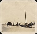
No. 3, Sea Wall, From West of Rapid Fire Battery, Fort Crockett - NARA - 278143.jpg
Galveston Seawall during construction
Relief map of Texas.png
Red pog.svg
Galveston Seawall
Usa edcp relief location map.png
Red pog.svg
Galveston Seawall
LocationSeawall Blvd.,
Galveston, Texas
Coordinates 29°18′09″N94°46′27″W / 29.30250°N 94.77417°W / 29.30250; -94.77417 (Galveston Seawall)
Area8 acres (3.2 ha)
Built1902 (1902)
Built byJ.M. O`Rourke & Co.
ArchitectGen. H.M. Robert
Architectural styleProtective Seawall
NRHP reference No. 77001443 [1]
TSAL No. 8200000269
Significant dates
Added to NRHPAugust 18, 1977
Designated TSALJanuary 1, 1981

The Galveston Seawall is a seawall in Galveston, Texas, that was built after the Galveston hurricane of 1900 for protection from future hurricanes. Construction began in September 1902, and the initial segment was completed on July 29, 1904. From 1904 to 1963, the seawall was extended from 3.3 miles (5.3 km) to over 10 miles (16 km). [2]

Contents

Description

Although the Seawall performed as intended, it created an unintended and insurmountable consequence: passive erosion resulting in the gradual disappearance of the once-wide beach and the resort business with it. "Within twenty years, the city had lost one hundred yards of sand. People who once watched auto racing on a wide beach were left with a narrow strip of sand at low tide and a gloomy vista of waves on rocks when the tide was high." [3] Houston soon overtook Galveston as the major city in the region.

Reporting in the aftermath of the 1983 Hurricane Alicia, the Corps of Engineers estimated that $100 million in damage was avoided because of the seawall. [4] On September 13, 2008, Hurricane Ike's large waves over-topped the seawall. [5] As a result, a commission was established by the Texas governor to investigate preparing for and mitigating future disasters. [6]

A proposal has been put forth to build an "Ike Dike", a massive levee system that would protect the Galveston Bay and the important industrial facilities that line the coast and the Houston Ship Channel from a future, potentially more destructive storm. The proposal has gained widespread support from a variety of business interests. However, this proposal never passed the conceptual stage. Since 2009 there has been many similar propositions brought forth for a more practical layered network to consist of smaller, local levees and natural protections have been put forward by the SSPEED Center at Rice University and the University of Houston. These proposals include a surge gate at the mouth of the Houston Ship Channel connecting adjacent high ground near the Hartman Bridge and hard protections for the west shore of Galveston Bay and around the densely developed east end of Galveston Island. Also included is the proposed lower coastal Lone Star Coastal National Recreation Area.

Texas F.M. 3005 is known as Seawall Boulevard where it runs along the seawall. The sidewalk adjacent to Seawall Boulevard on top of the seawall is claimed to be the longest continuous sidewalk in the world at 10.3 miles (16.6 km) long. [7]

The seawall is 10 miles (16 km) long. It is approximately 17 feet (5.2 m) high and 16 feet (4.9 m) thick at its base. The seawall was listed in the National Register of Historic Places in 1977 and designated a National Historic Civil Engineering Landmark by the American Society of Civil Engineers in 2001. [8] [9]

Many miles of the seawall are painted with murals. These huge murals are painted by children and depict underwater life.

See also

Related Research Articles

<span class="mw-page-title-main">Gulf Coast of the United States</span> Coastline in the United States

The Gulf Coast of the United States, also known as the Gulf South or the South Coast, is the coastline along the Southern United States where they meet the Gulf of Mexico. The coastal states that have a shoreline on the Gulf of Mexico are Texas, Louisiana, Mississippi, Alabama, and Florida, and these are known as the Gulf States.

<span class="mw-page-title-main">Galveston, Texas</span> City in Texas, United States

Galveston is a coastal resort city and port off the Southeast Texas coast on Galveston Island and Pelican Island in the U.S. state of Texas. The community of 211.31 square miles (547.3 km2), with a population of 53,695 at the 2020 census, is the county seat of surrounding Galveston County and second-largest municipality in the county. It is also within the Houston–The Woodlands–Sugar Land metropolitan area at its southern end on the northwestern coast of the Gulf of Mexico.

<span class="mw-page-title-main">Bolivar Peninsula, Texas</span> CDP in Texas, United States

Bolivar Peninsula is a census-designated place (CDP) in Galveston County, Texas, United States. The population was 2,769 at the 2020 census. The communities of Port Bolivar, Crystal Beach, Caplen, Gilchrist, and High Island are located on Bolivar Peninsula.

<span class="mw-page-title-main">Texas City, Texas</span> City in Texas, United States

Texas City is a city in Galveston County, Texas, United States. Located on the southwest shoreline of Galveston Bay, Texas City is a busy deepwater port on Texas's Gulf Coast, as well as a petroleum-refining and petrochemical-manufacturing center. The population was 51,898 at the 2020 census, making it the third-largest city in Galveston County, behind League City and Galveston. It is a part of the Houston metropolitan area. It is notable as the site of a major explosion in 1947 that demolished the port and much of the city.

<span class="mw-page-title-main">1900 Galveston hurricane</span> Category 4 Atlantic hurricane

The 1900 Galveston hurricane, also known as the Great Galveston hurricane and the Galveston Flood, and known regionally as the Great Storm of 1900 or the 1900 Storm, is the deadliest natural disaster in United States history. The strongest storm of the 1900 Atlantic hurricane season, it left between 6,000 and 12,000 fatalities in the United States; the number most cited in official reports is 8,000. Most of these deaths occurred in and near Galveston, Texas, after the storm surge inundated the coastline and the island city with 8 to 12 ft of water. As of 2024, it remains the fourth deadliest Atlantic hurricane on record, behind Hurricane Fifi of 1974. In addition to the number killed, the storm destroyed about 7,000 buildings of all uses in Galveston, which included 3,636 demolished homes; every dwelling in the city suffered some degree of damage. The hurricane left approximately 10,000 people in the city homeless, out of a total population of fewer than 38,000. The disaster ended the Golden Era of Galveston, as the hurricane alarmed potential investors, who turned to Houston instead. In response to the storm, three engineers designed and oversaw plans to raise the Gulf of Mexico shoreline of Galveston Island by 17 ft (5.2 m) and erect a 10 mi (16 km) seawall.

Sabine Pass is a neighborhood in Port Arthur, Texas. It had been incorporated in 1861 before being formally annexed by Port Arthur in 1978. However, Sabine Pass retains its own distinct identity with its own school district, post office, and port authority. The Port Arthur Convention and Visitors Bureau stated that Sabine Pass is "often regarded as" being a "self-contained" community.

<span class="mw-page-title-main">Galveston Bay</span> Estuary bay near Houston on the Texas Gulf Coast

Galveston Bay is a bay in the western Gulf of Mexico along the upper coast of Texas. It is the seventh-largest estuary in the United States, and the largest of seven major estuaries along the Texas Gulf Coast. It is connected to the Gulf of Mexico and is surrounded by sub-tropical marshes and prairies on the mainland. The water in the bay is a complex mixture of sea water and fresh water, which supports a wide variety of marine life. With a maximum depth of about 10 feet (3 m) and an average depth of only 6 feet (2 m), it is unusually shallow for its size.

<span class="mw-page-title-main">Balinese Room</span> United States historic place

The Balinese Room was a famous nightclub in Galveston, Texas, United States built on a pier stretching 600 feet (183 m) from the Galveston Seawall over the waters of the Gulf of Mexico. For decades a dance hall and illegal casino, the Balinese Room was remodeled and reopened in 2001 without a casino. During the early morning hours of September 13, 2008, the structure was destroyed by Hurricane Ike.

<span class="mw-page-title-main">1915 Galveston hurricane</span> Category 4 Atlantic hurricane

The 1915 Galveston hurricane was a tropical cyclone that caused extensive damage in the Galveston area in August 1915. Widespread damage was also documented throughout its path across the Caribbean Sea and the interior of the United States. Due to similarities in strength and trajectory, the storm drew comparisons with the deadly 1900 Galveston hurricane. While the newly completed Galveston Seawall mitigated a similar-scale disaster for Galveston, numerous fatalities occurred along unprotected stretches of the Texas coast due to the storm's 16.2 ft (4.9 m) storm surge. Overall, the major hurricane inflicted at least $30 million in damage and killed 403–405 people. A demographic normalization of landfalling storms suggested that an equivalent storm in 2005 would cause $68.0 billion in damage in the United States.

<span class="mw-page-title-main">Crystal Beach, Texas</span> Unincorporated community in Texas, United States

Crystal Beach is an unincorporated community in the Bolivar Peninsula census-designated place, in Galveston County, Texas, United States. Also known as Patton, Crystal Beach stretches 7 miles (10 km) along Texas State Highway 87 in the middle of Bolivar Peninsula.

<span class="mw-page-title-main">Gilchrist, Texas</span> Town in Galveston County, Texas, United States

Gilchrist, Texas is an unincorporated residential community and beachfront resort along State Highway 87, located seventeen miles east of Bolivar Point in the Bolivar Peninsula census-designated place, in Galveston County, Texas, United States.

<span class="mw-page-title-main">Galveston Bay Area</span> Region in Texas, United States of America

The Galveston Bay Area, also known as Bay Area Houston or simply the Bay Area, is a region that surrounds the Galveston Bay estuary of Southeast Texas in the United States, within Houston–The Woodlands–Sugar Land metropolitan area. Normally the term refers to the mainland communities around the bay and excludes Galveston as well as most of Houston.

<span class="mw-page-title-main">Texas City Dike</span> Dam in Texas, United States

The Texas City Dike is a levee located in Texas City, Texas, United States that projects nearly 5 miles (8.0 km) south-east into the mouth of Galveston Bay. It is flanked by the north-eastern tip of Galveston Island and the south-western tip of the Bolivar Peninsula. The dike, one of the area's most beloved and enduring landmarks, was originally designed to reduce the impact of sediment accumulation along the lower Bay.

<span class="mw-page-title-main">Hurricane Ike</span> Category 4 Atlantic hurricane in 2008

Hurricane Ike was a powerful tropical cyclone that swept through portions of the Greater Antilles and Northern America in September 2008, wreaking havoc on infrastructure and agriculture, particularly in Cuba and Texas. Ike took a similar track to the 1900 Galveston hurricane. The ninth tropical storm, fifth hurricane, and third major hurricane of the 2008 Atlantic hurricane season, Ike developed from a tropical wave west of Cape Verde on September 1 and strengthened to a peak intensity as a Category 4 hurricane over the open waters of the central Atlantic on September 4 as it tracked westward. Several fluctuations in strength occurred before Ike made landfall on eastern Cuba on September 8. The hurricane weakened prior to continuing into the Gulf of Mexico, but increased its intensity by the time of its final landfall in Galveston, Texas, on September 13 before becoming an extratropical storm on September 14. The remnants of Ike continued to track across the United States and into Canada, causing considerable damage inland, before dissipating on the next day.

<span class="mw-page-title-main">Effects of Hurricane Ike in Texas</span>

Hurricane Ike caused major destruction in Texas with crippling and long-lasting effects, including death, widespread damage, and impacts to the price and availability of oil and gas. Hurricane Ike also had a long-term impact on the U.S. economy. Making landfall over Galveston as a Category 2 hurricane, at 2:10 a.m. CDT on September 13, 2008, Hurricane Ike caused extensive damage in Texas, with sustained winds of 110 mph (180 km/h), a 22 ft (6.7 m) storm surge, and widespread coastal flooding.

<span class="mw-page-title-main">Hotel Galvez</span> United States historic place

The Grand Galvez Resort & Spa is a historic 226-room resort hotel located in Galveston, Texas, United States that opened in 1911 as the Hotel Galvez. It was named to honor Bernardo de Gálvez, 1st Viscount of Galveston, for whom the city was named. The hotel was added to the National Register of Historic Places on April 4, 1979. It is a member of Historic Hotels of America, the official program of the National Trust for Historic Preservation.

<span class="mw-page-title-main">Ike Dike</span> Proposed Galveston Bay, Texas storm surge protection project

The Ike Dike is a proposed coastal barrier that, when completed, would protect the Galveston Bay in Texas, United States. The project would be a dramatic enhancement of the existing Galveston Seawall, complete with floodgates, which would protect more of Galveston, the Bolivar Peninsula, the Galveston Bay Area, and Houston. The barrier would extend across Galveston Island and the Bolivar Peninsula and would provide a barrier against all Gulf surges into the bay. The project is primarily the suggestion of Dr. Bill Merrell of Texas A&M University at Galveston. The Ike Dike would be able to withstand a 10000 year storm.

<span class="mw-page-title-main">History of Galveston, Texas</span> History of a city in Texas, US

The history of Galveston, Texas, begins with the archaeological record of Native Americans who used the island. The first European settlements on the island were constructed around 1816. The Port of Galveston was established in 1825 by the Congress of Mexico following its successful revolution from Spain. The city served as the main port for the Texas Navy during the Texas Revolution. Galveston was founded in 1836 by Michel Menard, Samuel May Williams, and Thomas F. McKinney, and briefly served as the capital of the Republic of Texas. The Battle of Galveston was fought in Galveston Bay during the American Civil War when Confederate forces under Major General John B. Magruder attacked and expelled occupying Union troops from the city.

<span class="mw-page-title-main">1909 Velasco hurricane</span> Category 3 Atlantic hurricane in 1909

The 1909 Velasco hurricane was an intense tropical cyclone that devastated areas of the Texas coast in July 1909. The fourth tropical storm, second hurricane, and first major hurricane of the season, it formed from an area of disturbed weather east of the Leeward Islands on July 13, 1909. Remaining weak for much of its early existence, the system began to intensify after nearing Jamaica. Curving towards the northwest, it reached hurricane strength on July 18 near the western tip of Cuba. Intensification stalled as it moved westwards across the Gulf of Mexico, but resumed as the hurricane approached the Texas coast. The storm intensified to a major hurricane on July 21 and subsequently reached its peak intensity with winds of 115 mph (185 km/h) prior to making landfall near Velasco, Texas. Once over land, the system began to quickly weaken, and dissipated near the Rio Grande on July 22.

<span class="mw-page-title-main">Effects of the 1919 Florida Keys hurricane in Texas</span>

The effects of the 1919 Florida Keys hurricane in Texas were the deadliest of any tropical cyclone in the Texas Coastal Bend, killing at least 284 people. The hurricane produced a widespread swath of devastation across the region, exacerbated by the large extent of its winds. The city of Corpus Christi bore the brunt of the hurricane's impacts, contributing to the largest portion of the damage toll in Texas; nearly all of the confirmed fatalities were residents of the city. The storm originated from the Leeward Islands early in September 1919 and took a generally west-northwestward course, devastating the Florida Keys en route to the Gulf of Mexico. On the afternoon of September 14, the center of the hurricane made landfall upon the Texas coast at Baffin Bay. The storm's winds were estimated at 115 mph (185 km/h) at landfall, making it a Category 3 hurricane on the Saffir–Simpson hurricane wind scale. After slowly moving ashore, it weakened and straddled the Rio Grande before dissipating on September 16 over West Texas.

References

  1. "National Register Information System". National Register of Historic Places . National Park Service. November 2, 2013.
  2. SEAWALL Archived 2009-03-21 at the Wayback Machine Accessed 2008-09-17.
  3. "Against the Tide".
  4. "Hurricane Alicia, 1983". USA Today . September 21, 2005. Retrieved February 12, 2017.
  5. Casselman, Ben (September 12, 2008). "As Waters Rise, Many Decline To Leave Galveston Island". The Wall Street Journal . Retrieved September 13, 2008. By 4 p.m., waves were overtopping the city's 17-foot-tall seawall and parts of...island were unreachable even by rescue crews.
  6. Casselman, Ben (June 4, 2009). "Planning the 'Ike Dike' Defense". Wall Street Journal.
  7. Galveston, Texas Outdoor Recreation & Nature Accessed 2012-03-15.
  8. Moran, Kevin (September 9, 1990). "City has raised storm preparedness to a fine art". Houston Chronicle.
  9. "Galveston Seawall and Grade Raising Historical Marker". The Historical Marker Database. Retrieved April 23, 2021.

Further reading