Geography of Dominica

Last updated
Dominica
Nickname: Nature Isle of the Caribbean
Dominica.png
Map of Dominica
LocationDominica.png
Geography
Location Caribbean Sea
Coordinates 15°25′N61°20′W / 15.417°N 61.333°W / 15.417; -61.333
Archipelago Windward Islands
Area751 km2 (290 sq mi)
Length47 km (29.2 mi)
Width29 km (18 mi)
Coastline148 km (92 mi)
Highest elevation1,447 m (4747 ft)
Highest point Morne Diablotins
Administration
Largest settlement Roseau (pop. 14,847)
Demographics
Population71,727 (2003)
Pop. density95.51/km2 (247.37/sq mi)
Ethnic groups Black 90%, Mulatto, 8 % Carib-Amerindian 2%

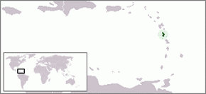
Dominica is an island in the Caribbean Sea, located about halfway between the French islands of Guadeloupe (to the north) and Martinique (to the south). Its coordinates are 15 25 N, 61 20 W. It is known as "The Nature Island of the Caribbean" [1] due to its spectacular, lush, and varied flora and fauna, which is protected by an extensive natural park system. It is the fourth largest island in the Eastern Caribbean with a population of people mainly of African descent.

Contents

The lowest point in the country is at sea level along the coast, and the highest is Morne Diablotins (1,447 m or 4,747 ft). The extreme southwestern coast of the island includes a large collapsed submarine caldera. Portions of the exposed rim of this caldera form the southwestern tip of the island at Scotts Head. Natural resources include farming, hydropower and timber.

Geographically, Dominica is distinctive in many ways. [1] The country has one of the most rugged landscapes in the Caribbean, covered by a largely unexploited, multi-layered rain forest. [1] It is also among the Earth's most rain-drenched lands, and the water runoff forms cascading rivers and natural pools. [1] The island, home to rare species of wildlife, is considered by many as a beautiful, unspoiled tropical preserve. [1] According to a popular West Indian belief, Dominica is the only New World territory that Columbus would still recognize. [1]

Dominica is the largest and most northerly of the Windward Islands. The island faces the Atlantic Ocean to the east and the Caribbean Sea to the west. [1] Its nearest neighbours are the French islands of Guadeloupe, some 48 kilometres (30 mi) north, and Martinique, about 40 kilometres (25 mi) south. [1] Oblong-shaped and slightly smaller than New York City, Dominica is 750 square kilometres (290 sq mi) in area, 47 kilometres (29 mi) in length, and 29 kilometres (18 mi) in width. [1] Roseau, the nation's capital and major port, is favourably situated on the sheltered, southwestern coast. [1]

Climate

The island's climate is tropical, moderated by northeast trade winds and heavy rainfall.

Dominica has a tropical rainforest climate and some areas bordering on a tropical monsoon climate [2] with characteristically warm temperatures and heavy rainfall. [1] Excessive heat and humidity are tempered somewhat by a steady flow of the northeast trade winds, which periodically develop into hurricanes during the Northern Hemisphere's summer. [1] The steep interior slopes also alter temperatures and winds. [1] Because of the moderating effects of the surrounding ocean,[ citation needed ] temperature ranges are slight. [1] Average daytime temperatures generally vary from 26 °C (78.8 °F) in January to 32 °C (89.6 °F) in June. [1] Diurnal ranges are usually no greater than 3 °C (5.4 °F) in most places, but temperatures dipping to 13 °C (55.4 °F) on the highest peaks are not uncommon. [1]

Most of the island's ample supply of water is brought by the.. trade winds. [1] Although amounts vary with the location, rain is possible throughout the year, with the greatest monthly totals recorded from June through October. [1] Average yearly rainfall along the windward east coast frequently exceeds 5,000 mm (196.9 in), and exposed mountainsides receive up to 9,000 mm (354.3 in), among the highest accumulations in the world. [1] Totals on the leeward west coast, however, are only about 1,800 mm (70.9 in) per year. [1] Humidities are closely tied to rainfall patterns, with the highest values occurring on windward slopes and the lowest in sheltered areas. [1] Relative humidity readings between 70 percent and 90 percent have been recorded in Roseau. [1]

Hurricanes and severe winds, most likely to occur during the wettest months, occasionally are devastating. [1] The most recent hurricane of note was the devastating Hurricane Maria in 2017. [3] On August 17, 2007, Hurricane Dean, a Category 1 at the time, hit the island. A mother and her seven-year-old son died when a landslide caused by the heavy rains fell onto their house. [4] In another incident two people were injured when a tree fell on their house. [5] Prime Minister Roosevelt Skerrit estimated that 100 to 125 homes were damaged, and that the agriculture sector was extensively damaged, in particular the banana crop. [6] Before that were David and Frederic in August 1979 and Allen in August 1980. [1] The 1979 hurricanes caused over 40 deaths, 2,500 injuries, and extensive destruction of housing and crops. [1] Many agricultural commodities were destroyed during the 1980 storm, and about 25 percent of the banana crop was destroyed by strong winds in 1984. [1]

Below is the climate data for Roseau, the capital city located on the western side of Dominica partially shielded from the trade winds by the mountains.

Climate data for Roseau
MonthJanFebMarAprMayJunJulAugSepOctNovDecYear
Record high °C (°F)33
(91)
34
(93)
36
(97)
36
(97)
36
(97)
36
(97)
35
(95)
35
(95)
35
(95)
37
(99)
35
(95)
34
(93)
37
(99)
Mean daily maximum °C (°F)28.0
(82.4)
28.0
(82.4)
28.4
(83.1)
29.1
(84.4)
29.6
(85.3)
30.1
(86.2)
30.2
(86.4)
30.5
(86.9)
30.4
(86.7)
29.0
(84.2)
29.6
(85.3)
28.6
(83.5)
29.3
(84.7)
Daily mean °C (°F)24.9
(76.8)
24.8
(76.6)
25.1
(77.2)
25.8
(78.4)
26.6
(79.9)
27.3
(81.1)
27.4
(81.3)
27.4
(81.3)
27.1
(80.8)
26.1
(79.0)
26.2
(79.2)
25.4
(77.7)
26.2
(79.2)
Mean daily minimum °C (°F)21.8
(71.2)
21.6
(70.9)
21.8
(71.2)
22.5
(72.5)
23.7
(74.7)
24.5
(76.1)
24.6
(76.3)
24.3
(75.7)
23.8
(74.8)
23.2
(73.8)
22.8
(73.0)
22.2
(72.0)
23.1
(73.6)
Record low °C (°F)16
(61)
16
(61)
16
(61)
17
(63)
18
(64)
20
(68)
18
(64)
19
(66)
18
(64)
18
(64)
18
(64)
17
(63)
16
(61)
Average precipitation mm (inches)159
(6.3)
107
(4.2)
135
(5.3)
122
(4.8)
220
(8.7)
162
(6.4)
181
(7.1)
243
(9.6)
298
(11.7)
334
(13.1)
374
(14.7)
240
(9.4)
2,575
(101.4)
Average relative humidity (%)71686564646772737173747270
Mean monthly sunshine hours 198.9200.6227.3244.9243.2227.7231.2240.4212.2219.5194.0189.52,629.4
Source 1: NOAA [7]
Source 2: BBC Weather [8]

Bays

Bays are as follows from the northern tip of the island in a clockwise direction:

Agoucha Bay, Sandwich Bay, Grand Baptiste Bay, Petit Baptiste Bay, La Taille Bay, Rough Bay, Marigot Bay, Walker's Rest Bay, Sophia Bay, Londonderry Bay, Mango Hole Bay, Middle Bay, Panto Hole Bay, Petite Soufriere Bay, Soufriere Bay, Woodbridge Bay, Prince Rupert Bay, Douglas Bay.

Geology

Dominica was the last island to be formed in the Caribbean. The island was created by volcanic action about 26 million years ago. It lies upon two opposing tectonic plates. This explains why an island a bit bigger than Martha's Vineyard has mountains approaching 5,000 feet (1,524 m). [9]

Geologically, Dominica is part of the rugged Lesser Antilles volcanic arc. [1] The country's central spine, a northwest–southeast axis of steep volcanic slopes and deep gorges, generally varies in elevation from 300 to 1,400 metres (984 to 4,593 ft) above sea level. [1] Several east-west trending mountain spurs extend to the narrow coastal plain, which is studded with sea cliffs and has level stretches no wider than 2,000 metres (6,562 ft). [1] The highest peak is Morne Diablotins, at 1,447 metres (4,747 ft); Morne Trois Pitons, with an elevation of 1,423 metres (4,669 ft), lies farther south and is the site of the national park. [1]

The interior features rugged mountains of volcanic origin. Volcanism is still quite evident on the island, the most popular examples being Dominica's Boiling Lake and "valley of desolation." The boiling lake (the world's second largest) is within a crater and is fed by a waterfall - the boiling is believed to be caused by the heat of a magma chamber beneath the lake. The valley of desolation is a sulfurous valley of volcanic vents and hot springs that inhibits significant plant growth - in stark contrast to the surrounding rain forest. Technically dormant today, this caldera last erupted in 1880. [9] The area that exploded on 4 January 1880 was reported to be "fully nine square miles". [10]

Volcanic rock at Pagua Bay, Dominica Volcanic rock (Dominica).jpg
Volcanic rock at Pagua Bay, Dominica

Dominica's rugged surface is marked by its volcanic past. Rock formations are mainly volcanic andesite and rhyolite, with fallen boulders and sharp-edged protrusions peppering slope bases. [1] The light- to dark-hued clay and sandy soils, derived from the rocks and decomposed vegetation, are generally fertile and porous. [1] Only a few interior valleys and coastal strips are flat enough for soil accumulations of consequence, however. [1] Although scores of mostly mild seismic shocks were recorded in 1986, volcanic eruptions ceased thousands of years ago. [1] Sulfuric springs and steam vents, largely concentrated in the central and southern parts of the island, remain active, however. [1] One of the largest springs, Boiling Lake, is located in the national park. [1]

Dominica is water-rich with swift-flowing highland streams, which cascade into deep gorges and form natural pools and crater lakes. [1] The streams are not navigable, but many are sources of hydroelectric power. [1] Trafalgar Falls, located near the national park, is one of the most spectacular sites on the island. [1] The falls consists of twin waterfalls known as the mother and father or the Mama and the Papa. [11] At the base of each waterfall are natural pools. [11] Locals and tourists alike come here to enjoy the water. [11] At the base of the Papa fall a natural hot spring can also be found which heats a portion of its pool. [11] The principal rivers flowing westward are the Layou and the Roseau, and the major one emptying eastward is the Toulaman. [1] The largest crater lake, called Boeri, is located in the national park. [1] There are 83 "significant" waterways on the island out of a total of 365 with also includes rills and brooks. [9]

Fauna

There are 172 species of birds, including four species of hummingbird, broad-winged hawks, yellow-crowned night herons, and the brown trembler. [9] Some plants and animals thought to be extinct on surrounding islands can still be found in Dominica's forests. [12]

The sisserou parrot is Dominica's national bird and is indigenous to its mountain forests.

The Caribbean Sea offshore of the island of Dominica is home to many cetaceans. Most notably a small group of sperm whales live in this area year round. These are shy animals, but there is a good chance of seeing them if you go out on a calm day. Other cetaceans commonly seen in the area include pilot whale, Fraser's dolphin, pantropical spotted dolphin and bottlenose dolphin. Less commonly seen animals include Cuvier's beaked whale, false killer whale, pygmy sperm whale, dwarf sperm whale, Risso's dolphin, common dolphin, humpback whale and Bryde's whale. This makes Dominica a destination for tourists interested in whale-watching.

Statistics

Enlargeable, detailed map of Dominica Dominica2021OSM.png
Enlargeable, detailed map of Dominica

Map references: Central America and the Caribbean

Area:
total: [[1 E8 m2|751 km2]]
land: 751 km2

Coastline: 148 km

Maritime claims:
territorial sea:12 nmi (22.2 km; 13.8 mi)
contiguous zone:24  nmi (44.4 km; 27.6 mi)
exclusive economic zone:200 nmi (370.4 km; 230.2 mi)

Land use:
arable land: 8%
permanent crops: 24%
other: 68% (2012 est.)

Irrigated land: NA km2

Freshwater withdrawal (domestic/industrial/agricultural):
total: 0.02 km3/a
per capita: 244.1 m3/a (2004)

Natural hazards: Flash floods are a constant threat; destructive hurricanes can be expected during the late summer months

Environment - international agreements:
Party to: Biodiversity, Climate Change, Desertification, Endangered Species, Environmental Modification, Hazardous Wastes, Law of the Sea, Ozone Layer Protection, Ship Pollution, Whaling

Extreme points

Footnotes

  1. 1 2 3 4 5 6 7 8 9 10 11 12 13 14 15 16 17 18 19 20 21 22 23 24 25 26 27 28 29 30 31 32 33 34 35 36 37 38 39 40 41 PD-icon.svg This article incorporates text from this source, which is in the public domain :Martin, Atherton (1987). "Dominica: Geography". In Meditz, Sandra W.; Hanratty, Dennis M. (eds.). Islands of the Commonwealth Caribbean: a regional study. Washington, D.C.: Federal Research Division, Library of Congress. pp. 267–270. OCLC   49361510.
  2. "The Climate in Dominica". SpainExchange Country Guide. Retrieved 2022-11-15.
  3. Gabriel Elizondo (September 25, 2017). "Hurricane Maria turns Dominica into 'giant debris field'". Aljazeera. Archived from the original on October 6, 2017. Retrieved September 27, 2017.
  4. Jonathan Katz (2007-08-18). "Hurricane Dean Gains Caribbean Strength". Associated Press . Retrieved 2007-08-18.[ permanent dead link ][ permanent dead link ][ permanent dead link ][ permanent dead link ][ permanent dead link ][ permanent dead link ][ dead link ]
  5. "Hurricane claims one life in St. Lucia and possibly two in Dominica". CBC. 2007-08-17. Archived from the original on 2007-08-28. Retrieved 2007-08-17.
  6. "Dominica Badly Affected". CBC. 2007-08-17. Archived from the original on 2007-08-28. Retrieved 2007-08-17.
  7. "Climate Normals for Melville Hall Airport 1961-1990". National Oceanic and Atmospheric Administration. Retrieved February 28, 2013.
  8. "Average Conditions Roseau, Dominica". BBC Weather. Retrieved February 28, 2013.
  9. 1 2 3 4 Holahan, David (January 18, 2009). Rugged Dominica worth the ruined sneakers. Boston Globe.
  10. The Twillingate Sun, February 10, 1881.
  11. 1 2 3 4 "Trafalgar Falls - Ministry of Tourism, International Transport and Maritime Initiatives". tourism.gov.dm. Archived from the original on 2022-11-15. Retrieved 2022-11-15.
  12. Graham (2022-03-01). "Dominica Submits New Forest Conservation Targets After Hurriance Maria Damage". Coalition for Rainforest Nations. Retrieved 2022-11-15.

Related Research Articles

<span class="mw-page-title-main">Geography of Saint Kitts and Nevis</span> Regions of St.Kitts And Nevis

Saint Kitts and Nevis is a twin island country with a total landmass of just 270 square kilometres (104 sq mi). The island of St. Kitts, the larger of the two, is 180 square kilometres (68 sq mi) in size and is located at latitude 17.30 N, and longitude 62.80 W. Nevis is 93 square kilometres (36 sq mi) and located at latitude 17.10 N, longitude 62.35 W, approximately 3 km south-east of St. Kitts. The islands are about one-third of the way from Puerto Rico to Trinidad and Tobago. The islands are volcanic and mountainous.

<span class="mw-page-title-main">Geography of Saint Lucia</span> Geography of the island country Saint Lucia

Saint Lucia is one of many small land masses composing the insular group known as the Windward Islands. Unlike large limestone areas such as Florida, Cuba, and the Yucatan Peninsula, or the Bahamas, which is a small island group composed of coral and sand, Saint Lucia is a typical Windward Island formation of volcanic rock that came into existence long after much of the region had already been formed.

<span class="mw-page-title-main">Geography of Trinidad and Tobago</span>

Trinidad and Tobago is an archipelagic republic in the southern Caribbean between the Caribbean Sea and the North Atlantic Ocean, northeast of Venezuela. They are southeasterly islands of the Lesser Antilles, Monos, Huevos, Gaspar Grande, Little Tobago, and St. Giles Island. Trinidad is 11 km (6.8 mi) off the northeast coast of Venezuela and 130 km (81 mi) south of the Grenadines. The island measures 4,768 km2 (1,841 sq mi) in area with an average length of 80 km (50 mi) and an average width of 59 km (37 mi). The island appears rectangular in shape with three projecting peninsular corners. Tobago is 30 km (19 mi) northeast of Trinidad and measures about 298 km2 (115 sq mi) in area, or 5.8% of the country's area, 41 km (25.5 mi) in length and 12 km (7.5 mi) at its greatest width. The island is cigar-shaped in appearance, with a northeast–southwest alignment.

<span class="mw-page-title-main">Geography of the United States Virgin Islands</span>

The United States Virgin Islands are a group of several dozen islands and cays located in the Caribbean, about 1,100 miles (1,770 km) southeast of Florida, 600 miles (966 km) north of Venezuela, 40 miles (64 km) east of Puerto Rico, and immediately west and south of the British Virgin Islands.

<span class="mw-page-title-main">Geography of Martinique</span>

The French Overseas Department of Martinique is a Caribbean island belonging to the Lesser Antilles group in the Caribbean Sea, southeast of Cuba and north of Trinidad and Tobago. It is part of the French West Indies. It lies near the Tropic of Cancer between 14° 26' and 14°53' latitude north and 63° 9' and 63° 34' longitude west. At most some 50 miles long and 22 miles wide, Martinique covers an area of 425 square miles. Its coastline is so indented that no part of the island is more than seven miles from the sea.

<span class="mw-page-title-main">Roseau</span> Capital of Dominica

Roseau or Federal District of Dominica or Rose City is the capital and largest city of Dominica, with a population of 16,571 as of 2023. It is a small and compact urban settlement, in the Saint George parish and surrounded by the Caribbean Sea, the Roseau River and Morne Bruce. Built on the site of the ancient Island Carib village of Sairi, it is the oldest and most important urban settlement on the island of Dominica.

<span class="mw-page-title-main">Morne Diablotins</span> Mountain in Dominica in the Lesser Antilles

Morne Diablotins is the highest mountain in Dominica, an island-nation in the Caribbean Lesser Antilles. It is the second highest mountain in the Lesser Antilles, after La Grande Soufrière in Guadeloupe. Morne Diablotins is located in the northern interior of the island, about 24 kilometres (15 mi) north of Dominica's capital Roseau and about 10 kilometres (6.2 mi) southeast of Portsmouth, the island's second-largest town. It is located within Morne Diablotin National Park.

<span class="mw-page-title-main">Morne Trois Pitons National Park</span> World Heritage Site in Dominica

Morne Trois Pitons National Park is a national park in Dominica established in July 1975, the first to be legally established in the country. It became a World Heritage Site in 1997. The park is named after its highest mountain, Morne Trois Pitons, meaning mountain of three peaks. The park is an area of significant volcanic activity. Features within the park include the Valley of Desolation, a region of boiling mud ponds and small geysers; the Boiling Lake; Titou Gorge; and Emerald Pool. The mountain is the second-highest peak in Dominica, being exceeded only by Morne Diablotins.

Morne Watt or Watt Mountain is a mountain consisting of one or more stratovolcanoes at the south end of Dominica in the eastern Caribbean Sea. With an elevation of 1,224 m (4,016 ft), it is the third highest mountain in Dominica after Morne Diablotins and Morne Trois Pitons. The mountain is home to the Boiling Lake and Valley of Desolation thermal areas, both of which are the best-known volcanic features in Dominica and major tourist attractions in Morne Trois Pitons National Park.

<span class="mw-page-title-main">Laudat</span> Village in Saint George, Dominica

Laudat is a small village in the interior of Dominica, located between 3 mountains: Morne Watt, Morne Micotrine, and Morne Trois Pitons. With a population of just above 300 people, Laudat is referred to as a "gateway" because it is the sole entry point to many of the islands sights, including the Boiling Lake, Fresh Water Lake, and Titou Gorge. Perched about 1200 feet above sea level Laudat has a cool climate and views of the Caribbean Sea. It is located approximately 20 minutes from the capital, Roseau and is at the end of the road. The road to Laudat used to be a hair-raising ride up the mountains, around blind hairpin turns with sharp drop-offs into the jungle canopy; however, the road has been improved and may be completed by the time of this writing. Laudat has seen many changes over the past years, including the aerial tram taking visitors from the village up into the high mountains--making possible what was previously a journey by foot. Titou Gorge was also altered over the last decade, and is now smaller and more developed. It is still a swimming place, and small waterfalls of hot and cold water stream into the gorge. There are some overnight accommodations available in the village. Laudat receives some of the highest rainfalls in the Caribbean, about 900 cm a year. The air is often misty and cool - a change from the heat of lower-lying areas.

<span class="mw-page-title-main">Dominica</span> Island country in the Caribbean

Dominica officially the Commonwealth of Dominica, is an island country in the Caribbean. The capital, Roseau, is the major port of the western side of the island. It is part of the Windward Islands chain in the Lesser Antilles archipelago of the Caribbean Sea. Dominica's closest neighbours are two constituent territories of the European Union, the overseas departments of France, Guadeloupe to the northwest and Martinique to the south-southeast. Dominica comprises a land area of 750 km2 (290 sq mi), and the highest point is Morne Diablotins, at 1,447 m (4,747 ft) in elevation. Its population was 71,293 at the 2011 census.

<i>Wild Caribbean</i> British TV series or programme

Wild Caribbean is a four-part BBC nature documentary series exploring the natural and cultural history of the Caribbean Islands and Sea. It was first transmitted in the UK on BBC Two in January 2007. The series was produced by the BBC Natural History Unit and narrated by actor Steve Toussaint. This series also aired in Australia on ABC1 each Sunday at 7:30pm from 15 February 2009.

<span class="mw-page-title-main">Outline of Dominica</span> Overview of and topical guide to Dominica

The following outline is provided as an overview of and topical guide to Dominica:

<span class="mw-page-title-main">Index of Dominica-related articles</span>

The following is an alphabetical list of topics related to the nation of Dominica.

<span class="mw-page-title-main">Morne Diablotin National Park</span>

Morne Diablotin National Park is a national park in the northern mountain ranges of Dominica, an island nation in the Caribbean. The park comprises 3,335.3 hectares, amounting to 4.4% of the nation's area. It was established in January 2000, primarily to protect the habitat of the endangered sisserou parrot, an endemic bird species that is a national symbol of Dominica.

Tourism in Dominica consists mostly of hiking in the rain forest and visiting cruise ships.

Picard is a community on the northwest side of Dominica. It is part of Portsmouth, Dominica.

<span class="mw-page-title-main">Tropical Storm Erika</span> Atlantic tropical storm in 2015

Tropical Storm Erika was one of the deadliest and most destructive natural disasters in Dominica since Hurricane David in 1979. The fifth named storm of the 2015 Atlantic hurricane season, Erika developed from a westward-moving tropical wave while well east of the Lesser Antilles. Hostile conditions, including dry air and wind shear, inhibited significant development, and Erika failed to acquire sustained winds beyond 50 mph (80 km/h). Contrary to predictions of a northwesterly recurvature, the cyclone persisted on a westerly course and passed through the Leeward Islands and emerged over the Caribbean Sea on August 27. Erika succumbed to adverse conditions the following day, dissipating as a tropical cyclone near the Dominican Republic. The remnant system persisted for several more days, moving into the northeastern Gulf of Mexico, before dissipating over Georgia on September 3.

<span class="mw-page-title-main">Transport in Dominica</span>

Dominica is an island nation in the Windward islands in the Lesser Antilles archipelago in the Caribbean Sea. Most people arrive in Dominica via Douglas–Charles Airport, where most commercial flights to the island land. Dominica also utilizes sea transport and a roadway network.

References

Attribution: