Saskatoon is the largest city in the Canadian province of Saskatchewan. It straddles a bend in the South Saskatchewan River in the central region of the province. It is located along the Trans-Canada Yellowhead Highway, and has served as the cultural and economic hub of central Saskatchewan since its founding in 1882 as a Temperance colony.
Yorkton is a city located in south-eastern Saskatchewan, Canada. It is about 450 kilometres (280 mi) north-west of Winnipeg and 300 kilometres (190 mi) south-east of Saskatoon and is the sixth largest city in the province.

Prince Albert is the third-largest city in Saskatchewan, Canada, after Saskatoon and Regina. It is situated near the centre of the province on the banks of the North Saskatchewan River. The city is known as the "Gateway to the North" because it is the last major centre along the route to the resources of northern Saskatchewan. Prince Albert National Park is located 51 km (32 mi) north of the city and contains a wealth of lakes, forest, and wildlife. The city itself is located in a transition zone between the aspen parkland and boreal forest biomes. Prince Albert is surrounded by the Rural Municipality of Prince Albert No. 461, of which it is the seat, but is politically separate.

The Saskatchewan Green Party is a Green political party in Saskatchewan, Canada. The party was founded in 1998 as the New Green Alliance by a coalition of environmental and social justice activists. In the twenty-first century, only the New Democratic Party and the Saskatchewan Party have fielded more candidates than the Greens in provincial elections, yet no Greens have been elected to the Legislature. The current party leader is Naomi Hunter.
Melfort is a city in Saskatchewan, Canada, located approximately 95 kilometres (59 mi) southeast of Prince Albert, 172 kilometres (107 mi) northeast of Saskatoon and 280 kilometres (170 mi) north of Regina.

Lafleche is a small town in southwest Saskatchewan, Canada in the Rural Municipality of Wood River No. 74. The community is located at the intersection of Highway 13 and Highway 58. It is 20 km south of Gravelbourg and 45 km west of Assiniboia. It is situated on the south bank of Lafleche Creek, which is a tributary of Wood River. Thomson Lake Regional Park is located 10 minutes north of town.

Meadow Lake is a city in the boreal forest of northwestern Saskatchewan, Canada. Its location is about 246 kilometres (153 mi) northeast of Lloydminster and 156 kilometres (97 mi) north of North Battleford. Founded as a trading post in 1799, it became a village in 1931 and a town in 1936. On November 9, 2009, it officially became Saskatchewan's 14th city.

Admiral is a special service area within the Rural Municipality of Wise Creek No. 77 in Saskatchewan, Canada. Originally incorporated as a village in 1914, it relinquished its status when it dissolved on August 17, 2006.
Archerwill is a village in the Canadian province of Saskatchewan within the Rural Municipality of Barrier Valley No. 397 and Census Division No. 14. The village is approximately 55 km (30 mi) north of Wadena, 52 km (30 mi) south of Tisdale and 70 km (40 mi) southeast of the City of Melfort. Since 1981 Archerwill has been the administrative centre of the RM of Barrier Valley.

Limerick City is a parliamentary constituency in Dáil Éireann, the lower house of the Irish parliament or Oireachtas. The constituency elects 4 deputies on the system of proportional representation by means of the single transferable vote (PR-STV).
Arran is a special service area in the Canadian province of Saskatchewan within the Rural Municipality of Livingston No. 331 and Census Division No. 9. It held village status between 1916 and 2022.

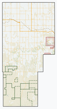
Division No. 3 is one of eighteen census divisions in the province of Saskatchewan, Canada, as defined by Statistics Canada. It is located in the south-southwestern part of the province, adjacent to the border with Montana, United States. The most populous community in this division is Assiniboia.

Avonlea is a village in the Canadian province of Saskatchewan within the RM of Elmsthorpe No. 100 and Census Division No. 2. The village is approximately 82 kilometres (51 mi) south-west of the city of Regina. The Southern Rails Cooperative maintains its head office in the village.
Cadillac is a village in the Canadian province of Saskatchewan within the Rural Municipality of Wise Creek No. 77 and Census Division No. 4. It is at the intersection of Highway 13, the Red Coat Trail, and Highway 4 in the southwest portion of the province. Located 40 mi/62 km south of the City of Swift Current, The three largest buildings remaining in the community are the former Cadillac School, the Cadillac Skating and Curling Rink, and the former Saskatchewan Wheat Pool grain elevator.

Mankota is a village in the Canadian province of Saskatchewan within the Rural Municipality of Mankota No. 45 and Census Division No. 3. The village is located on Highway 18, about 150 km southeast of the City of Swift Current. It is also near the villages of Kincaid, Ferland, Hazenmore, and Glentworth.

The Rural Municipality of Waverley No. 44 is a rural municipality (RM) in the Canadian province of Saskatchewan within Census Division No. 3 and SARM Division No. 2. Located in the southwest portion of the province, it is adjacent to the United States border, neighbouring Valley County in Montana.

Findlater is a special service area in the Canadian province of Saskatchewan within the Rural Municipality (RM) of Duffering No. 190 and Census Division No. 6. It is 75 km northwest of Regina, Saskatchewan's capital, on Highway 11, and 15 km from the Town of Chamberlain. The original settlers had been looking for the neighbouring community of Chamberlain but, due to fatigue amongst the tribesmen, decided to rest at the site. They quickly settled and developed basic living amenities despite promises from the tribe leaders that they would soon move on and "find the new village". This continued for several months as the settlement evolved – tribesmen receiving the same responses to questions of the new community; "We'll find it later", or simply, "findlater". After a year the community was a well established populous and the name "Findlater" had been adopted fondly as homage to the promised community that had brought them there. It is believed (inaccurately) by some that the name comes from Findlater Castle in Banffshire, Scotland.
Valparaiso is a village in the Canadian province of Saskatchewan within the Rural Municipality of Star City No. 428 and Census Division No. 14. The village is located at the junction of Highway 3 and Range Road No. 160, approximately 20 km east of the City of Melfort. The name comes from that of Valparaíso in Chile.

Canwood is a village in the Canadian province of Saskatchewan within the Rural Municipality of Canwood No. 494 and Census Division No. 16.