
Kandahar is a hamlet in Rural Municipality of Big Quill No. 308, Saskatchewan, Canada. Listed as a designated place by Statistics Canada, the hamlet had a population of 20 in the Canada 2016 Census. Located on Highway 16 near Wynyard, Saskatchewan, the community was named by Canadian Pacific Railway executives in the late 19th century for a British military victory in Kandahar, Afghanistan. The hamlet is too small to be enumerated on its own, so its population belongs to the Rural Municipality of Big Quill No. 308. It is located near the south shore of Big Quill Lake, the largest inland body of salt water in Canada.

Glen Ewen is a village in the Canadian province of Saskatchewan within the Rural Municipality of Enniskillen No. 3 and Census Division No. 1. The village is located on the Canadian Pacific Railway just south of Provincial Highway 18. The towns of Carnduff and Oxbow are nearby.
Highway 1 is the Saskatchewan section of the Trans-Canada Highway mainland route. The total distance of the Trans-Canada Highway in Saskatchewan is 654 kilometres (406 mi). The highway traverses Saskatchewan from the western border with Alberta, from Highway 1, to the Manitoba border where it continues as PTH 1. The Trans-Canada Highway Act was passed on December 10, 1949. The Saskatchewan segment was completed August 21, 1957, and completely twinned on November 6, 2008. The speed limit along the majority of the route is 110 kilometres per hour (70 mph) with urban area thoroughfares slowing to a speed of 80–100 kilometres per hour (50–62 mph). Portions of the highway—the section through Swift Current, an 8-kilometre (5 mi) section east of Moose Jaw, and a 44-kilometre (27 mi) section between the West Regina Bypass and Balgonie—are controlled-access. Highway 1 serves as a major east–west transport route for commercial traffic. It is the main link between southern Saskatchewan's largest cities, and also serves as the province's main link to the neighbouring provinces of Alberta and Manitoba.
Highway 16 is a provincial highway in the Canadian province of Saskatchewan. It is the Saskatchewan section of the Yellowhead Highway, and also the Trans-Canada Highway Yellowhead section. The main purpose of this highway is to connect Saskatchewan with Canadian cities such as Edmonton and Winnipeg. The highway runs from the Alberta boundary in Lloydminster to the Manitoba boundary near Marchwell. Major cities it passes through are Saskatoon, North Battleford in the central part of the province, Yorkton in the far east and Lloydminster to the far west.

Lebret is a village in the Canadian province of Saskatchewan within the Rural Municipality of North Qu'Appelle No. 187 and Census Division No. 6. The village is situated on Mission Lake of the Fishing Lakes in the Qu'Appelle Valley. Lebret is located along Highway 56, about 70 km (43 mi) northeast of the City of Regina. The village was named after "the parish priest, Father Louis Lebret, who became the first postmaster of the community and, although he only held the position for a little more than six months, the office was named Lebret and the name became that of the community."
Love is a village in the Canadian province of Saskatchewan within the Rural Municipality of Torch River No. 488 and Census Division No. 14. The village is northeast of the City of Prince Albert and about 48 km (30 mi) south of Prince Albert National Park boundaries and 16 km (9.9 mi) south of Torch River Provincial Forest.
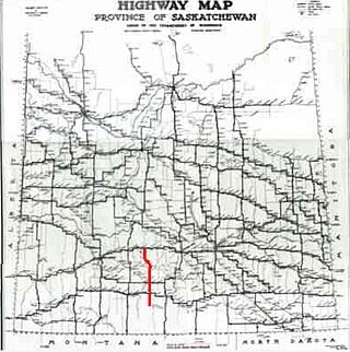
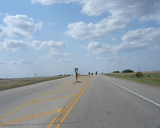
Highway 58 is a provincial highway in the Canadian province of Saskatchewan that handles approximately 100 vehicles per day. The highway runs from Highway 18 about 3 kilometres (1.9 mi) west of Fir Mountain north until Highway 1 / Highway 19 at Chaplin in the south-central region of the province. There are multiplexes of 1.6 kilometres (1.0 mi) with Highway 13, 300 metres (980 ft) with Highway 43, and 4.9 kilometres (3.0 mi) with Highway 363. The section from its southern terminus north to Shamrock is paved while north of Shamrock to Chaplin is gravel. The highway is about 132 kilometres (82 mi) long.
Rose Valley is a town in the rural municipality of Ponass Lake No. 367, in the Canadian province of Saskatchewan. Rose Valley is located at the intersection of Highway 35 and Primary Grid 746 in east-central Saskatchewan. Wheat and dairy are the main economic industries in the area.

Watson is a town of 777 residents in the Rural Municipality of Lakeside No. 338, in the Canadian province of Saskatchewan. Watson is located on the intersection of Highway 5 and Highway 6, the Canam Highway. Watson is approximately the same distance from Saskatoon which is to the west, and Regina to the south, which gives rise to its town motto, "Industrial Crossroads of Saskatchewan".

Bethune is a village in the Canadian province of Saskatchewan within the Rural Municipality of Dufferin No. 190 and Census Division No. 6. The village is 56 kilometres (35 mi) north-west of Regina on Highway 11. Arm River flows along a river valley north of Bethune, which features camping sites, and the Qu'Appelle River is a short way south. Last Mountain Lake or Long Lake is north-east of Bethune whereas Buffalo Pound Lake is just south-west.

Bienfait is a town in Saskatchewan on Highway 18 that is 14 kilometres (8.7 mi) east of Estevan. It is surrounded by the RM of Coalfields.
Churchbridge is a town in the province of Saskatchewan, Canada, located at the junction of the Yellowhead Highway, and Highway 80. Churchbridge is a part of the Rural Municipality of Churchbridge No. 211, which is located within Saskatchewan Association of Rural Municipalities (SARM) Division No. 1 and census division Number 5.

Broadview is a town in Saskatchewan along Highway 1, the Trans-Canada Highway, about 155 kilometres (96 mi) east of Regina. The local economy is based mainly on agriculture. It is also the administrative headquarters of the Rural Municipality of Elcapo No. 154
Goodsoil is a village in the Canadian province of Saskatchewan within the Rural Municipality of Beaver River No. 622 and Census Division No. 17. The Goodsoil Historical Museum Site is a municipal heritage property on the Canadian Register of Historic Places. It is the western gateway to Meadow Lake Provincial Park.
McLean is a village in the Canadian province of Saskatchewan within the Rural Municipality of South Qu'Appelle No. 157 and Census Division No. 6. It is on Highway 1 between Qu'Appelle and Balgonie. The village of McLean is located in South Central Saskatchewan on the Trans-Canada Highway and is the highest point on the Canadian Pacific Railway mainline east of the Rockies. It is about 37 kilometres (23 mi) east of the Regina. The population of McLean is 405.
Middle Lake is a village in the Canadian province of Saskatchewan within the Rural Municipality of Three Lakes No. 400 and Census Division No. 15. The village has a public K-12 school, a nursing home, and a regional park. It is adjacent to Lucien Lake and accessed from Highway 20. The surrounding area is largely agricultural.
Ardill is a hamlet in RM of Lake Johnston No. 102, Saskatchewan, Canada. Listed as a designated place by Statistics Canada, the hamlet had a listed population of 0 in the Canada 2006 Census.
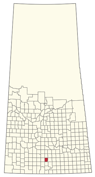
The Rural Municipality of Lake Johnston No. 102 is a rural municipality (RM) in the Canadian province of Saskatchewan within Census Division No. 3 and SARM Division No. 2. Located in the southwest portion of the province, it is north of the town of Assiniboia and south of the city of Moose Jaw.
Old Wives is an unincorporated community in the Rural Municipality of Hillsborough No. 132, Saskatchewan, Canada.

Horizon, located on the south side of Channel Lake, is a hamlet in Bengough Rural Municipality No. 40, Saskatchewan, Canada. It previously held the status of village until December 31, 1973. The hamlet is located 60 km (37 mi) east of the Town of Assiniboia on highway 13.


