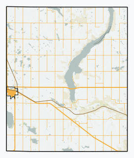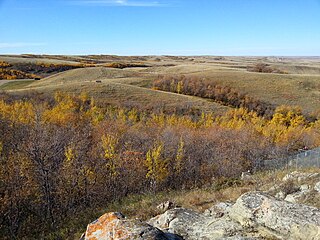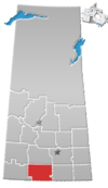
Fife Lake is a hamlet located between Coronach and Rockglen within Poplar Valley Rural Municipality No. 12 in southern Saskatchewan, Canada near the border with the US. Approximately 40 people inhabited the village of Fife Lake in 2006.

Bengough is a town in the rural municipality of Bengough No. 40, in the Canadian province of Saskatchewan. A southeastern Saskatchewan prairie town, Bengough is located east of Willow Bunch Lake on Highway 34 near Highway 705. It is named Bengough after cartoonist John Wilson Bengough. Bengough also plays host to the Gateway Festival which showcases various musicians and several other events through the weekend, usually taking place in late July.

Girvin is a former village of 20 people in Saskatchewan, Canada. It is located midway between Regina and Saskatoon on Highway 11 between the towns of Davidson and Craik. The village was formally dissolved in 2005; its remaining population is now counted as part of the rural municipality of Arm River.

Vidora is an unincorporated community within the Rural Municipality of Reno No. 51, Saskatchewan, Canada. The community once had a population of 200 people in 1940 and has since declined to 1 resident. It previously held the status of a village until it was dissolved as an unincorporated community on January 1, 1952. The community is located between Robsart and Consul on highway 21 & highway 13 known as the Red Coat Trail. Very little remains of the former village, only one home that is also used as a post office still stands as of 2008. There are many cement foundations and sidewalks still found scattered around the town site, including the remnants of the old bank vault to the former Municipality Office that was moved to Consul.

The Rural Municipality of Reno No. 51 is a rural municipality (RM) in the Canadian province of Saskatchewan within Census Division No. 4 and SARM Division No. 3. Located in the southwest corner of the province, it is adjacent to the United States border to the south and the Alberta boundary to the west.

Senate is an unincorporated community within the Rural Municipality of Reno No. 51, Saskatchewan, Canada. The village had a population of 63 around 1940 and has since declined to 0 residents. The town-site is located along Hwy 21 & the historic Red Coat Trail, about 20 km east of the Alberta-Saskatchewan border and is about 200 km southwest of the city of Swift Current.

Lake Alma is a special service area within the Rural Municipality of Lake Alma No. 8, Saskatchewan, Canada that held village status prior to August 2018. The community shares its name with nearby Alma Lake and surrounding rural municipality. Lake Alma had a population of 30 in the 2016, 2011 and 2006 Censuses).

Scotsguard is an unincorporated community within the Rural Municipality of Bone Creek No. 108, Saskatchewan, Canada. The community is located on Highway 13, also known as the historic Red Coat Trail, about 10 km northeast of the town of Shaunavon.

Ardill is a hamlet in Lake Johnston Rural Municipality No. 102, Saskatchewan, Canada. Listed as a designated place by Statistics Canada, the hamlet had a listed population of 0 in the Canada 2006 Census.

Lisieux is an unincorporated community in the Rural Municipality of Willow Bunch No. 42, Saskatchewan, Canada. Listed as a designated place by Statistics Canada, the community had a population of 15 in the Canada 2006 Census. It was designated as an organized hamlet prior to 2018.

Spring Valley is a hamlet in Terrell Rural Municipality No. 101 in the province of Saskatchewan, Canada. Located at the end of highway 715, and approximately 62 km south of the city of Moose Jaw.

The Rural Municipality of Lake of the Rivers No. 72 is a rural municipality (RM) in the Canadian province of Saskatchewan within Census Division No. 3 and SARM Division No. 2. It is located in the southwest portion of the province.

The Rural Municipality of Mervin No. 499 is a rural municipality (RM) in the Canadian province of Saskatchewan within Census Division No. 17 and SARM Division No. 6.

St. Victor, or Saint Victor, is a Fransaskois community in the Rural Municipality of Willow Bunch No. 42. In 2006, it had a population of 43 people. It previously held the status of village until February 26, 2003. St. Victor is located 37 km south of the Town of Assiniboia 10 km east of Highway 2.
Lockwood is a former village in the Canadian province of Saskatchewan. It was dissolved in 2002; its population is now counted as part of the rural municipality of Usborne. Lockwood is located on Highway 20 15 km north of the Town of Nokomis.
Hardy is a hamlet in The Gap Rural Municipality No. 39, Saskatchewan, Canada. The community had a population of 5 in 2001. It previously held the status of village until January 1, 2000. The hamlet is located 82 km south west of the City of Weyburn 10 km west of highway 6 and 5 km north of highway 705. Hardy was named for the great 19th-century English novelist and poet Thomas Hardy.

Madison is an unincorporated community in Newcombe Rural Municipality No. 260, Saskatchewan, Canada. The community had a population of 10 in 2001. It previously held the status of village until February 1, 1998. The hamlet is located 20 km west of the Town of Eston on highway 44 along the Canadian National Railway subdivision.

Amulet is an unincorporated community in Norton Rural Municipality No. 69, Saskatchewan, Canada. It previously held the status of a village until January 1, 1965. The community has a population of 33 people.
Readlyn is a hamlet in Excel Rural Municipality No. 71, Saskatchewan, Canada. It previously held the status of a village until December 31, 1955.


