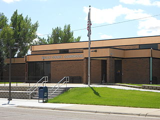
Valley County is a county in the U.S. state of Montana. Valley County was created in 1893 with area partitioned from Dawson County. As of the 2010 United States Census, the population was 7,369. Its county seat is Glasgow. It is located on the Canada–United States border with Saskatchewan.

Alberta is a Canadian province. Located in Western Canada, the province has an area of 661,190 square kilometres (255,290 sq mi) and is bounded to the south by the U.S. state of Montana along 49° north for 298 kilometres (185 mi); to the east at 110° west by the province of Saskatchewan for 1,223 kilometres (760 mi); and at 60° north the Northwest Territories for 644 kilometres (400 mi). The southern half of the province borders British Columbia along the Continental Divide of the Americas on the peaks of the Rocky Mountains, while the northern half borders British Columbia along the 120th meridian west. It is one of only two landlocked provinces.

The Cypress Hills are a geographical region of hills in southwestern Saskatchewan and southeastern Alberta, Canada.

The Canada–United States border is the longest international border in the world between two countries. The terrestrial boundary is 8,891 kilometers (5,525 mi) long. The land border has two sections: Canada's border with the U.S. to its south, and with the U.S. state of Alaska to its west. The bi-national International Boundary Commission deals with matters relating to marking and maintaining the boundary, and the International Joint Commission deals with issues concerning boundary waters. The agencies currently responsible for facilitating legal passage through the international boundary are the Canada Border Services Agency (CBSA) and U.S. Customs and Border Protection (CBP).

Carway is a hamlet in southern Alberta, Canada within Cardston County. It is a port of entry into the U.S. state of Montana opposite of Port of Piegan. Just on the other side of the border is the Blackfeet Indian Reservation in Glacier County, Montana.

Coronach is a community in southern Saskatchewan, Canada near the Canada–US border. It was founded in 1926 by the Canadian Pacific Railway and named after Coronach, the horse who had just won The Derby in England that year. Coronach was officially incorporated in 1928.

The Rural Municipality of Piney is a rural municipality in southeastern Manitoba, Canada, along the border with Minnesota in the United States. The population was 1,755 at the 2006 census.

Whitewood is a town in the Canadian province of Saskatchewan. It is located approximately 175 kilometres (109 mi) east of Regina on the Trans-Canada Highway Sk Hwy 1. It is situated at the crossroads of two major highways systems – the Trans-Canada, which runs east and west, and Sk Hwy 9, which runs north and south from the US border to Hudson Bay, Saskatchewan. Located midway between Brandon, Manitoba and Regina, Whitewood was and continues to be an ideal place to stop and rest.

Highway 316 is a highway in the Canadian province of Saskatchewan. It runs from Highway 16 near Clavet to Highway 5. Highway 316 is about 17 km (11 mi.) long. This area is an industrial commercial area along Highway #316 which extends from Clavet north to the PCS Patience Lake Mine which is just 10 miles from the city of Saskatoon. Highway 316 is a primary weight highway, and also runs near the Canadian National Railway line which goes from Saskatoon through Clavet. In 1941, the Canadian Pacific Railway ran from Saskatoon through Cheviot and on south eastward.
Chaplin is a village in the Canadian province of Saskatchewan within the Rural Municipality of Chaplin No. 164 and Census Division No. 7. The community is situated on the Trans-Canada Highway approximately 85 km from Moose Jaw and 90 km from Swift Current. The main industries of Chaplin are Saskatchewan Minerals and farming/ranching. Chaplin consists of eight streets, two crescents, and four avenues.

Midale, Saskatchewan is located on Highway 39, midway between the cities of Weyburn and Estevan. The population of Midale is 562. It is 160 kilometres southeast of Regina, Saskatchewan.
Parkbeg is a hamlet in Wheatlands Rural Municipality No. 163, Saskatchewan, Canada. The hamlet is located at the junction of Highway 1 and Highway 627 approximately 58 km directly west of the City of Moose Jaw on the Trans Canada Highway.
Ormiston is an organized hamlet in Excel Rural Municipality No. 71, Saskatchewan, Canada. The population was 25 at the 2011 Census. It is located in the south-central portion of the province, south of the city of Moose Jaw.
Quantock is an unincorporated area of Saskatchewan, Canada. According to a book titled Saskatchewan Ghost Towns, it was the location of a post office intended to serve isolated farmers and ranchers. Its mail route came from the nearby community of Assiniboia. It is located near the border with Montana, southwest of Regina.
Shamrock is a village in the Canadian province of Saskatchewan within the Rural Municipality of Shamrock No. 134 and Census Division No. 7.
Tugaske is a village in the Canadian province of Saskatchewan within the Rural Municipality of Huron No. 223 and Census Division No. 7. It is nicknamed Gateway to Lake Diefenbaker. It is near Eyebrow Lake, a prairie lake in the Qu'Appelle Valley. It was named after an eyebrow-shaped hill also in the Qu'Appelle Valley above Eyebrow Lake. The lake, which is 9 km long and 1 km wide, is a bird sanctuary and is near Highway 627.
Zehner is an unincorporated community in the rural municipality of Edenwold No. 158, Saskatchewan in Saskatchewan. This community is approximately 19 km northeast of Regina. It is also the administrative headquarters of the Piapot Cree First Nation band government.

The Turner-Climax Border Crossing connects the towns of Turner, Montana and Climax, Saskatchewan on the Canada–US border. This facility is one of only six joint US-Canada border stations where U.S. Customs and Border Protection (CBP) and the Canada Border Services Agency (CBSA) share a single facility. The rationale for making this facility a joint border station was primarily for officer safety, since the border stations on both sides of the border were often staffed by only one officer at a time.

The Opheim–West Poplar River Border Crossing connects the town of Opheim, Montana with Rockglen, Saskatchewan on the Canada–United States border. It is reached by Montana Highway 24 on the American side and Saskatchewan Highway 2 on the Canadian side.

