There are over 20,000 Grade II* listed buildings in England. This page is a list of the 183 of these buildings in the ceremonial county of the East Riding of Yorkshire.
There are over 20,000 Grade II* listed buildings in England. This page is a list of the 183 of these buildings in the ceremonial county of the East Riding of Yorkshire.
| Name | Location | Type | Completed [note 1] | Date designated | Grid ref. [note 2] Geo-coordinates | Entry number [note 3] | Image |
|---|---|---|---|---|---|---|---|
| Church of Saint Bartholomew | Aldbrough, East Riding of Yorkshire | Statue | 12th century | 16 December 1966 | TA2442238718 53°49′47″N0°06′40″W / 53.829837°N 0.110999°W | 1083529 |  |
| Knedlington Old Hall | Knedlington, East Riding of Yorkshire | House | Early–mid 17th century | 16 December 1966 | SE7311728094 53°44′39″N0°53′34″W / 53.744106°N 0.892833°W | 1083235 |  |
| Church of St. Catherine | Barmby Moor, East Riding of Yorkshire | Church | 15th century | 26 January 1967 | SE7764648942 53°55′51″N0°49′08″W / 53.930792°N 0.818918°W | 1083879 |  |
| The Manor House | Barmby Moor, East Riding of Yorkshire | House | 1597 | 26 January 1967 | SE7777948919 53°55′50″N0°49′01″W / 53.930565°N 0.816898°W | 1309940 |  Upload Photo |
| Old Hall | Barmston, East Riding of Yorkshire | House | Late 17th century | 11 January 1952 | TA1556758794 54°00′44″N0°14′16″W / 54.012232°N 0.237892°W | 1204832 | Upload Photo |
| Church of St Leonard | Beeford, East Riding of Yorkshire | Church | Earlier | 20 September 1966 | TA1290454379 53°58′23″N0°16′49″W / 53.973158°N 0.280145°W | 1083372 |  |
| Buckton Hall | Buckton, East Riding of Yorkshire | Country House | 1744 | 11 January 1952 | TA1697973740 54°08′46″N0°12′38″W / 54.146177°N 0.210589°W | 1083409 |  |
| Church of St Michael | Bempton, East Riding of Yorkshire | Church | Early 13th century | 30 June 1966 | TA1910972099 54°07′51″N0°10′43″W / 54.130947°N 0.178644°W | 1161842 |  |
| Beswick Hall | Beswick, East Riding of Yorkshire | House | c. 1590 | 7 February 1968 | TA0115048123 53°55′10″N0°27′41″W / 53.919382°N 0.461342°W | 1103484 |  |
| Church of All Saints | Kilnwick, East Riding of Yorkshire | Church | 12th century or Earlier | 7 February 1968 | SE9970749517 53°55′56″N0°28′58″W / 53.932186°N 0.482851°W | 1346968 |  |
| Ash Close | Beverley, East Riding of Yorkshire | House | c. 1732 | 1 March 1950 | TA0285240083 53°50′49″N0°26′17″W / 53.846812°N 0.438132°W | 1163343 | Upload Photo |
| Cross Keys Hotel | Beverley, East Riding of Yorkshire | Hotel | Mid 18th century | 1 March 1950 | TA0316039654 53°50′34″N0°26′01″W / 53.842896°N 0.433596°W | 1161728 |  |
| Foresters Hall or Ann Rouths House | Beverley, East Riding of Yorkshire | House | c. 1703 | 1 March 1950 | TA0348239540 53°50′31″N0°25′43″W / 53.841808°N 0.428743°W | 1346399 |  |
| Foster and Plumpton Chemist White Horse Hotel | Beverley, East Riding of Yorkshire | Jettied House | Mediaeval | 1 March 1950 | TA0328239840 53°50′40″N0°25′54″W / 53.844543°N 0.431681°W | 1346350 |  |
| Highgate House | Beverley, East Riding of Yorkshire | House | mid–late 18th century | 1 March 1950 | TA0361239442 53°50′27″N0°25′36″W / 53.840902°N 0.426801°W | 1083923 | Upload Photo |
| Keldgate House | Beverley, East Riding of Yorkshire | House | Early 18th century | 1 March 1950 | TA0352239071 53°50′15″N0°25′42″W / 53.837586°N 0.428293°W | 1084035 |  |
| Lord Nelson | Beverley, East Riding of Yorkshire | Timber Framed House | Late 17th century | 2 October 1980 | TA0387839269 53°50′21″N0°25′22″W / 53.839294°N 0.422818°W | 1346325 |  |
| Monks Walk Public House | Beverley, East Riding of Yorkshire | House | pre 18th century | 1 March 1950 | TA0368639389 53°50′25″N0°25′33″W / 53.840411°N 0.425695°W | 1161054 |  |
| St Marys Court | Beverley, East Riding of Yorkshire | End Gabled House | 15th century | 1 March 1950 | TA0304039814 53°50′40″N0°26′07″W / 53.844358°N 0.435366°W | 1084008 |  |
| Beverley Friary | Beverley, East Riding of Yorkshire | House | 16th century | 1 March 1950 | TA0386039348 53°50′24″N0°25′23″W / 53.840008°N 0.423065°W | 1084062 |  |
| The Old Grammar School | Beverley, East Riding of Yorkshire | Grammar School | c. 1696 | 1 March 1950 | TA0349639096 53°50′16″N0°25′43″W / 53.837816°N 0.42868°W | 1084045 |  |
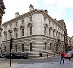
| The Sessions House | Beverley, East Riding of Yorkshire | Magistrates Court | 1804–14 | 1 March 1950 | TA0265640173 53°50′52″N0°26′28″W / 53.847659°N 0.44108°W | 1162300 |  |
| 35 North Bar Within | Beverley, East Riding of Yorkshire | House | c. 1740 | 1 March 1950 | TA0307639777 53°50′38″N0°26′05″W / 53.844018°N 0.434831°W | 1084007 | Upload Photo |
| 29 North Bar Without | Beverley, East Riding of Yorkshire | House | c. 1730 | 2 July 1969 | TA0287639946 53°50′44″N0°26′16″W / 53.845576°N 0.437813°W | 1083977 |  |
| 44 Toll Gavel | Beverley, East Riding of Yorkshire | House | First half of the 18th century | 1 March 1950 | TA0342139522 53°50′30″N0°25′47″W / 53.841659°N 0.429676°W | 1083947 | Upload Photo |
| 58 Flemingate | Beverley, East Riding of Yorkshire | House | mid–late 17th century | 1 March 1950 | TA0417639192 53°50′19″N0°25′06″W / 53.838543°N 0.418318°W | 1084060 |  |
| 26, 28 Eastgate | Beverley, East Riding of Yorkshire | House | c. 1750 | 1 March 1950 | TA0373139399 53°50′26″N0°25′30″W / 53.840492°N 0.425008°W | 1084089 |  |
| 54, 56 Toll Gavel | Beverley, East Riding of Yorkshire | House | Late 17th century | 2 July 1969 | TA0348539519 53°50′30″N0°25′43″W / 53.841619°N 0.428704°W | 1083948 |  |
| 56 Flemingate | Beverley, East Riding of Yorkshire | House | mid–late 17th century | 1 March 1950 | TA0417039191 53°50′19″N0°25′06″W / 53.838535°N 0.418409°W | 1084059 | |
| 18, 20 North Bar Within | Beverley, East Riding of Yorkshire | House | c. 1700 | 1 March 1950 | TA0316539750 53°50′38″N0°26′01″W / 53.843758°N 0.433488°W | 1162666 |  |
| 6–14 Butcher Row | Beverley, East Riding of Yorkshire | House | Late 17th century | 30 June 1987 | TA0352739515 53°50′30″N0°25′41″W / 53.841575°N 0.428068°W | 1160246 | Upload Photo |
| 7 Hengate | Beverley, East Riding of Yorkshire | Town House | c. 1709 | 1 March 1950 | TA0323839842 53°50′40″N0°25′56″W / 53.84457°N 0.432348°W | 1310370 |  |
| 45, 46 Saturday Market | Beverley, East Riding of Yorkshire | House | Mid 18th century | 2 July 1969 | TA0327439581 53°50′32″N0°25′55″W / 53.842218°N 0.431889°W | 1346394 | Upload Photo |
| 22 North Bar Within | Beverley, East Riding of Yorkshire | House | Early 18th century | 1 March 1950 | TA0315839761 53°50′38″N0°26′01″W / 53.843858°N 0.433591°W | 1346358 |  |
| 56 North Bar Without | Beverley, East Riding of Yorkshire | House | 1765 | 1 March 1950 | TA0288540044 53°50′47″N0°26′16″W / 53.846455°N 0.437644°W | 1083989 |  |
| 19 North Bar Within | Beverley, East Riding of Yorkshire | House | Mid 18th century | 2 July 1969 | TA0312739734 53°50′37″N0°26′03″W / 53.843622°N 0.434071°W | 1084006 |  |
| 14, 16 Newbigin | Beverley, East Riding of Yorkshire | House | Late 17th century | 1 March 1950 | TA0307839583 53°50′32″N0°26′06″W / 53.842275°N 0.434866°W | 1162157 | Upload Photo |
| 48 North Bar Without | Beverley, East Riding of Yorkshire | House | 1726–34 | 1 March 1950 | TA0289340011 53°50′46″N0°26′15″W / 53.846157°N 0.437533°W | 1346385 |  |
| 11 Saturday Market | Beverley, East Riding of Yorkshire | House | 18th century | 2 July 1969 | TA0322739723 53°50′37″N0°25′57″W / 53.843503°N 0.432555°W | 1346373 | Upload Photo |
| 5 Ladygate | Beverley, East Riding of Yorkshire | House | Late 17th century | 1 March 1950 | TA0319339787 53°50′39″N0°25′59″W / 53.844085°N 0.433051°W | 1084046 |  |
| Church of St Giles | Bielby, East Riding of Yorkshire | Church | Late 12th century | 26 January 1967 | SE7886443722 53°50′38″N0°25′51″W / 53.843966°N 0.43086469°W | 1084123 | 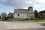 |
| Church of All Saints | Bishop Burton, East Riding of Yorkshire | Church | Early 13th century | 7 February 1968 | SE9905039731 53°50′40″N0°29′46″W / 53.844387°N 0.496014°W | 1103429 |  |
| Garden House at Boynton Hall | Boynton, East Riding of Yorkshire | Garden House | 16th century | 30 June 1966 | TA1376167729 54°05′34″N0°15′44″W / 54.0929°N 0.262091°W | 1346640 | Upload Photo |
| Church of All Saints | Brantingham, East Riding of Yorkshire | Church | 12th century | 7 February 1968 | SE9437830085 53°45′31″N0°34′12″W / 53.758585°N 0.569951°W | 1103351 |  |
| Church of St John the Evangelist | Sewerby, East Riding of Yorkshire | Church | 1846–1848 | 9 January 1976 | TA2011169074 54°06′13″N0°09′52″W / 54.103541°N 0.16452°W | 1083693 |  |
| Church of St Magnus | Bessingby, East Riding of Yorkshire | Church | 1893–1894 | 9 January 1976 | TA1590065948 54°04′35″N0°13′48″W / 54.076424°N 0.230084°W | 1083689 |  |
| Conservatory to East of Sewerby House | Sewerby, East Riding of Yorkshire | Conservatory | Mid 19th century | 7 September 1951 | TA2037069067 54°06′12″N0°09′38″W / 54.103418°N 0.160563°W | 1346514 | Upload Photo |
| Courtyard Archway to North West of Sewerby House | Sewerby, East Riding of Yorkshire | Courtyard | Mid 19th century | 7 September 1951 | TA2031669066 54°06′12″N0°09′41″W / 54.103421°N 0.161389°W | 1054767 |  |
| Craven House | Bridlington, East Riding of Yorkshire | House | Late 17th century | 7 September 1951 | TA1746367859 54°05′36″N0°12′20″W / 54.093237°N 0.205467°W | 1346541 |  |
| Dominican Convent School of Mercy | Bridlington, East Riding of Yorkshire | Convent School | 18th century | 7 September 1951 | TA1744167858 54°05′36″N0°12′21″W / 54.093233°N 0.205804°W | 1345558 | 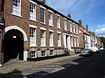 |
| Gate House, Comprising Archway and Lodges (numbers 2 and 4) to Sewerby House Attached Forecourt Walls and Gatepiers to West | Sewerby, East Riding of Yorkshire | Gate Pier | Mid 19th century | 9 January 1976 | TA2014668932 54°06′08″N0°09′51″W / 54.102257°N 0.164041°W | 1346515 |  |
| Hebblethwaite House | Bridlington, East Riding of Yorkshire | House | c. 1670 | 7 September 1951 | TA1715067869 54°05′36″N0°12′37″W / 54.093398°N 0.210246°W | 1083599 |  |
| Marton Hall School | Marton, Bridlington, East Riding of Yorkshire | School | 1672 | 7 September 1951 | TA2012469687 54°06′33″N0°09′51″W / 54.109045°N 0.164078°W | 1083696 | 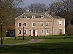 |
| Stable Block to North West of Sewerby House | Sewerby, East Riding of Yorkshire | Cafe | c. 1825 | 7 September 1951 | TA2028469077 54°06′13″N0°09′43″W / 54.103528°N 0.161874°W | 1083691 |  |
| Terrace Balustrade and Attached Garden Wall and Archway to Sewerby House | Sewerby, East Riding of Yorkshire | Balustrade | c. 1850 | 7 September 1951 | TA2035069025 54°06′11″N0°09′39″W / 54.103045°N 0.160886°W | 1083690 | 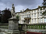 |
| The Avenue Hospital | Bridlington, East Riding of Yorkshire | House | 1714 | 7 September 1951 | TA1702267875 54°05′37″N0°12′44″W / 54.093481°N 0.2122°W | 1083603 |  |
| The Old Laundry, Sewerby House | Sewerby, East Riding of Yorkshire | Laundry | 18th century | 7 September 1951 | TA2032069082 54°06′13″N0°09′41″W / 54.103564°N 0.161322°W | 1055861 | Upload Photo |
| The Toft | Bridlington, East Riding of Yorkshire | House | 1673 | 7 September 1951 | TA1736367836 54°05′35″N0°12′25″W / 54.093053°N 0.207004°W | 1083660 |  |
| 70 High Street | Bridlington, East Riding of Yorkshire | House | Early 18th century | 7 September 1951 | TA1726567879 54°05′36″N0°12′31″W / 54.093462°N 0.208485°W | 1083679 |  |
| 67 High Street | Bridlington, East Riding of Yorkshire | House | Early 19th century | 7 September 1951 | TA1729367854 54°05′36″N0°12′29″W / 54.093231°N 0.208067°W | 1083664 |  |
| 42 and 44 High Street | Bridlington, East Riding of Yorkshire | House | Late 17th century or Early 18th century | 7 September 1951 | TA1736467854 54°05′36″N0°12′25″W / 54.093215°N 0.206982°W | 1083673 |  |
| 51 & 53 High Street | Bridlington, East Riding of Yorkshire | House | Early 18th century | 7 September 1951 | TA1733167846 54°05′35″N0°12′27″W / 54.093151°N 0.207489°W | 1083662 |  |
| 45 High Street | Bridlington, East Riding of Yorkshire | House | Late 17th century | 7 September 1951 | TA1735167840 54°05′35″N0°12′26″W / 54.093092°N 0.207186°W | 1346536 | 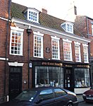 |
| 46, 46A, 48, 50 and 50A High Street | Bridlington, East Riding of Yorkshire | House | 18th century | 7 September 1951 | TA1735067856 54°05′36″N0°12′26″W / 54.093236°N 0.207195°W | 1039110 |  |
| Low Hall | Bugthorpe, East Riding of Yorkshire | House | Late Medieval | 26 January 1967 | SE7713658120 54°00′48″N0°49′28″W / 54.01334°N 0.824365°W | 1083872 | Upload Photo |
| The Menagerie Approximately 45 Metres to West of Burton Constable Hall | Burton Constable Park, Burton Constable, East Riding of Yorkshire | House | Late C20 | 16 December 1966 | TA1835236676 53°48′46″N0°12′14″W / 53.812908°N 0.203961°W | 1083447 | Upload Photo |
| The Orangery Approximately 10 Metres to South-west of Burton Constable Hall | Burton Constable Park, Burton Constable, East Riding of Yorkshire | Orangery | 1788–1789 | 16 December 1966 | TA1884136687 53°48′46″N0°11′48″W / 53.812896°N 0.196534°W | 1083445 |  |
| Church of St Cuthbert | Burton Fleming, East Riding of Yorkshire | Sundial | 12th century | 30 June 1966 | TA0834872368 54°08′09″N0°20′35″W / 54.135742°N 0.343155°W | 1083394 |  |
| Church of St John the Baptist | Carnaby, East Riding of Yorkshire | Church | Late C13–early 14th century | 30 June 1966 | TA1446665591 54°04′25″N0°15′08″W / 54.073537°N 0.252124°W | 1083821 |  |
| Kexby Old Bridge | Catton, East Riding of Yorkshire | Bridge | 1650 | 17 November 1966 | SE7050151115 53°57′05″N0°55′38″W / 53.951339°N 0.927215°W | 1316288 |  |
| Church of St Michael | Catwick, East Riding of Yorkshire | Church | 15th century | 16 December 1966 | TA1309245387 53°53′32″N0°16′50″W / 53.892336°N 0.280604°W | 1249378 |  |
| Downs Hall, the Lawns | Cottingham, East Riding of Yorkshire | Hall of Residence | 1963–7 | 30 March 1993 | TA0371033601 53°47′18″N0°25′38″W / 53.788404°N 0.427278°W | 1103346 |  |
| Grant Hall, the Lawns | Cottingham, East Riding of Yorkshire | Hall of Residence | 1963–7 | 30 March 1993 | TA0368933644 53°47′20″N0°25′39″W / 53.788794°N 0.427582°W | 1103345 | Upload Photo |
| Lambert Hall, the Lawns | Cottingham, East Riding of Yorkshire | Hall of Residence | 1963–7 | 30 March 1993 | TA0379633419 53°47′12″N0°25′34″W / 53.786751°N 0.426035°W | 1232675 |  |
| Morgan Hall, the Lawns | Cottingham, East Riding of Yorkshire | Hall of Residence | 1963–7 | 30 March 1993 | TA0380733541 53°47′16″N0°25′33″W / 53.787845°N 0.425827°W | 1103344 | Upload Photo |
| Nicholson Hall, the Lawns | Cottingham, East Riding of Yorkshire | Hall of Residence | 1963–7 | 30 March 1993 | TA0379933475 53°47′14″N0°25′33″W / 53.787254°N 0.42597°W | 1276987 |  |
| Reckitt Hall, the Lawns | Cottingham, East Riding of Yorkshire | Hall of Residence | 1963–7 | 30 March 1993 | TA0367233588 53°47′18″N0°25′40″W / 53.788294°N 0.427859°W | 1103343 | Upload Photo |
| Southwood Hall | Cottingham, East Riding of Yorkshire | House | Before 1661 | 3 December 1951 | TA0383632224 53°46′34″N0°25′33″W / 53.776007°N 0.42583°W | 1310021 |  |
| Zion United Reformed Church | Cottingham, East Riding of Yorkshire | Presbyterian Chapel | 1819 | 31 January 1967 | TA0438132873 53°46′54″N0°25′02″W / 53.781729°N 0.417344°W | 1103393 |  |
| Dalton Hall | Dalton Holme, East Riding of Yorkshire | House | Before 1737 | 6 May 1952 | SE9558445076 53°53′35″N0°32′49″W / 53.89306°N 0.547011°W | 1161304 |  |
| Church of St Mary | Little Driffield, East Riding of Yorkshire | Cross | Late C9–10 | 25 January 1985 | TA0098857798 54°00′23″N0°27′38″W / 54.006338°N 0.460608°W | 1083376 |  |
| Tithe Barn | Easington, East Riding of Yorkshire | Horse Engine House | 19th century | 27 February 1987 | TA3983719124 53°39′00″N0°06′51″E / 53.649931°N 0.114197°E | 1083473 |  |
| Blue Hall | Garton, East Riding of Yorkshire | House | c. 1600 | 16 December 1966 | TA2617335593 53°48′05″N0°05′08″W / 53.801343°N 0.085691°W | 1346612 |  |
| Stable Block at Grimston Garth | Grimston, East Riding of Yorkshire | Gate Pier | c1781–6 | 16 December 1966 | TA2829435189 53°47′50″N0°03′13″W / 53.797196°N 0.053674°W | 1083500 | Upload Photo |
| Church of St Mary | Elloughton, East Riding of Yorkshire | Church | 15th century | 7 February 1968 | SE9443328243 53°44′31″N0°34′11″W / 53.742024°N 0.569679°W | 1203258 |  |
| Church of St Mary | Etton, East Riding of Yorkshire | Church | 12th century | 7 February 1968 | SE9814043579 53°52′45″N0°30′31″W / 53.879133°N 0.508611°W | 1103443 |  |
| Church of Saint Everilda | Everingham, East Riding of Yorkshire | Church | Early 13th century | 26 January 1967 | SE8040442313 53°52′15″N0°46′43″W / 53.870805°N 0.778661°W | 1310669 |  |
| Church of St Martin | Fangfoss, East Riding of Yorkshire | Church | 12th century | 26 January 1967 | SE7668853346 53°58′14″N0°49′57″W / 53.970508°N 0.8324°W | 1083833 |  |
| Fangfoss Hall | Fangfoss, East Riding of Yorkshire | House | Late 18th century | 26 January 1967 | SE7673053378 53°58′15″N0°49′54″W / 53.970789°N 0.831752°W | 1346460 | Upload Photo |
| Church of St Oswald | Flamborough, East Riding of Yorkshire | Sculpture | c. 1100 | 30 June 1966 | TA2261570155 54°06′46″N0°07′33″W / 54.112661°N 0.125808°W | 1162230 |  |
| The Old Lighthouse | Flamborough, East Riding of Yorkshire | Lighthouse | 1674 | 11 January 1952 | TA2496670810 54°07′05″N0°05′23″W / 54.11798°N 0.089595°W | 1083400 | 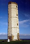 |
| Church of St Andrew | Foston, East Riding of Yorkshire | Church | 12th century | 20 September 1966 | TA1006455819 53°59′12″N0°19′22″W / 53.986707°N 0.322904°W | 1346653 | 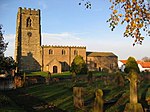 |
| Elmswell Old Hall | Elmswell, East Riding of Yorkshire | House | 1634 | 20 September 1966 | SE9979658140 54°00′35″N0°28′43″W / 54.009642°N 0.478677°W | 1083792 |  |
| Hall Garth | Goodmanham, East Riding of Yorkshire | House | 1823–4 | 26 January 1967 | SE8902743006 53°52′32″N0°38′50″W / 53.875626°N 0.647356°W | 1160374 | Upload Photo |
| Boat Hoist on South Side of South Dock | Goole, East Riding of Yorkshire | Boat Lift | c. 1862 | 18 April 1986 | SE7426822851 53°41′49″N0°52′36″W / 53.696828°N 0.876641°W | 1083214 |  |
| Lowther Hotel | Goole, East Riding of Yorkshire | Office | 1824–1826 | 29 July 1966 | SE7471923313 53°42′03″N0°52′11″W / 53.700915°N 0.8697°W | 1310687 |  |
| Railway Swing Bridge over River Ouse | Goole, East Riding of Yorkshire | Railway Bridge | 1869 | 15 September 1987 | SE7649924707 53°42′47″N0°50′33″W / 53.713185°N 0.8424°W | 1346710 |  |
| Goole Hall | Goole Fields, East Riding of Yorkshire | House | c. 1820 | 14 February 1967 | SE7532521521 53°41′05″N0°51′39″W / 53.684725°N 0.860958°W | 1103307 | Upload Photo |
| Constable Mausoleum | Halsham, East Riding of Yorkshire | Mausoleum | 1792–1802 | 4 March 1952 | TA2705427866 53°43′54″N0°04′32″W / 53.731718°N 0.0755°W | 1346604 |  |
| Church of Saint Nicholas | Ruston Parva, East Riding of Yorkshire | Church | 1832 | 20 September 1966 | TA0646361610 54°02′22″N0°22′33″W / 54.039487°N 0.375773°W | 1083348 |  |
| Church of St Martin | Lowthorpe, East Riding of Yorkshire | Cross | Pre-Conquest | 20 September 1966 | TA0790960807 54°01′55″N0°21′14″W / 54.031972°N 0.353987°W | 1346656 |  |
| Cross Approximately One Metre East of East Wall of Church of St Martin | Lowthorpe, East Riding of Yorkshire | Cross | Medieval | 20 September 1966 | TA0792660811 54°01′55″N0°21′13″W / 54.032005°N 0.353726°W | 1083347 | Upload Photo |
| Church of Saint Giles | Burnby, East Riding of Yorkshire | Church | Late 12th century | 26 January 1967 | SE8356846379 53°54′25″N0°43′46″W / 53.906841°N 0.729447°W | 1084145 |  |
| Church of St Mary and St Joseph | Hedon, East Riding of Yorkshire | Church | 1803 | 9 January 1954 | TA1904928593 53°44′24″N0°11′47″W / 53.740136°N 0.196497°W | 1083537 |  |
| Hedon Town Hall | Hedon, East Riding of Yorkshire | Lock Up | 1693 | 9 January 1954 | TA1890428616 53°44′25″N0°11′55″W / 53.740375°N 0.198686°W | 1083554 | 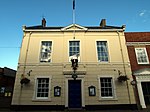 |
| Ravenspurn Cross in the Grounds of Holyrood House | Hedon, East Riding of Yorkshire | Cross | Early 15th century | 20 December 1991 | TA1903128731 53°44′29″N0°11′48″W / 53.74138°N 0.196717°W | 1240953 |  |
| The New Hall | Hedon, East Riding of Yorkshire | House | Mid 18th century | 9 January 1954 | TA1892728497 53°44′21″N0°11′54″W / 53.739301°N 0.198383°W | 1083574 |  |
| The Old Hall | Hedon, East Riding of Yorkshire | House | Early 18th century | 9 January 1954 | TA1909828519 53°44′22″N0°11′45″W / 53.73946°N 0.195783°W | 1083575 |  |
| Holme Hall | Holme upon Spalding Moor, East Riding of Yorkshire | House | Post 1766 | 16 December 1966 | SE8158838503 53°50′11″N0°45′42″W / 53.836385°N 0.76167°W | 1083338 |  |
| Church of St Mary | Hook, East Riding of Yorkshire | Church | 14th century | 14 February 1967 | SE7590825500 53°43′13″N0°51′04″W / 53.720397°N 0.851159°W | 1160360 |  |
| The White House | Hornsea, East Riding of Yorkshire | House | c. 1674 | 26 November 1985 | TA2018147340 53°54′30″N0°10′19″W / 53.908287°N 0.172027°W | 1249390 | 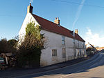 |
| Church of St Oswald | Hotham, East Riding of Yorkshire | Church | Early 12th century | 16 December 1966 | SE8944034580 53°47′59″N0°38′37″W / 53.799845°N 0.643525°W | 1083305 |  |
| Howden Hall | Howden, East Riding of Yorkshire | House | Late 17th century | 17 March 1952 | SE7509828532 53°44′52″N0°51′46″W / 53.74776°N 0.862696°W | 1160523 |  |
| The Bishop's Manor | Bishop's Manor Park, Howden, East Riding of Yorkshire | Hall House | Earlier than 1388 | 17 March 1952 | SE7488028183 53°44′41″N0°51′58″W / 53.744656°N 0.866085°W | 1083181 |  |
| The Langley Archway | Bishop's Manor Park, Howden, East Riding of Yorkshire | Arch | Early 15th century | 16 December 1966 | SE7482828176 53°44′41″N0°52′01″W / 53.7446°N 0.866875°W | 1083182 | Upload Photo |
| Church of St Peter | Hutton, Hutton Cranswick, East Riding of Yorkshire | Church | 12th century | 20 September 1966 | TA0241453355 53°57′58″N0°26′25″W / 53.96614°N 0.440351°W | 1161006 |  |
| Saltmarshe Hall | Saltmarshe, East Riding of Yorkshire | Country House | 1825 | 17 March 1952 | SE7820423965 53°42′23″N0°49′00″W / 53.706265°N 0.81676°W | 1203298 |  |
| Holy Trinity Church | Leven, East Riding of Yorkshire | Church | Pre-conquest 1066 | 7 February 1968 | TA1065745232 53°53′29″N0°19′04″W / 53.891468°N 0.317695°W | 1103456 |  |
| Gate Piers | Londesborough Park, Londesborough, East Riding of Yorkshire | Gate Pier | Early 18th century | 26 January 1967 | SE8691545398 53°53′51″N0°40′44″W / 53.897477°N 0.678793°W | 1160419 | Upload Photo |
| Church of All Saints | Lund, East Riding of Yorkshire | Church | 15th century | 7 February 1968 | SE9701748145 53°55′13″N0°31′27″W / 53.920369°N 0.524242°W | 1103410 |  |
| Church of All Saints | Mappleton, East Riding of Yorkshire | Church | 14th century | 16 December 1966 | TA2255143864 53°52′35″N0°08′14″W / 53.876508°N 0.137359°W | 1083417 | 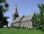 |
| Church of St. Andrew | Middleton, East Riding of Yorkshire | Church | Early 13th century | 20 September 1966 | SE9466749571 53°56′01″N0°33′34″W / 53.933615°N 0.559571°W | 1084151 |  |
| Church of Saint Ethelburgh | Great Givendale, East Riding of Yorkshire | Church | 1849 | 26 January 1967 | SE8133253879 53°58′29″N0°45′41″W / 53.974589°N 0.761479°W | 1346278 |  |
| Hotham Hall | North Cave, East Riding of Yorkshire | House | 1871 | 16 December 1966 | SE8964133707 53°47′31″N0°38′27″W / 53.791966°N 0.640728°W | 1203450 |  |
| Stable Block at Hotham Hall | North Cave, East Riding of Yorkshire | Garage | Early C20 | 16 December 1966 | SE8959033734 53°47′32″N0°38′29″W / 53.792217°N 0.641494°W | 1346681 | Upload Photo |
| Church of All Saints | North Dalton, East Riding of Yorkshire | Church | 12th century | 20 September 1966 | SE9346952200 53°57′27″N0°34′37″W / 53.957454°N 0.577008°W | 1161951 |  |
| Ferriby House | North Ferriby, East Riding of Yorkshire | House | c1760–1770 | 6 May 1952 | SE9877226148 53°43′21″N0°30′16″W / 53.722398°N 0.504583°W | 1347005 |  |
| Church of St Elgin | Church End, North Frodingham, East Riding of Yorkshire | Cross | 10th century | 20 September 1966 | TA0897953416 53°57′55″N0°20′25″W / 53.965348°N 0.340301°W | 1083362 |  |
| Kilnwick Percy Hall | Kilnwick Percy, East Riding of Yorkshire | Country House | c. 1845 | 26 January 1967 | SE8257949861 53°56′18″N0°44′37″W / 53.938288°N 0.743558°W | 1309858 |  |
| The White Hall | Winestead, East Riding of Yorkshire | Country House | 1814–15 | 16 December 1966 | TA2930823829 53°41′42″N0°02′35″W / 53.694901°N 0.043038°W | 1310373 | Upload Photo |
| Rise Hall | Rise, East Riding of Yorkshire | Country House | 1815–1820 | 16 December 1966 | TA1535241942 53°51′39″N0°14′51″W / 53.86089°N 0.247527°W | 1161753 |  |
| Church of St Margaret | Long Riston, East Riding of Yorkshire | Church | 13th century | 16 December 1966 | TA1233042725 53°52′07″N0°17′35″W / 53.868586°N 0.293168°W | 1083422 |  |
| Church of All Saints | Routh, East Riding of Yorkshire | Church | 14th century | 7 February 1968 | TA0911042505 53°52′02″N0°20′32″W / 53.867296°N 0.342193°W | 1160744 |  |
| Church of Saint Peter | Rowley, East Riding of Yorkshire | Church | 12th century | 7 February 1968 | SE9764732619 53°46′51″N0°31′11″W / 53.780752°N 0.519584°W | 1347015 |  |
| Thorpe Hall | Rudston, East Riding of Yorkshire | Country House | Mid 17th century | 11 January 1952 | TA1092967675 54°05′35″N0°18′19″W / 54.093032°N 0.305391°W | 1346645 | Upload Photo |
| Church of All Saints | Sancton, East Riding of Yorkshire | Church | 15th century | 26 January 1967 | SE8997439467 53°50′37″N0°38′02″W / 53.843664°N 0.633992°W | 1084105 |  |
| Wassand Hall | Wassand Park, Wassand, East Riding of Yorkshire | Country House | 1813–1819 | 4 March 1952 | TA1740746037 53°53′50″N0°12′53″W / 53.897217°N 0.21473°W | 1249398 |  |
| Church of St Lawrence | Sigglesthorne, East Riding of Yorkshire | Sundial | 1616 | 16 December 1966 | TA1544045666 53°53′40″N0°14′41″W / 53.894325°N 0.244789°W | 1249769 |  |
| Church of St Mary the Virgin | Wansford, East Riding of Yorkshire | Church | 1868 | 20 September 1966 | TA0621656654 53°59′42″N0°22′53″W / 53.995013°N 0.381272°W | 1162211 |  |
| Church of Saint Michael | Skidby, East Riding of Yorkshire | Church | 12th century | 7 February 1968 | TA0150833658 53°47′22″N0°27′38″W / 53.789349°N 0.46067°W | 1103341 |  |
| Skidby Mill and Attached Mill Buildings | Skidby, East Riding of Yorkshire | Corn Mill | 1821 | 6 May 1952 | TA0204833313 53°47′10″N0°27′09″W / 53.786144°N 0.452591°W | 1103339 | 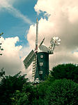 |
| Church of Saint Mary | Skirpenbeck, East Riding of Yorkshire | Church | 12th century | 26 January 1967 | SE7498357221 54°00′20″N0°51′27″W / 54.005578°N 0.857434°W | 1161856 | 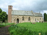 |
| Bloodstock Stables and Farmery with Walls and Gate Piers | Sledmere, East Riding of Yorkshire | Gate Pier | 1830 | 20 September 1966 | SE9304364854 54°04′16″N0°34′47″W / 54.071226°N 0.579631°W | 1083807 |  |
| Church of St Mary | Sledmere, East Riding of Yorkshire | Church | Medieval | 20 September 1966 | SE9300364553 54°04′07″N0°34′49″W / 54.068528°N 0.580335°W | 1310183 |  |
| Stables and Carriage House to Sledmere House | Sledmere, East Riding of Yorkshire | Garage | Late 18th century | 20 September 1966 | SE9300064750 54°04′13″N0°34′49″W / 54.070299°N 0.58032°W | 1161302 |  |
| Church of All Saints | South Cave, East Riding of Yorkshire | Church | Mid 13th century | 7 February 1968 | SE9161431008 53°46′03″N0°36′42″W / 53.767371°N 0.611588°W | 1103317 |  |
| Bridge over River Derwent | Stamford Bridge, East Riding of Yorkshire | Road Bridge | 1727 | 18 January 1952 | SE7114655578 53°59′29″N0°54′59″W / 53.991356°N 0.916349°W | 1346426 |  |
| Stamford Bridge Railway Viaduct (that Part in East Yorkshire District) | Stamford Bridge, East Riding of Yorkshire | Railway Viaduct | 1847 | 26 January 1967 | SE7087255407 53°59′23″N0°55′14″W / 53.989857°N 0.920567°W | 1083841 |  |
| Sutton Bridge | Sutton upon Derwent, East Riding of Yorkshire | Bridge | Late 17th century | 25 October 1952 | SE7048647663 53°55′13″N0°55′42″W / 53.920321°N 0.928239°W | 1148519 |  |
| Church of St Michael | Thornton, East Riding of Yorkshire | Bell Tower | 12th century | 26 January 1967 | SE7598445200 53°53′51″N0°50′43″W / 53.897413°N 0.845153°W | 1346434 |  |
| The Old Farmhouse, Glebe Farm | Octon, East Riding of Yorkshire | Farmhouse | Late 17th century | 2 January 1985 | TA0322569885 54°06′52″N0°25′21″W / 54.114488°N 0.42238°W | 1309563 | Upload Photo |
| Eske Manor | Eske, East Riding of Yorkshire | House | Mid 17th century | 9 February 1987 | TA0573743236 53°52′28″N0°23′36″W / 53.874561°N 0.393214°W | 1346994 | Upload Photo |
| Stone Building Approximately 25 Metres South of Church House | Adlingfleet, East Riding of Yorkshire | Outbuilding | Medieval | 14 February 1967 | SE8438120944 53°40′41″N0°43′27″W / 53.678158°N 0.72403°W | 1346748 |  |
| Whitgift Hall Including Attached Walls to North Outbuildings and Screen Wall to South East | Whitgift, East Riding of Yorkshire | Country House | Early 18th century | 14 February 1967 | SE8166222808 53°41′43″N0°45′53″W / 53.695339°N 0.764692°W | 1083149 | Upload Photo |
| Church of All Hallows | Walkington, East Riding of Yorkshire | Church | 12th century | 26 March 1987 | SE9984936824 53°49′05″N0°29′05″W / 53.818116°N 0.484817°W | 1161425 |  |
| Outbuildings to Watton Abbey | Watton, East Riding of Yorkshire | Wall | c. 1150 | 7 September 1987 | TA0232649907 53°56′07″N0°26′34″W / 53.935179°N 0.442847°W | 1083773 |  |
| Church of St Helen | Welton, East Riding of Yorkshire | Church | Pre 16th century | 7 February 1968 | SE9589627305 53°44′00″N0°32′52″W / 53.73333°N 0.547795°W | 1347029 |  |
| Welton Grange | Welton, East Riding of Yorkshire | House | c. 1741 | 6 May 1952 | SE9565827193 53°43′57″N0°33′05″W / 53.732367°N 0.551437°W | 1347030 |  |
| Church of St Nicholas | Wetwang, East Riding of Yorkshire | Church | 12th century | 20 August 1966 | SE9328759050 54°01′09″N0°34′40″W / 54.019034°N 0.577685°W | 1083774 |  |
| Church Bridge | Wilberfoss, East Riding of Yorkshire | Bridge | Late Medieval | 26 January 1967 | SE7322250967 53°56′59″N0°53′09″W / 53.949632°N 0.885797°W | 1083860 | 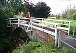 |
| Haltemprice Priory Farm | Willerby, East Riding of Yorkshire | House | Late C15/early 16th century | 3 December 1951 | TA0419830965 53°45′53″N0°25′15″W / 53.764623°N 0.420763°W | 1103364 |  |
| Church of St Nicholas | Withernsea, East Riding of Yorkshire | Parish Church | Mid 15th century | 27 February 1987 | TA3424927666 53°43′41″N0°02′00″E / 53.728121°N 0.033407°E | 1366257 |  |
| Church of All Saints | Wold Newton, East Riding of Yorkshire | Church | 12th century | 30 June 1966 | TA0457873130 54°08′36″N0°24′02″W / 54.143368°N 0.400568°W | 1346665 |  |
| Church of St James | Fordon, East Riding of Yorkshire | Church | 12th century | 30 June 1966 | TA0497275113 54°09′40″N0°23′38″W / 54.161102°N 0.39385°W | 1162675 | 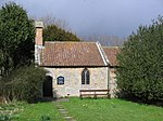 |
| Lantern Turret in Garden of No 4 King Street | Woodmansey, East Riding of Yorkshire | Church | c. 1400 | 26 March 1987 | TA0555137980 53°49′39″N0°23′52″W / 53.827377°N 0.397846°W | 1161446 | Upload Photo |
| The Bakehouse at Wressle Castle Approximately 30 Metres North of Ruins of Wressle Castle | Wressle, East Riding of Yorkshire | Bakehouse | c. 1380 | 16 December 1966 | SE7066631577 53°46′33″N0°55′45″W / 53.775743°N 0.929193°W | 1160652 | Upload Photo |
| Church of Saint Martin | Yapham, East Riding of Yorkshire | Church | 13th century | 26 January 1967 | SE7888551961 53°57′28″N0°47′57″W / 53.957733°N 0.799273°W | 1161970 |  |

There are more than 9000 Grade I listed buildings in England. This page is a list of these buildings in the county of Durham, sub-divided by unitary authority.

There are over 9,300 Grade I listed buildings in England. This page is a list of the 111 of these buildings in the ceremonial county of the East Riding of Yorkshire. In the United Kingdom, the term listed building refers to a building or other structure officially designated as being of special architectural, historical or cultural significance; Grade I structures are those considered to be "buildings of exceptional interest". In England, the authority for listing under the Planning Act 1990 rests with Historic England, a non-departmental public body sponsored by the Department for Culture, Media and Sport.
There are over 9300 Grade I listed buildings in England. This page is a list of these buildings in the county of East Sussex.

There are over 9,000 Grade I listed buildings in England. This page is a list of these buildings in the county of West Yorkshire, by metropolitan district.

There are over 20,000 Grade II* listed buildings in England. This list includes those in South Yorkshire.
There are over 20,000 Grade II* listed buildings in England. This page is a list of these buildings in the county of Durham, sub-divided by unitary authority.
There are over 20,000 Grade II* listed buildings in England. This page is a list of these buildings in the district of East Cambridgeshire in Cambridgeshire.
There are over 20,000 Grade II* listed buildings in England. This page is a list of these buildings in the metropolitan borough of Bradford in West Yorkshire.
There are over 20,000 Grade II* listed buildings in England. This page is a list of these buildings in the metropolitan borough of Calderdale in West Yorkshire.
There are over 20,000 Grade II* listed buildings in England. This page is a list of these buildings in the metropolitan borough of Kirklees in West Yorkshire.
There are over 20,000 Grade II* listed buildings in England. This page is a list of these buildings in the metropolitan borough of Leeds in West Yorkshire.
There are over 20,000 Grade II* listed buildings in England. This page is a list of these buildings in the district of Amber Valley in Derbyshire.

There are over 20,000 Grade II* listed buildings in England. This page is a list of these buildings in the district of Bolsover in Derbyshire.

There are over 20,000 Grade II* listed buildings in England. This page is a list of these buildings in the district of Christchurch in Dorset.
There are over 20,000 Grade II* listed buildings in England. This page is a list of these buildings in the district of Corby in Northamptonshire.
There are over 20,000 Grade II* listed buildings in England. This page is a list of these buildings in the district of Daventry in Northamptonshire.
There are over 9,000 Grade I listed buildings and 20,000 Grade II* listed buildings in England. This page is a list of these buildings in the district of Middlesbrough in North Yorkshire.
There are over 20,000 Grade II* listed buildings in England. This page is a list of these buildings in the district of the City of York in North Yorkshire.
There are over 9,000 Grade I listed buildings in England. This page is a list of these buildings in the City of York in North Yorkshire.
The Register of Historic Parks and Gardens of Special Historic Interest in England, created in 1983, is administered by Historic England. It includes more than 1,600 sites, ranging from gardens of private houses, to cemeteries and public parks.
| Unitary authorities | |
|---|---|
| Major settlements (cities in italics) | |
| Rivers | |
| Canals | |
| Topics | |