
Raleigh County is a county in the U.S. state of West Virginia. As of the 2020 census, the population was 74,591. Its county seat is Beckley. The county was founded in 1850 and is named for Sir Walter Raleigh. Raleigh County is included in the Beckley, West Virginia, Metropolitan Statistical Area.
Grandview or Grand View may refer to:

Whitby is an unincorporated community and coal town in the Winding Gulf Coalfield of southern West Virginia within Raleigh County, United States.
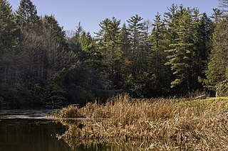
Little Beaver State Park is state park in Raleigh County, West Virginia. It is located near Beckley, West Virginia, about 2 miles (3.2 km) south of I-64 at Grandview Road, exit 129A. The park sits on the shores of 18-acre (0.07 km2) Little Beaver Lake.
Stotesbury is an unincorporated community and former coal town in Raleigh County in the U.S. state of West Virginia that flourished during the 1930s. The community was named for Edward T. Stotesbury, then the president of Beaver Coal Company.
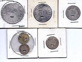
Hot Coal or Hotcoal was an unincorporated community and coal town located along the Winding Gulf Creek in Raleigh County, West Virginia, United States. Originally, it was named Patterson and later acquired the name Hot Coal. It was the next community past Big Stick on County Route 3/2. Although, the community now no longer exists, the Winding Gulf Bank, now the National Bank at Beckley, resided at Hot Coal and was moved to Beckley on January 1, 1914. Hot Coal at one time had a Post Office
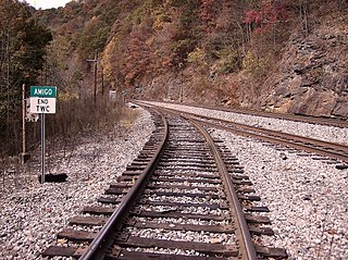
Amigo is an unincorporated community in Raleigh County, West Virginia, United States. The community is located on West Virginia Route 16 at the confluence of the Guyandotte River and Winding Gulf. The Amigo Post Office closed on October 22, 2011; it was established in 1915.

Pluto is an unincorporated community in Raleigh County, West Virginia. The elevation is 2,589 feet.
Abraham is a community in the Richmond District of Raleigh County, West Virginia, United States, that takes its name from an old post office. The name comes from Armistead Abraham Lilly, prosecuting attorney of Raleigh County from 1904 to 1908.

Raleigh is an unincorporated community and coal town in Raleigh County, West Virginia, United States. Raleigh is 1.5 miles (2.4 km) southeast of downtown Beckley. Raleigh has a post office with ZIP code 25911.
Arnett is an unincorporated community in Raleigh County, West Virginia, United States. Arnett is located on West Virginia Route 3, 14 miles (23 km) west-northwest of Beckley. Arnett has a post office with ZIP code 25007.
Packsville is an unincorporated community in Raleigh County, West Virginia, United States. Packsville is located on the Little Marsh Fork, 4.4 miles (7.1 km) south-southeast of Sylvester.
Mead is an unincorporated community in Raleigh County, West Virginia, United States. Mead is located on County Route 33 and Stonecoal Creek, 2.7 miles (4.3 km) east-northeast of Rhodell. Mead had a post office, which closed on June 10, 1989. It was also known as Vanwood.
McAlpin is an unincorporated community in Raleigh County, West Virginia, United States. McAlpin is located on County Route 30 and Winding Gulf, 1.9 miles (3.1 km) west-southwest of Sophia.
Dameron is an unincorporated community in Raleigh County, West Virginia, United States.
Hamlet was an unincorporated community in Raleigh County, West Virginia.
Pear is an unincorporated community in Raleigh County, West Virginia, United States.
Pettus is an unincorporated community in Raleigh County, West Virginia, United States.
Posey is an unincorporated community in Raleigh County, West Virginia, United States.

Wright is an unincorporated community in Raleigh County, West Virginia, United States.


