David McCreery is a Northern Irish former professional footballer who played for Newcastle United and many other clubs during his long career.

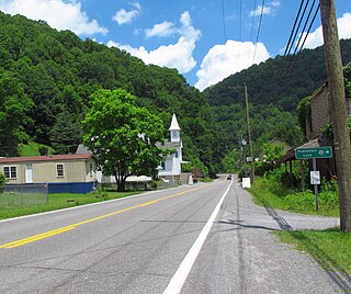
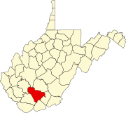
Cucumber is a census-designated place (CDP) in McDowell County, West Virginia, United States. Its population was 74 at the 2020 census. The community is centered on mining. Named either for nearby Cucumber Creek or for the cucumber trees in the area, it is the only community in the United States with this name. Its post office was still active as of October 2011.

Ennis is an unincorporated community in McDowell County, West Virginia, United States. Ennis lies on U.S. Route 52, west of Switchback.
McConnell is an unincorporated community and census-designated place (CDP) in Logan County, West Virginia, United States, on the Guyandotte River. As of the 2010 census, its population was 514. It was established in 1933.

William Armisted Burwell was a nineteenth-century Virginia politician and planter who served as presidential secretary and as a Democratic-Republican in the United States House of Representatives and the Virginia House of Delegates.
Galloway is a census-designated place (CDP) and coal town in northwestern Barbour County, West Virginia, United States. It lies along West Virginia Route 76 northwest of the city of Philippi, the county seat of Barbour County. Its elevation is 1,073 feet (327 m). It has a post office with the ZIP code 26349. As of the 2010 census, its population is 143.

Powhatan is an unincorporated community in McDowell County, West Virginia, United States, located approximately one mile from Northfork.
McGraws is an unincorporated community in Wyoming County, West Virginia, United States. McGraws is 12 miles (19 km) northwest of Mullens.
Mohawk is an unincorporated community in McDowell County, West Virginia, United States. Mohawk is 6 miles (9.7 km) west-northwest of Iaeger. Mohawk had a post office, which opened on December 8, 1903, and closed on June 27, 2009. The community was named after the Mohawk Indians.
Panther is an unincorporated community in McDowell County, West Virginia, United States. Panther is located along the Tug Fork, 4.5 miles (7.2 km) west-northwest of Iaeger. Panther has a post office with ZIP code 24872.
Squire is an unincorporated community in McDowell County, West Virginia, United States. Squire is located on West Virginia Route 16, 6.5 miles (10.5 km) southeast of War. Squire has a post office with ZIP code 24884.

Six is an unincorporated community in McDowell County, West Virginia, United States. Six is located on West Virginia Route 16, 5 miles (8.0 km) southwest of Welch.
Superior is an unincorporated community in McDowell County, West Virginia, United States. Superior is located on U.S. Route 52, 2.5 miles (4.0 km) east-southeast of Welch.
Twin Branch is an unincorporated community in McDowell County, West Virginia, United States. Twin Branch is 1 mile (1.6 km) west-southwest of Davy. It was founded by Henry Ford as a mining community.
McDowell is an unincorporated community in McDowell County, West Virginia, United States. McDowell is 3.5 miles (5.6 km) east-southeast of Northfork.
Lex is an unincorporated community in McDowell County, West Virginia, United States. Lex is located on West Virginia Route 80, 1.3 miles (2.1 km) north of Bradshaw.
McAlpin is an unincorporated community in Raleigh County, West Virginia, United States. McAlpin is located on County Route 30 and Winding Gulf, 1.9 miles (3.1 km) west-southwest of Sophia.
Prudence is an unincorporated community and coal town in Fayette County, West Virginia, United States.
Caperton is an unincorporated community and coal town in Fayette County, West Virginia, United States. It was also known as Elen.
MacDonald is an unincorporated community and coal town in Fayette County, West Virginia, United States.


