Frederick County is located in the Commonwealth of Virginia. As of the 2010 census, the population was 78,305. Its county seat is Winchester. The county was formed in 1743 by the splitting of Orange County. It is Virginia's northernmost county.

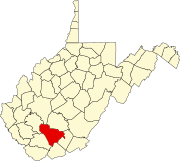
Wyoming County is a county in the U.S. state of West Virginia. As of the 2010 census, the population was 23,796. Its county seat is Pineville. The county was created in 1850 from Logan County and named for the Delaware Indian word meaning "large plains".

Mineral County is a county in the U.S. state of West Virginia. It is part of the Cumberland, MD-WV Metropolitan Statistical Area. As of the 2010 census, the population was 28,212. Its county seat is Keyser. The county was founded in 1866.

Kanawha County is a county in the U.S. state of West Virginia. As of the 2019 American Community Survey, the population was 183,279. This was a decrease of 9,784 since the 2010 Census; nevertheless, it is West Virginia's most populous county. The county seat is Charleston, which is also the state capital. Kanawha County is part of the Charleston, WV Metropolitan Statistical Area.

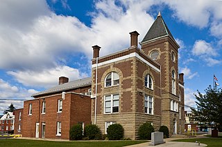
Pineville is a town in and the county seat of Wyoming County, West Virginia, United States, situated along the Guyandotte River. The population was 668 at the 2010 census.

The Cacapon River, located in the Appalachian Mountains of West Virginia's Eastern Panhandle region, is an 81.0-mile-long (130.4 km) river known for its fishing, boating, wildlife, and scenery. As part of the Potomac River watershed, it is an American Heritage River.

Sleepy Creek is a 44.0-mile-long (70.8 km) tributary of the Potomac River in the United States, belonging to the Chesapeake Bay's watershed. The stream rises in Frederick County, Virginia, and flows through Morgan County, West Virginia before joining the Potomac near the community of Sleepy Creek.

Sleepy Creek Mountain is a mountain ridge in the Ridge-and-Valley Appalachians on the border between Morgan and Berkeley counties in the Eastern Panhandle of West Virginia. The long-distance Tuscarora Trail traverses the southern ridge and northern bench of the mountain.

Orlando is an unincorporated community located in Braxton and Lewis counties, West Virginia, United States. It is located on Oil Creek, a tributary of the Little Kanawha River.

Key Rock is an unincorporated community in Wyoming County, West Virginia, United States.

Rock Camp is an unincorporated community in Monroe County, West Virginia, United States. Rock Camp is located on U.S. Route 219 northeast of Peterstown and southwest of Union.

Rock Creek is an unincorporated community in Boone County, West Virginia, United States. Rock Creek is located on U.S. Route 119, 3.5 miles (5.6 km) north-northwest of Madison.

Falling Rock is an unincorporated community in Kanawha County, West Virginia, United States. Falling Rock is located at the confluence of Falling Rock Creek with the Elk River 3 miles (4.8 km) southwest of Clendenin along US Route 19. Falling Rock has a post office with ZIP code 25079.

Clear Creek is an unincorporated community in Raleigh County, West Virginia, United States. Clear Creek is 4.5 miles (7.2 km) west of Pax. Clear Creek has a post office with ZIP code 25044.

Rosbys Rock is an unincorporated community in Marshall County, West Virginia, United States.

Barbours Creek Wilderness is a U.S. wilderness area in the Eastern Divide Ranger District of George Washington and Jefferson National Forests of western Virginia, United States. The wilderness area was established in 1988 and consists of 5,382 acres (2,178 ha) of forests in the Appalachian Mountains ranging in elevation from 1,700 to 3,800 feet.
The North Carolina–Tennessee–Virginia Corners is a tripoint at which North Carolina, Tennessee and Virginia meet. The landmark is located in the Iron Mountains, and is roughly 16 miles north of Snake Mountain, and 8 miles southwest of Mount Rogers.

Cooper Magisterial District is one of ten magisterial districts in Mason County, West Virginia, United States. The district was originally established as a civil township in 1863, and converted into a magisterial district in 1872. In 2010, Cooper District was home to 1,874 people.


