Amigo, West Virginia

Last updated

Amigo
Amigo West Virginia.jpg
Amigo, West Virginia
USA West Virginia location map.svg
Red pog.svg
Amigo
Location within the state of West Virginia
Usa edcp location map.svg
Red pog.svg
Amigo
Amigo (the United States)
Coordinates: 37°35′19″N81°20′50″W / 37.58861°N 81.34722°W / 37.58861; -81.34722
Country United States
State West Virginia
County Raleigh
Elevation
[1]
1,580 ft (480 m)
Time zone UTC-5 (Eastern (EST))
  Summer (DST) UTC-4 (EDT)
ZIP code
25811
GNIS feature ID1534921 [2]

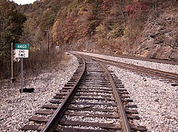
Amigo is an unincorporated community in Raleigh County, West Virginia, United States. [3] The community is located on West Virginia Route 16 at the confluence of the Guyandotte River and Winding Gulf. [4] The Amigo Post Office closed on October 22, 2011; it was established in 1915. [5]

Contents

Amigo Coal Company

The community most likely derives its name from the Amigo Coal Company, based on a conversation with the principal at Amigo in 1935. [6]

The Amigo Coal Company is listed in the "Annual Report of the Department of Mines For the Fiscal Year Ending June 30, 1920" in Raleigh County with company name "Amigo Coal Company", mine name "Amigo", and post office "Amigo". [7]

Related Research Articles

<span class="mw-page-title-main">Raleigh County, West Virginia</span> County in West Virginia, United States

Raleigh County is a county in the U.S. state of West Virginia. As of the 2020 census, the population was 74,591. Its county seat is Beckley. The county was founded in 1850 and is named for Sir Walter Raleigh. Raleigh County is included in the Beckley, West Virginia Metropolitan Statistical Area.

<span class="mw-page-title-main">Whitby, West Virginia</span> Unincorporated community in West Virginia, United States

Whitby is an unincorporated community and coal town in the Winding Gulf Coalfield of southern West Virginia within Raleigh County, United States.

<span class="mw-page-title-main">Fireco, West Virginia</span> Unincorporated community in West Virginia, United States

Fireco is an unincorporated community coal town in Raleigh County, West Virginia, United States. It lies in the Winding Gulf Coalfield of the southern part of the state. The name Fireco denotes the amount of heat the specific coal mined there could produce. This name was once a common descriptor.

Stotesbury is an unincorporated community and former coal town in Raleigh County in the U.S. state of West Virginia that flourished during the 1930s. The community was named for Edward T. Stotesbury, then the president of Beaver Coal Company.

<span class="mw-page-title-main">Kay Moor, West Virginia</span> United States historic place

Kay Moor, also known as Kaymoor, is the site of an abandoned coal mine, coal-processing plant, and coal town near Fayetteville, West Virginia. The town site is located in the New River Gorge at Kaymoor Bottom (38°03′00″N81°03′17″W). It is linked to the mine portal 560 feet (170 m) above on Sewell Bench (38°02′52″N81°03′58″W) in the wall of the Gorge by conveyors.

<span class="mw-page-title-main">Winding Gulf, West Virginia</span> Unincorporated community in West Virginia, United States

Winding Gulf is an unincorporated community in Raleigh County, West Virginia, United States. Winding Gulf is located on Winding Gulf, south of Sophia.

<span class="mw-page-title-main">Helen, West Virginia</span> Census-designated place in West Virginia, United States

Helen is a census-designated place (CDP) in Raleigh County, West Virginia, United States. As of the 2010 census, its population was 219. West Virginia Route 16, Winding Gulf and railroad tracks run right through the community.

<span class="mw-page-title-main">Raleigh, West Virginia</span> Unincorporated community in West Virginia, United States

Raleigh is an unincorporated community and coal town in Raleigh County, West Virginia, United States. Raleigh is 1.5 miles (2.4 km) southeast of downtown Beckley. Raleigh has a post office with ZIP code 25911.

<span class="mw-page-title-main">Glen White, West Virginia</span> Census-designated place in West Virginia, United States

Glen White is a census-designated place (CDP) in Raleigh County, West Virginia, United States. Glen White is located on state routes 54 and 97, 1 mile (1.6 km) southeast of Lester. Glen White had a post office with ZIP code 25849. As of the 2010 census, its population is 266.

<span class="mw-page-title-main">Tams, West Virginia</span> Unincorporated community in West Virginia, United States

Tams is an unincorporated community in Raleigh County, West Virginia, United States. Tams is located on West Virginia Route 16 and Winding Gulf, 4 miles (6.4 km) southwest of Sophia.

Colcord is an unincorporated community in Raleigh County, West Virginia, United States. Colcord is 5.5 miles (8.9 km) east-southeast of Whitesville. Colcord had a post office, which closed on November 30, 2002. The community was named after the proprietor of the Colcord Coal Company.

Micco is an unincorporated community in Logan County, West Virginia, United States. Micco is located along Island Creek and West Virginia Route 44, 4.5 miles (7.2 km) south of Logan. It is included in the Switzer census-designated place.

Packsville is an unincorporated community in Raleigh County, West Virginia, United States. Packsville is located on the Little Marsh Fork, 4.4 miles (7.1 km) south-southeast of Sylvester.

Mead is an unincorporated community in Raleigh County, West Virginia, United States. Mead is located on County Route 33 and Stonecoal Creek, 2.7 miles (4.3 km) east-northeast of Rhodell. Mead had a post office, which closed on June 10, 1989. It was also known as Vanwood.

McAlpin is an unincorporated community in Raleigh County, West Virginia, United States. McAlpin is located on County Route 30 and Winding Gulf, 1.9 miles (3.1 km) west-southwest of Sophia.

Parcoal is an unincorporated community in Webster County, West Virginia, United States. Parcoal is located along the Elk River, 2.3 miles (3.7 km) east-southeast of Webster Springs. Parcoal had a post office, which closed on November 26, 1988.

Hollywood was an unincorporated community located in Raleigh County, West Virginia, United States. Its post office no longer exists. There is also a Hollywood in Monroe County, West Virginia. Hollywood was renamed to MacArthur in 1942. However, it was a distinct mining community with its own coal mines see mine map 336094, located in Beckley. MacArthur used different mines see mine map 335329.

Devils Fork was an unincorporated community located in Wyoming and Raleigh counties, West Virginia, United States.

Cinderella is an unincorporated community and coal town in Mingo County, West Virginia, United States.

Weyanoke is an unincorporated community in Mercer County, West Virginia, United States. Weyanoke is located on County Route 11, 1 mile (1.6 km) west of Matoaka.

References

  1. Rhodell, WV, 7.5 Minute Topographic Quadrangle, USGS, 1967
  2. U.S. Geological Survey Geographic Names Information System: Amigo, West Virginia
  3. "Amigo". Geographic Names Information System . United States Geological Survey, United States Department of the Interior.
  4. Raleigh County, West Virginia General Highway Map (PDF) (Map). West Virginia Department of Transportation. 2011. p. 3. Archived from the original (PDF) on April 25, 2012. Retrieved December 12, 2011.
  5. http://webpmt.usps.gov/pmt015.cfm%5B%5D
  6. Kenny, Hamill (1945). West Virginia Place Names: Their Origin and Meaning, Including the Nomenclature of the Streams and Mountains. Piedmont, WV: The Place Name Press. p. 79.
  7. "Annual Report of the Department of Mines For the Fiscal Year Ending June 30, 1920". June 30, 1920. Retrieved July 19, 2020.

Commons-logo.svg Media related to Amigo, West Virginia at Wikimedia Commons