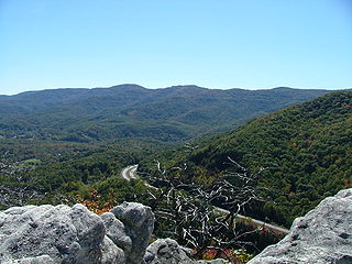
The Appalachian Mountains, often called the Appalachians, are a system of mountains in eastern North America. The Appalachians first formed roughly 480 million years ago during the Ordovician Period. They once reached elevations similar to those of the Alps and the Rocky Mountains before experiencing natural erosion. The Appalachian chain is a barrier to east–west travel, as it forms a series of alternating ridgelines and valleys oriented in opposition to most highways and railroads running east–west.

Pine Hills is a census-designated place (CDP) and unincorporated subdivision in Orange County, Florida, United States, west of Orlando. As of the 2010 U.S. Census, Pine Hills had a population of 60,076. It is a part of the Orlando–Kissimmee–Sanford, Florida Metropolitan Statistical Area.

The Cumberland Mountains are a mountain range in the southeastern section of the Appalachian Mountains. They are located in western Virginia, southwestern West Virginia, eastern edges of Kentucky, and eastern middle Tennessee, including the Crab Orchard Mountains. Their highest peak, with an elevation of 4,223 feet (1,287 m) above mean sea level, is High Knob, which is located near Norton, Virginia.

The Battle of Seven Pines, also known as the Battle of Fair Oaks or Fair Oaks Station, took place on May 31 and June 1, 1862, in Henrico County, Virginia, as part of the Peninsula Campaign of the American Civil War. It was the culmination of an offensive up the Virginia Peninsula by Union Maj. Gen. George B. McClellan, in which the Army of the Potomac reached the outskirts of Richmond.
Rees Jones is an American golf course architect.

Robert Pine is an American actor who is best known as Sgt. Joseph Getraer on the television series CHiPs (1977–1983).

Purgitsville is an unincorporated community in Hampshire County in the U.S. state of West Virginia. According to the 2000 census, the ZCTA for Purgitsville had a population of 813. Purgitsville is located on U.S. Highway 220/West Virginia Route 28 at its intersection with Huffman Road south of Junction. An elementary school, Mill Creek Elementary, was open here until 1993 when it was consolidated with Romney Elementary.
Back Creek is a 59.5-mile-long (95.8 km) tributary of the Potomac River that flows north from Frederick County, Virginia, to Berkeley County in West Virginia's Eastern Panhandle. Back Creek originates along Frederick County's border with Hampshire County, West Virginia, at Farmer's Gap in the Great North Mountain. Its name reflects its location to the west of North Mountain. The perspective of colonists from the east in the 18th century led them to call it "Back Creek", because it lay to the back of North Mountain.

Short Mountain Wildlife Management Area is located on 8,005 acres (32.40 km2) eight miles (13 km) south of Augusta off Augusta-Ford Hill Road in Hampshire County, West Virginia. Short Mountain WMA is owned by the West Virginia Division of Natural Resources.

Meadow Branch is a 16.7-mile-long (26.9 km) tributary stream of Sleepy Creek in West Virginia's Eastern Panhandle region. It passes through the Sleepy Creek Wildlife Management Area, where it is dammed to form the 205-acre (0.83 km2) Sleepy Creek Lake.

Sleepy Creek Mountain is a mountain ridge in the Ridge-and-Valley Appalachians on the border between Morgan and Berkeley counties in the Eastern Panhandle of West Virginia. The long-distance Tuscarora Trail traverses the southern ridge and northern bench of the mountain.
Pine Hills may refer to the following places:
The Great Eastern Trail is a north-south hiking route that runs roughly 1,600 miles (2,600 km) through the Appalachian Mountains west of the Appalachian Trail in the eastern United States. As of 2019, it is still under development. From south to north, it runs from Flagg Mountain through Alabama, Georgia, Tennessee, Kentucky, West Virginia, Virginia, Maryland, and Pennsylvania, ending in western New York state. A connection from Flagg Mountain south to the Florida-Georgia border is considered "Phase II Development".

Grassy Hill Natural Area Preserve is a 1,440-acre (5.8 km2) Natural Area Preserve located in Franklin County, Virginia, just to the west of the town of Rocky Mount. The site is composed of rocky slopes with various hardwood species and patches of Virginia pine. Shallow basic soils, typified by heavy clay, are found among bedrock outcrops rich in magnesium. Rare woodland communities live upon these substrates, and numerous rare plants may be found within grassy forest clearings near the summit. Evidence at the preserve suggests that the majority of the site was once more open, and may have historically been maintained through a natural fire regime that has been suppressed during modern times.

Burches Run Wildlife Management Area, formerly Burches Run Lake WMA, is located on 55 acres (22 ha) near Wheeling in Marshall County, West Virginia. Until 2005 the wildlife management area contained a lake impounded by a dam at risk of failure. The name change occurred after the dam was removed. The terrain climbs gently above Burches Run and is covered by a mature oak-hickory second-growth forest.

Pine Bluff is an unincorporated community in Harrison County, West Virginia, United States. Pine Bluff is 2 miles (3.2 km) northwest of Shinnston.

Pine Creek is an unincorporated community in Logan County, West Virginia.

Old Pine Church, also historically known as Mill Church, Nicholas Church, and Pine Church, is a mid-19th century church located near to Purgitsville, West Virginia, United States. It is among the earliest extant log churches in Hampshire County, along with Capon Chapel and Mount Bethel Church.


