Great Lakes Commission

Last updated
.mw-parser-output .legend{page-break-inside:avoid;break-inside:avoid-column}.mw-parser-output .legend-color{display:inline-block;min-width:1.25em;height:1.25em;line-height:1.25;margin:1px 0;text-align:center;border:1px solid black;background-color:transparent;color:black}.mw-parser-output .legend-text{}
Members
Associate members Great Lakes Commission members map.svg
  Members
  Associate members
The Great Lakes from space. Great Lakes from space.jpg
The Great Lakes from space.
A map of the Great Lakes Basin showing the five sub-basins within. Left to right they are: Superior (magenta); Michigan (cyan); Huron (pale green); Erie (yellow); Ontario (light coral). Sub-basins Great Lakes Basin.png
A map of the Great Lakes Basin showing the five sub-basins within. Left to right they are: Superior (magenta); Michigan (cyan); Huron (pale green); Erie (yellow); Ontario (light coral).

The Great Lakes Commission is a United States interstate agency established in 1955 through the Great Lakes Basin Compact, in order to "promote the orderly, integrated and comprehensive development, use and conservation of the water resources of the Great Lakes Basin," [1] which includes the Saint Lawrence River. The Great Lakes Commission provides policy development, coordination, and advocacy on issues of regional concern, as well as communication and research services.

Contents

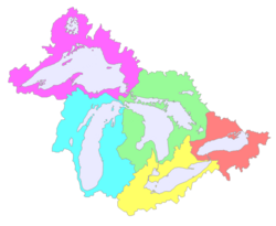
The eight member states are Illinois, Indiana, Michigan, Minnesota, New York, Ohio, Pennsylvania, and Wisconsin. The Canadian provinces of Ontario and Quebec are associate members. Each state has three votes on matters coming before the commission, while associate members and observers (representing the United States and Canadian federal governments, tribes, and other regional organizations [2] ) are permitted to participate in discussions, deliberations and other activities as approved by the Commission but have no vote. [3]

There is a separate and distinct entity with a similar brief, the International Joint Commission, which exists between the federal levels of the United States and Canada.

See also

Related Research Articles

Great Lakes Group of lakes in North America

The Great Lakes, also called the Great Lakes of North America or the Laurentian Great Lakes, is a series of large interconnected freshwater lakes in the mid-east region of North America that connect to the Atlantic Ocean via the Saint Lawrence River. They are Lakes Superior, Michigan, Huron, Erie, and Ontario and are in general on or near the Canada–United States border. Hydrologically, there are four lakes, because lakes Michigan and Huron join at the Straits of Mackinac. The Great Lakes Waterway enables travel by water among the lakes.

St. Lawrence Seaway Locks and canals in the USA and Canada

The St. Lawrence Seaway is a system of locks, canals, and channels in Canada and the United States that permits oceangoing vessels to travel from the Atlantic Ocean to the Great Lakes of North America, as far inland as Duluth, Minnesota, at the western end of Lake Superior. The seaway is named for the St. Lawrence River, which flows from Lake Ontario to the Atlantic Ocean. Legally, the seaway extends from Montreal, Quebec, to Lake Erie, and includes the Welland Canal.

St. Lawrence River Major river in eastern Canada and the United States, flowing into the Gulf of St. Lawrence

The St. Lawrence River is a large river in the middle latitudes of North America, flowing from Lake Ontario in a roughly northeasterly direction into the Gulf of St. Lawrence, connecting the Great Lakes to the North Atlantic Ocean and forming the primary drainage outflow of the Great Lakes Basin. The river traverses the Canadian provinces of Ontario and Quebec as well as the U.S. state of New York, and is part of the international boundary between Canada and the United States. It also provides the basis for the commercial St. Lawrence Seaway.

Drainage basin Area of land where precipitation collects and drains off into a common outlet

A drainage basin is any area of land where precipitation collects and drains off into a common outlet, such as into a river, bay, or other body of water. The drainage basin includes all the surface water from rain runoff, snowmelt, hail, sleet and nearby streams that run downslope towards the shared outlet, as well as the groundwater underneath the earth's surface. Drainage basins connect into other drainage basins at lower elevations in a hierarchical pattern, with smaller sub-drainage basins, which in turn drain into another common outlet.

In the United States, an interstate compact is a pact or agreement between two or more states, or between states and any foreign government. The Compact Clause of the United States Constitution provides that "No State shall, without the Consent of Congress,... enter into any Agreement or Compact with another State, or with a foreign Power,..."

International Joint Commission

The International Joint Commission is a bi-national organization established by the governments of the United States and Canada under the Boundary Waters Treaty of 1909. Its responsibilities were expanded with the signing of the Great Lakes Water Quality Agreement of 1972. The commission deals with issues affecting the extensive waters and waterways along the Canada–United States border.

Ogoki River

The Ogoki River is a river in the Thunder Bay and Cochrane Districts of Ontario. It springs from the wilderness just east of Savant Lake, flowing north of Lake Nipigon to Ogoki, where it joins the Albany River which empties into James Bay. The river is 480 kilometres (300 mi) long.

The Boundary Waters Treaty is the 1909 treaty between the United States and Canada providing mechanisms for resolving any dispute over any waters bordering the two countries. The treaty covers the

Main shore to main shore of the lakes and rivers and connecting waterways, or the portions thereof, along which the international boundary between the United States and the Dominion of Canada passes, including all bays, arms, and inlets thereof, but not including tributary waters which in their natural channels would flow into such lakes, rivers, and waterways, or waters flowing from such lakes, rivers, and waterways,or canals or streams, or steams or the waters of rivers flowing across the boundary.

Great Lakes Basin Large drainage basin around the Great Lakes

The Great Lakes Basin consists of the Great Lakes and the surrounding lands of the states of Illinois, Indiana, Michigan, Minnesota, New York, Ohio, Pennsylvania, and Wisconsin in the United States, and the province of Ontario in Canada, whose direct surface runoff and watersheds form a large drainage basin that feeds into the lakes. It is generally considered to also include a small area around and beyond Wolfe Island, Ontario, at the east end of Lake Ontario, which does not directly drain into the Great Lakes, but into the Saint Lawrence River.

The Great Lakes-St. Lawrence Lowlands, or simply St. Lawrence Lowlands, is a physiographic region of Eastern Canada that comprises a section of southern Ontario bounded on the north by the Canadian Shield and by three of the Great Lakes — Lake Huron, Lake Erie and Lake Ontario — and extends along the St. Lawrence River to the Strait of Belle Isle and the Atlantic Ocean. The lowlands comprise three sub-regions that were created by intrusions from adjacent physiographic regions — the West Lowland, Central Lowland and East Lowland. The West Lowland includes the Niagara Escarpment, extending from the Niagara River to the Bruce Peninsula and Manitoulin Island. The Central Lowland stretches between the Ottawa River and the St. Lawrence River. The East Lowland includes Anticosti Island, Îles de Mingan, and extends to the Strait of Belle Isle.

Shared vision planning was developed by the U.S. Army Corps of Engineers during the National Drought Study (1989–1993). At the end of the Drought Study, Shared vision planning had three basic elements: (1) an updated version of the systems approach to water resources management developed during the Harvard Water Program; (2) an approach to public involvement called "Circles of Influence"; and (3) collaboratively built computer models of the system to be managed. Alternative dispute resolution methods are often used to bring people in conflict to the table, and to resolve differences that occur during planning. A method of collaborative decision making called "Informed consent" is used to make decisions internally consistent, more defensible and transparent.

The Water Resources Development Act of 1986 is part of Pub.L. 99–662, a series of acts enacted by Congress of the United States on November 17, 1986.

Citizens Campaign for the Environment (CCE) was founded in 1985 by a small group of Long Island citizens. CCE is as a not-for-profit. Offices are in Farmingdale, NY, White Plains, NY, Albany, NY, Syracuse, NY, Buffalo, NY, and Hamden, CT. CCE has 120,000 members and is a non-partisan environmental advocacy organization and is classified as a 501(c)4 non-profit.

Susquehanna River Basin Commission

The Susquehanna River Basin Commission (SRBC) is a federal-interstate compact commission created by the Susquehanna River Basin Compact between three U.S states:, and the federal government, and signed into law by President Richard Nixon on Christmas Eve 1970 to be effective 30 days later on January 23, 1971.

Great Lakes Compact

The Great Lakes–St. Lawrence River Basin Water Resources Compact is a legally binding interstate compact among the U.S. states of Illinois, Indiana, Michigan, Minnesota, New York, Ohio, Pennsylvania and Wisconsin. The compact details how the states manage the use of the Great Lakes Basin's water supply and builds on the 1985 Great Lakes Charter and its 2001 Annex. The compact is the means by which the states implement the governors' commitments under the Great Lakes–St. Lawrence River Basin Sustainable Water Resources Agreement that also includes the Premiers of Ontario and Quebec.

Great Lakes–Saint Lawrence River Basin Sustainable Water Resources Agreement

The Great Lakes–Saint Lawrence River Basin Sustainable Water Resources Agreement is a good-faith agreement among the Governors of the U.S. states of Illinois, Indiana, Michigan, Minnesota, New York, Ohio, Pennsylvania and Wisconsin, and the Premiers of the Canadian provinces of Ontario and Quebec. The agreement details how the States and Provinces will manage the use of the Great Lakes Basin's water supply and builds on the 1985 Great Lakes Charter and its 2001 Annex. It was signed on December 13, 2005.

Great Lakes and St. Lawrence Governors and Premiers

The Conference of Great Lakes and St. Lawrence Governors and Premiers is a North American intergovernmental organization led by the governing chief executives of the Canadian provinces of Ontario and Québec and the US states of Illinois, Indiana, Michigan, Minnesota, New York, Ohio, Pennsylvania, and Wisconsin. Through the organization, they seek to grow the region's economy and protect the Great Lakes. The organization began in 1983 as the Council of Great Lakes Governors to encourage and facilitate environmentally responsible economic development. The Council now serves as secretariat to the Governors’ Compact Council and the Governor and Premiers’ Regional Body.

Great Lakes Protection Fund

The Great Lakes Protection Fund is a publicly capitalized, private corporation created in 1989 by the governors of the states surrounding the Great Lakes. The Fund invests a one-time contribution of public funds and uses the investment income for two purposes: first, to test new regional actions that improve the health of the Great Lakes; and second, to provide resources for states to support their individual Great Lakes priorities.

Great Lakes Treaty Topics referred to by the same term

Great Lakes Treaty may refer to:

The Convention on the Protection and Use of Transboundary Watercourses and International Lakes, also known as the Water Convention, is an international environmental agreement and one of five UNECE's negotiated environmental treaties. The purpose of this Convention is to improve national attempts and measures for protection and management of transboundary surface waters and groundwaters. On the international level, Parties are obliged to cooperate and create joint bodies. The Convention includes provisions on: monitoring, research, development, consultations, warning and alarm systems, mutual assistance and access as well as exchange of information.

References

  1. "Great Lakes Basin Compact" (PDF). Great Lakes Commission. Retrieved 2019-03-20.Cite journal requires |journal= (help)
  2. "Great Lakes Commission Observers October 14, 2021" (PDF). Great Lakes Commission. Retrieved 2021-12-10.Cite journal requires |journal= (help)
  3. "Great Lakes Commission Bylaws" (PDF). Great Lakes Commission. Retrieved 2021-12-10.Cite journal requires |journal= (help)