Lake Ontario is one of the five Great Lakes of North America. It is bounded on the north, west, and southwest by the Canadian province of Ontario, and on the south and east by the U.S. state of New York. The Canada–United States border spans the centre of the lake.

Lake Huron is one of the five Great Lakes of North America. Hydrologically, it comprises the easterly portion of Lake Michigan–Huron, having the same surface elevation as Lake Michigan, to which it is connected by the 5-mile-wide (8.0 km), 20-fathom-deep Straits of Mackinac. It is shared on the north and east by the Canadian province of Ontario and on the south and west by the U.S. state of Michigan. The name of the lake is derived from early French explorers who named it for the indigenous people they knew as Huron (Wyandot) inhabiting the region.

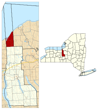
Wayne County is a county in the U.S. state of New York. As of the 2020 Census, the population was 91,283. The county seat is Lyons. The name honors General Anthony Wayne, an American Revolutionary War hero and American statesman.
Fair Haven is a village located on the southern shore of Lake Ontario in Cayuga County, New York, United States. As of the 2020 census, its population was 760. Fair Haven is within the town of Sterling and is northwest of Syracuse. The village is on Little Sodus Bay, an arm of Lake Ontario.

Sterling is a town in Cayuga County, New York, United States. The population was 3,040 at the 2010 census. Located on the shore of Lake Ontario, the town is named after William Alexander, Lord Stirling, an American general of the Revolutionary War. Sterling is the most northerly town in the county and lies northwest of Syracuse.

Huron is a town in Wayne County, New York, United States. The population was 2,118 at the 2010 census. The town is named after the Huron Indians.

Sodus Point is a village in Wayne County, New York, United States. The population was 900 at the 2010 census. However, the last official US Census in 2020 recorded the population at 822. The name is derived from a nearby body of water, Sodus Bay. It is considered to be within the larger Rochester metropolitan area.

Sodus is a town in Wayne County, New York, United States. The population was 8,384 at the 2010 census. The town takes its name from a native word for the bay in the eastern part of the town: "Assorodus," meaning "silvery water."

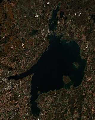
Lake Simcoe is a lake in southern Ontario, Canada, the fourth-largest lake wholly in the province, after Lake Nipigon, Lac Seul, and Lake Nipissing. At the time of the first European contact in the 17th century the lake was called Ouentironk by the native Wendat/Ouendat (Huron) people. It was also known as Lake Taronto until it was renamed by John Graves Simcoe, the first Lieutenant-Governor of Upper Canada, in memory of his father, Captain John Simcoe of the Royal Navy. In Anishinaabemowin, the ancestral language of the First Nations living around this lake, namely Anishinaabek of Rama and Georgina Island First Nations, Lake Simcoe is called Zhooniyaang-zaaga'igan, meaning "Silver Lake".

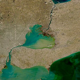
The St. Clair River is a 40.5-mile-long (65.2 km) river in central North America which flows from Lake Huron into Lake St. Clair, forming part of the international boundary between Canada and the United States and between the Canadian province of Ontario and the U.S. state of Michigan. The river is a significant component in the Great Lakes Waterway, whose shipping channels permit cargo vessels to travel between the upper and lower Great Lakes.

Chimney Bluffs State Park is a 597-acre (2.42 km2) state park in the town of Huron in Wayne County, New York. The park is situated on the southern shore of Lake Ontario, east of Sodus Bay. From the park's hiking trails, visitors can view the large clay formations at the water's edge for which the park is named.

The Nottawasaga River is a river in Simcoe County and Dufferin County in Central Ontario, Canada. It is part of the Great Lakes Basin, and is a tributary of Lake Huron. The river flows from the Orangeville Reservoir in the town of Orangeville, Dufferin County, through the Niagara Escarpment and the Minesing Wetlands, the latter a wetland of international significance, and empties into Nottawasaga Bay, an inlet of Georgian Bay on Lake Huron, at the town of Wasaga Beach, Simcoe County.

The Bruce Peninsula is a peninsula in Ontario, Canada, that divides Georgian Bay of Lake Huron from the lake's main basin. The peninsula extends roughly northwestwards from the rest of Southwestern Ontario, pointing towards Manitoulin Island, with which it forms the widest strait joining Georgian Bay to the rest of Lake Huron. The Bruce Peninsula contains part of the geological formation known as the Niagara Escarpment.
Ridge Road is a 121.5-mile (195.5 km) east–west road that traverses four counties in Upstate New York in the United States. The road begins adjacent to the Niagara River at an intersection with Water Street in the village of Lewiston, Niagara County, and passes through several towns, villages, and the city of Rochester before arriving at its eastern terminus at a junction with New York State Route 370 (NY 370) southwest of Red Creek, Wayne County. It is named for the rise atop which the road was built, a mound of sand and gravel that was formed when it was the shoreline of ancient Glacial Lake Iroquois. The ridge is often confused with the nearby Niagara Escarpment, which is much taller, geologic in origin, and lies a few miles to the south.

The Great Lakes Seaway Trail, formerly named and commonly known as the Seaway Trail, is a 518-mile (834 km) National Scenic Byway in the northeastern United States, mostly contained in New York but with a small segment in Pennsylvania. The trail consists of a series of designated roads and highways that travel along the Saint Lawrence Seaway—specifically, Lake Erie, the Niagara River, Lake Ontario, and the Saint Lawrence River. It begins at the Ohio state line in rural Erie County, Pennsylvania, and travels through several cities and villages before ending at the Seaway International Bridge northeast of the village of Massena in St. Lawrence County, New York. It is maintained by the non-profit Seaway Trail, Inc.

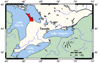
Point Clark is a lakefront cottage community on Lake Huron, in the municipality of Huron-Kinloss, Ontario, Canada. It is approximately 15 kilometres south of Kincardine and 40 kilometres north of Goderich. Main streets include Huron Road and Lake Range Road. Point Clark is served by Highway 21 (Ontario). It is a cottage town, and has a rare Imperial Tower style lighthouse. There is a sandy beach and a small harbour with a boat ramp. There are two streams or rivers that run into Lake Huron around Point Clark: Clark Creek and Pine River. There is a separate harbour in the mouth of the Pine River. Amberley is just outside and to the south of Point Clark and Lucknow is to the south-east of Point Clark.

Lake Erie Basin consists of Lake Erie and surrounding watersheds, which are typically named after the river, creek, or stream that provides drainage into the lake. The watersheds are located in the states of Indiana, Michigan, New York, Ohio, and Pennsylvania in the United States, and in the province of Ontario in Canada. The basin is part of the Great Lakes Basin and Saint Lawrence River Watershed, which feeds into the Atlantic Ocean. 80% of the lake's water flows in from the Detroit River, with only 9% coming from all of the remaining watersheds combined. A littoral zone serves as the interface between land and lake, being that portion of the basin where the lake is less than 15 feet (4.6 m) in depth.
Eighteen Mile Creek, or Eighteenmile Creek, is a tributary of Lake Ontario located entirely in Niagara County, New York in the United States. The name of "Eighteen Mile" Creek refers not to the length of the creek, but to its distance from the Niagara River to the west.
Lake Road is an east–west roadway in western New York in the United States. It extends for 29 miles (47 km) from the Irondequoit Bay Outlet Bridge in the Monroe County town of Webster to New York State Route 14 (NY 14) in the Wayne County village of Sodus Point. As its name implies, it follows the southern shore of Lake Ontario for its entire length. Lake Road serves as the northern terminus of NY 250 and was once the northern terminus of NY 21. The entirety of the roadway east of Bay Road in Webster is part of the Seaway Trail, a National Scenic Byway.

Beechwood State Park is a 288-acre (1.17 km2) state park located on the shore of Lake Ontario in the Town of Sodus in Wayne County, New York. The park occupies land that was formerly the site of a Girl Scout camp. The park is owned by the New York State Office of Parks, Recreation and Historic Preservation and is currently operated by the Town of Sodus under an agreement with New York State.


