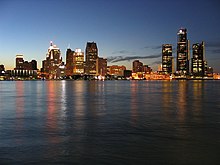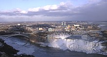


This is a list of cities on the Great Lakes of the United States and Canada, arranged by the body of water on which they are located. Cities with more than 100,000 population are in bold, major cities are italicized.


This is a list of cities on the Great Lakes of the United States and Canada, arranged by the body of water on which they are located. Cities with more than 100,000 population are in bold, major cities are italicized.
The Pere Marquette Railway was a railroad that operated in the Great Lakes region of the United States and southern parts of Ontario in Canada. It had trackage in the states of Michigan, Ohio, Indiana, and the Canadian province of Ontario. Its primary connections included Buffalo; Toledo; and Chicago. The company was named after Jacques Marquette, a French Jesuit missionary who founded Michigan's first European settlement, Sault Ste Marie.

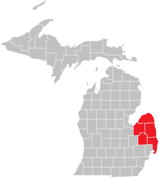
The Thumb is a region and a peninsula of the U.S. state of Michigan, so named because the Lower Peninsula is shaped like a mitten. The Thumb area is generally considered to be in the Central Michigan region, east of the Flint area and the Tri-Cities and north of Metro Detroit. The region is also branded as the Blue Water Area.

Central Station was an intercity passenger terminal in downtown Chicago, Illinois, at the southern end of Grant Park near Roosevelt Road and Michigan Avenue. Owned by the Illinois Central Railroad, it also served other companies via trackage rights. It opened in 1893, replacing Great Central Station, and closed in 1972 when Amtrak rerouted services to Union Station. The station building was demolished in 1974. It is now the site of a redevelopment called Central Station, Chicago.
A border town is a town or city close to the boundary between two countries, states, or regions. Usually the term implies that the nearness to the border is one of the things the place is most famous for. With close proximities to a different country, diverse cultural traditions can have certain influence to the place. Border towns can have highly cosmopolitan communities, a feature they share with port cities, as traveling and trading often go through the town. They can also be flashpoints for international conflicts, especially when the two countries have territorial disputes.

Michigan consists of two peninsulas surrounded primarily by four of the Great Lakes and a variety of nearby islands. The Upper Peninsula is bounded on the southwest by Wisconsin, and the Lower Peninsula is bounded on the south by Indiana and Ohio. Both land masses are also separated from the Canadian province of Ontario by waterways of the Great Lakes, and from each other by the Straits of Mackinac. Because its land is largely surrounded by the Great Lakes, which flow into the Saint Lawrence River, Michigan is the only U.S. state whose streams and rivers are almost entirely within the Great Lakes-St. Lawrence watershed.

The Great Lakes Circle Tour is a designated scenic road system connecting all of the Great Lakes and the St. Lawrence River. It consists of routes for circumnavigating the lakes, either individually or collectively. It was designated by the Great Lakes Commission in 1988.

MV Paul R. Tregurtha is a Great Lakes-based bulk carrier freighter. She is the current Queen of the Lakes, an unofficial but widely recognized title given to the longest vessel active on the Great Lakes. Launched as MV William J. De Lancey, she was the last of the thirteen "thousand footers" to enter service on the Great Lakes, and was also the last Great Lakes vessel built at the American Ship Building Company yard in Lorain, Ohio. The MV Paul R. Tregurtha is the current flagship for the Interlake Steamship Company.

Due to its unique geography, being made of two peninsulas surrounded by the Great Lakes, Michigan has depended on many ferries for connections to transport people, vehicles and trade. The most famous modern ferries are those which carry people and goods across the Straits of Mackinac to the car-free Mackinac Island but before the Mackinac Bridge was built, large numbers of ferries carried people and cars between the two peninsulas. Other ferries continue to provide transportation to small islands and across the Detroit River to Canada. Ferries once provided transport to island parks for city dwellers. The state's only national park, Isle Royale cannot be reached by road and is normally accessed by ferry. The largest ferries in Michigan are the car ferries which cross Lake Michigan to Wisconsin. One of these, the SS Badger is one of the last remaining coal steamers on the Great Lakes and serves as a section of US Highway 10 (US 10). The Badger is also the largest ferry in Michigan, capable of carrying 600 passengers and 180 autos.

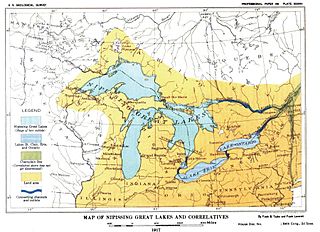
Nipissing Great Lakes was a prehistoric proglacial lake. Parts of the former lake are now Lake Superior, Lake Huron, Georgian Bay and Lake Michigan. It formed about 7,500 years before present (YBP). The lake occupied the depression left by the Labradorian Glacier. This body of water drained eastward from Georgian Bay to the Ottawa valley. This was a period of isostatic rebound raising the outlet over time, until it opened the outlet through the St. Clair valley, at one stage it had two stable outlets both draining to the east.
District 9 is a United States Coast Guard district, based at the Anthony J. Celebrezze Federal Building, in Cleveland, Ohio. District 9 is responsible for all Coast Guard operations on the five Great Lakes, the Saint Lawrence Seaway, and surrounding states accumulating 6,700 miles of shoreline and 1,500 miles of international shoreline with Canada.

Thomas Friant was a wooden-hulled ferry that served on the Great Lakes from her construction in 1884 to her sinking in 1924. In January 1924, while gillnetting out of Two Harbors, Minnesota in Lake Superior, she was holed by ice, and sank with no fatalities. In 2004 her wreck was discovered in over 300 feet (91 m) of water in pristine condition. The wreck of Thomas Friant was listed on the National Register of Historic Places in 2019.