
A swamp is a forested wetland. Swamps are considered to be transition zones because both land and water play a role in creating this environment. Swamps vary in size and are located all around the world. The water of a swamp may be fresh water, brackish water, or seawater. Freshwater swamps form along large rivers or lakes where they are critically dependent upon rainwater and seasonal flooding to maintain natural water level fluctuations. Saltwater swamps are found along tropical and subtropical coastlines. Some swamps have hammocks, or dry-land protrusions, covered by aquatic vegetation, or vegetation that tolerates periodic inundation or soil saturation. The two main types of swamp are "true" or swamp forests and "transitional" or shrub swamps. In the boreal regions of Canada, the word swamp is colloquially used for what is more formally termed a bog, fen, or muskeg. Some of the world's largest swamps are found along major rivers such as the Amazon, the Mississippi, and the Congo.

A wetland is a distinct semi-aquatic ecosystem whose groundcovers are flooded or saturated in water, either permanently, for years or decades, or only seasonally for a shorter periods. Flooding results in oxygen-poor (anoxic) processes taking place, especially in the soils. Wetlands form a transitional zone between waterbodies and dry lands, and are different from other terrestrial or aquatic ecosystems due to their vegetation's roots having adapted to oxygen-poor waterlogged soils. They are considered among the most biologically diverse of all ecosystems, serving as habitats to a wide range of aquatic and semi-aquatic plants and animals, with often improved water quality by the plants removing excess nutrients such as nitrates and phosphates.

In ecology, a marsh is a wetland that is dominated by herbaceous plants rather than by woody plants. More in general, the word can be used for any low-lying and seasonally waterlogged terrain. In Europe and in agricultural literature low-lying meadows that require draining and embanked polderlands are also referred to as marshes or marshland.
Freshwater ecosystems are a subset of Earth's aquatic ecosystems. They include lakes, ponds, rivers, streams, springs, bogs, and wetlands. They can be contrasted with marine ecosystems, which have a larger salt content. Freshwater habitats can be classified by different factors, including temperature, light penetration, nutrients, and vegetation. There are three basic types of freshwater ecosystems: Lentic, lotic and wetlands. Freshwater ecosystems contain 41% of the world's known fish species.

A Ramsar site is a wetland site designated to be of international importance under the Ramsar Convention, also known as "The Convention on Wetlands", an international environmental treaty signed on 2 February 1971 in Ramsar, Iran, under the auspices of UNESCO. It came into force on 21 December 1975, when it was ratified by a sufficient number of nations. It provides for national action and international cooperation regarding the conservation of wetlands, and wise sustainable use of their resources. Ramsar identifies wetlands of international importance, especially those providing waterfowl habitat.
Phytoremediation technologies use living plants to clean up soil, air and water contaminated with hazardous contaminants. It is defined as "the use of green plants and the associated microorganisms, along with proper soil amendments and agronomic techniques to either contain, remove or render toxic environmental contaminants harmless". The term is an amalgam of the Greek phyto (plant) and Latin remedium. Although attractive for its cost, phytoremediation has not been demonstrated to redress any significant environmental challenge to the extent that contaminated space has been reclaimed.

Vernal pools, also called vernal ponds or ephemeral pools, are seasonal pools of water that provide habitat for distinctive plants and animals. They are considered to be a distinctive type of wetland usually devoid of fish, and thus allow the safe development of natal amphibian and insect species unable to withstand competition or predation by fish. Certain tropical fish lineages have however adapted to this habitat specifically.
An aquatic ecosystem is an ecosystem found in and around a body of water, in contrast to land-based terrestrial ecosystems. Aquatic ecosystems contain communities of organisms—aquatic life—that are dependent on each other and on their environment. The two main types of aquatic ecosystems are marine ecosystems and freshwater ecosystems. Freshwater ecosystems may be lentic ; lotic ; and wetlands.

Rhizofiltration is a form of phytoremediation that involves filtering contaminated groundwater, surface water and wastewater through a mass of roots to remove toxic substances or excess nutrients.

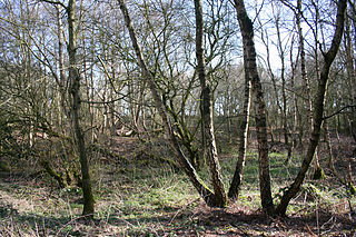
A wet woodland is a type of plant community. It is a biodiversity habitat in the United Kingdom as part of the British National Vegetation Classification system.

A pond is a small, still, land-based body of water formed by pooling inside a depression, either naturally or artificially. A pond is smaller than a lake and there are no official criteria distinguishing the two, although defining a pond to be less than 5 hectares in area, less than 5 metres (16 ft) in depth and with less than 30% with emergent vegetation helps in distinguishing the ecology of ponds from those of lakes and wetlands. Ponds can be created by a wide variety of natural processes, or they can simply be isolated depressions filled by runoff, groundwater, or precipitation, or all three of these. They can be further divided into four zones: vegetation zone, open water, bottom mud and surface film. The size and depth of ponds often varies greatly with the time of year; many ponds are produced by spring flooding from rivers. Ponds are usually freshwater but may be brackish in nature. Saltwater pools, with a direct connection to the sea to maintain full salinity, may sometimes be called 'ponds' but these are normally regarded as part of the marine environment. They do not support fresh or brackish water-based organisms, and are rather tidal pools or lagoons.

Freshwater biology is the scientific biological study of freshwater ecosystems and is a branch of limnology. This field seeks to understand the relationships between living organisms in their physical environment. These physical environments may include rivers, lakes, streams, ponds, lakes, reservoirs, or wetlands. Knowledge from this discipline is also widely used in industrial processes to make use of biological processes involved with sewage treatment and water purification. Water presence and flow is an essential aspect to species distribution and influences when and where species interact in freshwater environments.

Wetland conservation is aimed at protecting and preserving areas of land including marshes, swamps, bogs, and fens that are covered by water seasonally or permanently due to a variety of threats from both natural and anthropogenic hazards. Some examples of these hazards include habitat loss, pollution, and invasive species. Wetland vary widely in their salinity levels, climate zones, and surrounding geography and play a crucial role in maintaining biodiversity, ecosystem services, and support human communities. Wetlands cover at least six percent of the Earth and have become a focal issue for conservation due to the ecosystem services they provide. More than three billion people, around half the world's population, obtain their basic water needs from inland freshwater wetlands. They provide essential habitats for fish and various wildlife species, playing a vital role in purifying polluted waters and mitigating the damaging effects of floods and storms. Furthermore, they offer a diverse range of recreational activities, including fishing, hunting, photography, and wildlife observation.
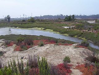
Los Cerritos Wetlands is located in both Los Angeles County and Orange County in the cities of Long Beach, California, and Seal Beach, California. The San Gabriel River, historically and currently flows through the Los Cerritos Wetlands Complex.
Sound Heath, also known as Sound Common, is an area of common land in Sound, near Nantwich in Cheshire, England, which includes heathland, grassland, scrub, woodland and wetland habitats. The majority of the area is designated a Site of Special Scientific Interest and a Local Nature Reserve.
Phytotechnology implements solutions to scientific and engineering problems in the form of plants. It is distinct from ecotechnology and biotechnology as these fields encompass the use and study of ecosystems and living beings, respectively. Current study of this field has mostly been directed into contaminate removal (phytoremediation), storage (phytosequestration) and accumulation. Plant-based technologies have become alternatives to traditional cleanup procedures because of their low capital costs, high success rates, low maintenance requirements, end-use value, and aesthetic nature.
The Point Cook Coastal Park covers an area of 863 hectares and includes the Cheetham Wetlands. The park extends from the RAAF Williams Point Cook Base northeast along the coast to the Laverton creek which comprises its northern boundary. The park is approximately 20 kilometres (12 mi) from Melbourne, Australia in a southwesterly direction along Port Phillip Bay. The park is adjoined by the Point Cook Marine Sanctuary, which extends around the point to the south and the east. The northwestern boundary to the park is residential housing.

Callitriche brutia, the pedunculate water-starwort, is a dwarf amphibious annual or perennial dicotyledon herb in the genus Callitriche. The common name of this species is water starwort. It colonizes aquatic environments, such as wetlands, lakes, rivers, streams, and pools, and it grows in oligotrophic conditions, meaning it grows in an environment that has little to sustain life. Pedunculate water-starwort was found in Ireland and England, but is now an invasive species due to its resistance to environmental stressors, and its ability to grow in still water.
Bioremediation of petroleum contaminated environments is a process in which the biological pathways within microorganisms or plants are used to degrade or sequester toxic hydrocarbons, heavy metals, and other volatile organic compounds found within fossil fuels. Oil spills happen frequently at varying degrees along with all aspects of the petroleum supply chain, presenting a complex array of issues for both environmental and public health. While traditional cleanup methods such as chemical or manual containment and removal often result in rapid results, bioremediation is less labor-intensive, expensive, and averts chemical or mechanical damage. The efficiency and effectiveness of bioremediation efforts are based on maintaining ideal conditions, such as pH, RED-OX potential, temperature, moisture, oxygen abundance, nutrient availability, soil composition, and pollutant structure, for the desired organism or biological pathway to facilitate reactions. Three main types of bioremediation used for petroleum spills include microbial remediation, phytoremediation, and mycoremediation. Bioremediation has been implemented in various notable oil spills including the 1989 Exxon Valdez incident where the application of fertilizer on affected shoreline increased rates of biodegradation.

