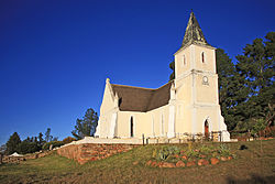
Haarlem is a city and municipality in the Netherlands. It is the capital of the province of North Holland. Haarlem is situated at the northern edge of the Randstad, one of the most populated metropolitan areas in Europe; it is also part of the Amsterdam metropolitan area, being located about 15 km to the west of the core city of Amsterdam. Haarlem had a population of 161,265 in 2019.

Hillegom is a town and municipality in the western Netherlands, in the province of South Holland. Hillegom is part of an area called the Duin- en Bollenstreek. As such, a large portion of the local economy was traditionally geared to the cultivation of bulb flowers.
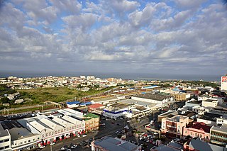
East London is a city on the southeast coast of South Africa in the Buffalo City Metropolitan Municipality of the Eastern Cape province. The city lies on the Indian Ocean coast, largely between the Buffalo River and the Nahoon River, and hosts the country's only river port. As of 2011, East London had a population of over 267,000 with over 755,000 in the metropolitan area.

George Municipality is a municipality located in the Western Cape Province of South Africa. As of 2011 the population is 193,672. Its municipality code is WC044.

Derby is a small town situated in North West Province of South Africa that was named after the British Secretary of State Lord Derby. Derby began as a refuge for destitute people.
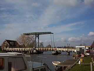
Vijfhuizen is a village in the Dutch province of North Holland. It is a part of the municipality of Haarlemmermeer, and lies about 4 km southeast of Haarlem. In January 2011, the town of Vijfhuizen had 4387 inhabitants. The built-up area of the town was 0.48 km2, and contained 728 residences. The wider statistical area of Vijfhuizen has a population of around 2800.
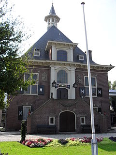
Halfweg is a village in the Dutch province of North Holland. Previously a part of the municipality of Haarlemmerliede en Spaarnwoude, it is currently a part of the municipality of Haarlemmermeer and lies about 8 km (5.0 mi) east of Haarlem. Its name, which translates as "halfway," comes from its location approximately halfway between Haarlem and Amsterdam.
Halfweg is the name of several villages in the Netherlands and a place in South Africa:

The R62 is a provincial route in South Africa that connects Ashton with Humansdorp. The R62 runs through the Little Karoo and the Langkloof, passing through Montagu, Ladismith, Calitzdorp, Oudtshoorn, and Joubertina.

Prieska is a town on the south bank of the Orange River, in the province of the Northern Cape, in western South Africa. It is located on the southern bank of the Orange River, 130 km north-west of Britstown and 75 km south-east of Marydale.

Chintsa is a village in the Wild Coast region of the Eastern Cape province, South Africa. It is situated 38 km north-east from East London and 10 km north from Gonubie, at the mouth of the Chintsa River.
Petrusville is a village in the eastern Karoo region of South Africa, located in the Northern Cape province.
Umbogintwini is a suburb located approximately 23 km south-west of Durban, in KwaZulu-Natal, South Africa.
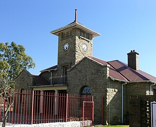
Elliot, officially known as Khowa, is a town in Chris Hani District Municipality in the Eastern Cape province of South Africa, and lies 80 km south-west of Maclear and 65 km south-east of Barkly East on the R56 road.
Trichardt is a town on the N17 National Route in Gert Sibande District Municipality in the Mpumalanga province of South Africa. The village is 34 km west of Bethal and 32 km east-south-east of Leandra, adjacent to Secunda.

Mamre is a small rural town in the Western Cape province of South Africa. It is situated on the northernmost border of the City of Cape Town Metropolitan Municipality. It is situated approximately 55 kilometres (30 mi) north of central Cape Town, and 5–6 km to the neighbouring industrial town of Atlantis.
Ntabankulu, formerly Tabankulu, is a town in Alfred Nzo District Municipality in the Eastern Cape province of South Africa.
Anerley is a coastal village in the South Coast of KwaZulu-Natal, South Africa.
Leslie is a town in Gert Sibande District Municipality in the Mpumalanga province of South Africa. It is part of Leandra. The village is 63 km west of Bethal, Mpumalanga and 56 km east-south-east of Springs, Gauteng. Administered by a village council, it was laid out on the farm Brakkefontein and proclaimed in December 1939, an extension being proclaimed in December 1957. The village is thought to be named after Leslie in Fife, Scotland.
Vanwyksdorp is a town in Kannaland Local Municipality in the Western Cape province of South Africa. Village on the Groot River, some 55 km south-east of Ladismith and 66 km north-east of Riversdale.
