Hancock | |
---|---|
Motto(s): "Community you know, place to grow" [1] | |
Coordinates: 45°29′52″N95°47′42″W / 45.49778°N 95.79500°W | |
Country | United States |
State | Minnesota |
County | Stevens |
Area | |
• Total | 0.90 sq mi (2.34 km2) |
• Land | 0.90 sq mi (2.34 km2) |
• Water | 0.00 sq mi (0.00 km2) |
Elevation | 1,158 ft (353 m) |
Population (2020) | |
• Total | 863 |
• Density | 955.70/sq mi (369.14/km2) |
Time zone | UTC-6 (CST) |
• Summer (DST) | UTC-5 (CDT) |
ZIP code | 56244 |
Area code | 320 |
FIPS code | 27-26936 [4] |
GNIS feature ID | 2394283 [3] |
Website | hancockmn.org |
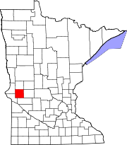
Hancock is a city in Stevens County, Minnesota, United States. The population was 863 at the 2020 census. [5]
Hancock was laid out in 1871 when the Great Northern Railway was extended to that point. [6] The city was named for Joseph Woods Hancock, a county official. [6] A post office has been in operation at Hancock since 1871. [7]
Hancock is a city in Stevens County, Minnesota. Minnesota Highway 9 serves as a main route in the community. According to the United States Census Bureau, the city has a total area of 1.0 square miles (2.6 km2), of which 1.00% is water. The elevation is 1,155 ft (352 m) above sea level. [8]
Census | Pop. | Note | %± |
---|---|---|---|
1880 | 91 | — | |
1890 | 218 | 139.6% | |
1900 | 415 | 90.4% | |
1910 | 524 | 26.3% | |
1920 | 763 | 45.6% | |
1930 | 798 | 4.6% | |
1940 | 827 | 3.6% | |
1950 | 852 | 3.0% | |
1960 | 942 | 10.6% | |
1970 | 806 | −14.4% | |
1980 | 877 | 8.8% | |
1990 | 723 | −17.6% | |
2000 | 717 | −0.8% | |
2010 | 765 | 6.7% | |
2020 | 863 | 12.8% | |
U.S. Decennial Census [9] 2020 Census [5] |
As of the census [10] of 2010, there were 765 people, 302 households, and 197 families residing in the city. The population density was 772.7 inhabitants per square mile (298.3/km2). There were 334 housing units at an average density of 337.4 per square mile (130.3/km2). The racial makeup of the city was 97.8% White, 0.5% Native American, 0.1% Asian, 1.2% from other races, and 0.4% from two or more races. Hispanic or Latino of any race were 3.7% of the population.
There were 302 households, of which 32.1% had children under the age of 18 living with them, 54.6% were married couples living together, 6.3% had a female householder with no husband present, 4.3% had a male householder with no wife present, and 34.8% were non-families. 29.1% of all households were made up of individuals, and 13.2% had someone living alone who was 65 years of age or older. The average household size was 2.51 and the average family size was 3.09.
The median age in the city was 34.4 years. 27.5% of residents were under the age of 18; 9.2% were between the ages of 18 and 24; 25.7% were from 25 to 44; 24.7% were from 45 to 64; and 12.8% were 65 years of age or older. The gender makeup of the city was 52.3% male and 47.7% female.
As of the census of 2000, there were 717 people, 294 households, and 186 families residing in the city. The population density was 724.5 inhabitants per square mile (279.7/km2). There were 325 housing units at an average density of 328.4 per square mile (126.8/km2). The racial makeup of the city was 98.19% White, 0.14% African American (one African American resident), 0.14% Native American (one Native American), 0.28% Asian (two Asians), and 1.26% from two or more races. Hispanic or Latino of any race were 0.28% of the population.
There were 294 households, out of which 30.6% had children under the age of 18 living with them, 54.1% were married couples living together, 7.5% had a female householder with no husband present, and 36.4% were non-families. Some 32.7% of all households were made up of individuals, and 17.0% had someone living alone who was 65 years of age or older. The average household size was 2.34 and the average family size was 3.01.
In the city, the population was spread out, with 24.7% under the age of 18, 8.8% from 18 to 24, 24.3% from 25 to 44, 23.2% from 45 to 64, and 19.1% who were 65 years of age or older. The median age was 40 years. For every 100 females, there were 106.0 males. For every 100 females age 18 and over, there were 102.2 males.
The median income for a household in the city was $34,583, and the median income for a family was $40,938. Males had a median income of $30,446 versus $20,114 for females. The per capita income for the city was $17,012. About 2.7% of families and 8.0% of the population were below the poverty line, including none of those under age 18 and 7.5% of those age 65 or over.
Hancock holds an annual community celebration every July 4. The celebration has been held since the 1870s and includes baseball, parades, dances and fireworks. [11]
Hancock Public Schools are part of the Hancock Public School District. Schools in the district include Hancock Elementary School and Hancock High School. [12] [13] The average class size is around 12 to 25 students and has been growing in recent years. The building that houses the K-12 school was expanded in 2012 and in 2020. [14]
Minnesota State Highway 9 serves as a main route in the community.
Wilkinson is a town in Brown Township, Hancock County, Indiana, United States. The population was 449 at the 2010 census.
Hancock is a city in Pottawattamie County, Iowa, United States, along the West Nishnabotna River. The population was 200 at the time of the 2020 census.
Foley is a city and the county seat of Benton County, Minnesota, United States. The population was 2,711 at the 2020 census.
Ironton is a city in Crow Wing County, Minnesota, United States. The population was 572 at the 2010 census. It is part of the Brainerd Micropolitan Statistical Area.
Myrtle is a city in Freeborn County, Minnesota, United States. The population was 48 at the 2010 census.
Deer River is a city in Itasca County, Minnesota, United States. The population was 909 at the 2020 census.
Oslo is a city in Marshall County, Minnesota, United States. The population was 239 at the 2020 census.
Granada is a city in Martin County, Minnesota, United States. The population was 291 at the 2020 census.
Lastrup is a city in Morrison County, Minnesota, United States. The population was 120 at the 2020 census.
Clitherall is a city in Otter Tail County, Minnesota, United States. The population was 62 at the 2020 census.
Elizabeth is a city in Otter Tail County, Minnesota, United States. The population was 168 at the 2020 census.
Richville is a city in Otter Tail County, Minnesota, United States. The population was 77 as of the 2020 census.
Wabasso is a city in Redwood County, Minnesota, United States. The population was 739 at the 2020 census.
Clear Lake is a city in Sherburne County, Minnesota, United States. The population was 641 at the 2020 census.
Lake Henry is a city in Stearns County, Minnesota, United States. The population was 103 at the 2010 census. It is part of the St. Cloud Metropolitan Statistical Area.
Hewitt is a city in Todd County, Minnesota, United States, along the Wing River. The population was 266 at the 2010 census. It was 251 by the time of the 2020 Decennial Census.
Dellwood is a city in Washington County, Minnesota, United States and a suburb of St. Paul. The population was 1,063 at the 2010 census.
Centerville is a city in Anoka County, Minnesota, United States. The population was 3,896 at the 2020 census.
Dennison is a city in Goodhue and Rice counties in the U.S. state of Minnesota. The population was 212 at the 2010 census. Most of Dennison is in Goodhue County, with only a small part that extends into Rice County.
Eden Valley is a city in Meeker and Stearns counties in the U.S. state of Minnesota. The population was 1,027 at the 2020 census. Most of Eden Valley is in Meeker County; the Stearns County portion is part of the St. Cloud Metropolitan Statistical Area.