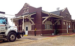
Harper, Kansas

Last updated

Harper, Kansas
Harper Train Station.jpg
Harper Train Depot (2015)
Harper County Kansas Incorporated and Unincorporated areas Harper Highlighted.svg
Location within Harper County and Kansas
Map of Harper Co, Ks, USA.png
Coordinates: 37°17′06″N98°01′39″W / 37.28500°N 98.02750°W / 37.28500; -98.02750 [1]
Country United States
State Kansas
County Harper
Founded1877
Incorporated 1880
Named for Sergeant Marion Harper
Government
   Mayor Eric Latta [2]
Area
[3]
  Total1.62 sq mi (4.20 km2)
  Land1.62 sq mi (4.20 km2)
  Water0.00 sq mi (0.00 km2)
Elevation
[1]
1,417 ft (432 m)
Population
 (2020) [4]
  Total1,313
  Density810/sq mi (310/km2)
Time zone UTC-6 (CST)
  Summer (DST) UTC-5 (CDT)
ZIP code
67058
Area code 620
FIPS code 20-30175
GNIS ID 485587 [1]
Website cityofharper.com

Harper is a city in Harper County, Kansas, United States. [1] As of the 2020 census, the population of the city was 1,313. [4]

Contents

History

Harper was founded in 1877 by a colony from Iowa. [5] The city of Harper, like Harper County, is named for Sergeant Marion Harper of the 2nd Kansas Cavalry, who fell in the (American) Civil War. [6] Harper was incorporated as a city in 1880. [7]

The first post office in Harper was established in May 1877 as Cora City, but in June of that year, the post office was renamed Harper. [8]

Geography

According to the United States Census Bureau, the city has a total area of 1.63 square miles (4.22 km2), all of it land. [9]

Demographics

Historical population
CensusPop.Note
1890 1,579
1900 1,151−27.1%
1910 1,63842.3%
1920 1,7708.1%
1930 1,485−16.1%
1940 1,69514.1%
1950 1,672−1.4%
1960 1,89913.6%
1970 1,665−12.3%
1980 1,8239.5%
1990 1,735−4.8%
2000 1,567−9.7%
2010 1,473−6.0%
2020 1,313−10.9%
U.S. Decennial Census

2020 census

The 2020 United States census counted 1,313 people, 584 households, and 348 families in Harper. [10] [11] The population density was 809.0 per square mile (312.4/km2). There were 741 housing units at an average density of 456.6 per square mile (176.3/km2). [11] [12] The racial makeup was 76.77% (1,008) white or European American (73.95% non-Hispanic white), 0.23% (3) black or African-American, 2.36% (31) Native American or Alaska Native, 0.23% (3) Asian, 0.08% (1) Pacific Islander or Native Hawaiian, 12.8% (168) from other races, and 7.54% (99) from two or more races. [13] Hispanic or Latino of any race was 19.95% (262) of the population. [14]

Of the 584 households, 30.0% had children under the age of 18; 41.4% were married couples living together; 27.6% had a female householder with no spouse or partner present. 35.6% of households consisted of individuals and 18.2% had someone living alone who was 65 years of age or older. [11] The average household size was 2.1 and the average family size was 2.8. [15] The percent of those with a bachelor’s degree or higher was estimated to be 7.1% of the population. [16]

25.6% of the population was under the age of 18, 6.3% from 18 to 24, 23.7% from 25 to 44, 22.7% from 45 to 64, and 21.7% who were 65 years of age or older. The median age was 39.6 years. For every 100 females, there were 98.0 males. [11] For every 100 females ages 18 and older, there were 96.6 males. [11]

The 2016-2020 5-year American Community Survey estimates show that the median household income was $51,750 (with a margin of error of +/- $2,828) and the median family income was $75,917 (+/- $18,670). [17] Males had a median income of $39,564 (+/- $6,208) versus $21,458 (+/- $1,773) for females. The median income for those above 16 years old was $33,750 (+/- $7,955). [18] Approximately, 4.4% of families and 11.4% of the population were below the poverty line, including 11.7% of those under the age of 18 and 12.0% of those ages 65 or over. [19] [20]

2010 census

As of the census [21] of 2010, there were 1,473 people, 624 households, and 385 families living in the city. The population density was 903.7 inhabitants per square mile (348.9/km2). There were 742 housing units at an average density of 455.2 per square mile (175.8/km2). The racial makeup of the city was 92.2% White, 0.2% African American, 1.3% Native American, 0.1% Asian, 0.5% Pacific Islander, 4.8% from other races, and 1.0% from two or more races. Hispanic or Latino of any race were 10.0% of the population.

There were 624 households, of which 30.9% had children under the age of 18 living with them, 47.0% were married couples living together, 8.7% had a female householder with no husband present, 6.1% had a male householder with no wife present, and 38.3% were non-families. 34.5% of all households were made up of individuals, and 15.4% had someone living alone who was 65 years of age or older. The average household size was 2.33 and the average family size was 2.95.

The median age in the city was 40.3 years. 25.1% of residents were under the age of 18; 8% were between the ages of 18 and 24; 22.8% were from 25 to 44; 25.1% were from 45 to 64; and 19.1% were 65 years of age or older. The gender makeup of the city was 50.2% male and 49.8% female.

2000 census

As of the census [22] of 2000, there were 1,567 people, 675 households, and 417 families living in the city. The population density was 1,219.0 inhabitants per square mile (470.7/km2). There were 787 housing units at an average density of 612.2 per square mile (236.4/km2). The racial makeup of the city was 97.57% White, 0.13% African American, 0.64% Native American, 0.57% from other races, and 1.08% from two or more races. Hispanic or Latino of any race were 1.21% of the population.

There were 675 households, out of which 28.0% had children under the age of 18 living with them, 51.3% were married couples living together, 8.7% had a female householder with no husband present, and 38.2% were non-families. 35.3% of all households were made up of individuals, and 18.1% had someone living alone who was 65 years of age or older. The average household size was 2.29 and the average family size was 2.98.

In the city, the population was spread out, with 26.0% under the age of 18, 6.4% from 18 to 24, 22.0% from 25 to 44, 23.9% from 45 to 64, and 21.7% who were 65 years of age or older. The median age was 42 years. For every 100 females, there were 93.5 males. For every 100 females age 18 and over, there were 93.2 males.

The median income for a household in the city was $30,272, and the median income for a family was $40,761. Males had a median income of $29,583 versus $19,779 for females. The per capita income for the city was $16,543. About 6.9% of families and 9.5% of the population were below the poverty line, including 11.0% of those under age 18 and 6.4% of those age 65 or over.

Education

The community is served by Chaparral USD 361 public school district. [23] USD 361 was created through school unification that consolidated Anthony and Harper schools.

Both Anthony and Harper have elementary schools. The district high school, Chaparral High School, is located halfway between the two towns. The Chaparral High School mascot is Roadrunners. [24]

Harper High School was closed through school unification. The Harper High School mascot was Bearcats. [25]

Related Research Articles

<span class="mw-page-title-main">Niotaze, Kansas</span> City in Chautauqua County, Kansas

Niotaze is a city in Chautauqua County, Kansas, United States. As of the 2020 census, the population of the city was 90.

<span class="mw-page-title-main">Bird City, Kansas</span> City in Cheyenne County, Kansas

Bird City is a city in Cheyenne County, Kansas, United States. As of the 2020 census, the population of the city was 437.

<span class="mw-page-title-main">Gridley, Kansas</span> City in Coffey County, Kansas

Gridley is a city in Coffey County, Kansas, United States. As of the 2020 census, the population of the city was 313.

<span class="mw-page-title-main">Coldwater, Kansas</span> City in Comanche County, Kansas

Coldwater is a city and county seat of Comanche County, Kansas, United States. As of the 2020 census, the population of the city was 687.

<span class="mw-page-title-main">Kinsley, Kansas</span> City in Edwards County, Kansas

Kinsley is a city in and the county seat of Edwards County, Kansas, United States. As of the 2020 census, the population of the city was 1,456. It is located along Highway 50.

<span class="mw-page-title-main">Howard, Kansas</span> City in Elk County, Kansas

Howard is a city in and the county seat of Elk County, Kansas, United States. As of the 2020 census, the population of the city was 570.

<span class="mw-page-title-main">Grandview Plaza, Kansas</span> City in Geary County, Kansas

Grandview Plaza is a city in Geary County, Kansas, United States. As of the 2020 census, the population of the city was 1,697.

<span class="mw-page-title-main">Gove City, Kansas</span> City in Gove County, Kansas

Gove City, more commonly known as Gove, is a city in and the county seat of Gove County, Kansas, United States. As of the 2020 census, the population of the city was 80.

<span class="mw-page-title-main">Ingalls, Kansas</span> City in Gray County, Kansas

Ingalls is a city in Gray County, Kansas, United States. As of the 2020 census, the population of the city was 252. It is located along Highway 50.

<span class="mw-page-title-main">Danville, Kansas</span> City in Harper County, Kansas

Danville is a city in Harper County, Kansas, United States. As of the 2020 census, the population of the city was 29.

<span class="mw-page-title-main">Mankato, Kansas</span> City in Jewell County, Kansas

Mankato is a city in and the county seat of Jewell County, Kansas, United States. As of the 2020 census, the population of the city was 836.

<span class="mw-page-title-main">Meade, Kansas</span> City in Meade County, Kansas

Meade is a city in and the county seat of Meade County, Kansas, United States. As of the 2020 census, the population of the city was 1,505.

<span class="mw-page-title-main">Ness City, Kansas</span> City in Ness County, Kansas

Ness City is a city in and the county seat of Ness County, Kansas, United States. As of the 2020 census, the population of the city was 1,329. Ness City is famous for its four-story Old Ness County Bank Building located downtown, and nicknamed Skyscraper of the Plains.

<span class="mw-page-title-main">Lyndon, Kansas</span> City in Osage County, Kansas

Lyndon is a city in, and the county seat of Osage County, Kansas, United States. As of the 2020 census, the population of the city was 1,037.

<span class="mw-page-title-main">Republic, Kansas</span> City in Republic County, Kansas, United States

Republic is a city in Republic County, Kansas, United States. As of the 2020 census, the population of the city was 82.

<span class="mw-page-title-main">Bison, Kansas</span> City in Rush County, Kansas

Bison is a city in Rush County, Kansas, United States. As of the 2020 census, the population of the city was 179.

<span class="mw-page-title-main">St. John, Kansas</span> City in Stafford County, Kansas

St. John is a city in and the county seat of Stafford County, Kansas, United States. As of the 2020 census, the population of the city was 1,228.

<span class="mw-page-title-main">Brewster, Kansas</span> City in Thomas County, Kansas

Brewster is a city in Thomas County, Kansas, United States. As of the 2020 census, the population of the city was 291.

<span class="mw-page-title-main">Barnes, Kansas</span> City in Washington County, Kansas

Barnes is a city in Washington County, Kansas, United States. As of the 2020 census, the population of the city was 165.

<span class="mw-page-title-main">Palmer, Kansas</span> City in Washington County, Kansas

Palmer is a city in Washington County, Kansas, United States. As of the 2020 census, the population of the city was 125.

References

  1. 1 2 3 4 U.S. Geological Survey Geographic Names Information System: Harper, Kansas
  2. Governing Body; City of Harper.
  3. "2019 U.S. Gazetteer Files". United States Census Bureau. Retrieved July 24, 2020.
  4. 1 2 "Profile of Harper, Kansas in 2020". United States Census Bureau. Archived from the original on March 24, 2022. Retrieved March 24, 2022.
  5. Blackmar, Frank Wilson (1912). Kansas: A Cyclopedia of State History, Embracing Events, Institutions, Industries, Counties, Cities, Towns, Prominent Persons, Etc. Standard Publishing Company. pp.  809.
  6. "Profile for Harper, Kansas". ePodunk . Retrieved June 11, 2014.
  7. History of the State of Kansas: Containing a Full Account of Its Growth from an Uninhabited Territory to a Wealthy and Important State. A. T. Andreas. 1883. p. 366.
  8. "Kansas Post Offices, 1828-1961 (archived)". Kansas Historical Society. Archived from the original on October 9, 2013. Retrieved June 11, 2014.
  9. "US Gazetteer files 2010". United States Census Bureau . Retrieved July 6, 2012.
  10. "US Census Bureau, Table P16: HOUSEHOLD TYPE". data.census.gov. Retrieved January 3, 2024.
  11. 1 2 3 4 5 "US Census Bureau, Table DP1: PROFILE OF GENERAL POPULATION AND HOUSING CHARACTERISTICS". data.census.gov. Retrieved January 3, 2024.
  12. Bureau, US Census. "Gazetteer Files". Census.gov. Retrieved December 30, 2023.
  13. "US Census Bureau, Table P1: RACE". data.census.gov. Retrieved January 3, 2024.
  14. "US Census Bureau, Table P2: HISPANIC OR LATINO, AND NOT HISPANIC OR LATINO BY RACE". data.census.gov. Retrieved January 3, 2024.
  15. "US Census Bureau, Table S1101: HOUSEHOLDS AND FAMILIES". data.census.gov. Retrieved January 3, 2024.
  16. "US Census Bureau, Table S1501: EDUCATIONAL ATTAINMENT". data.census.gov. Retrieved January 3, 2024.
  17. "US Census Bureau, Table S1903: MEDIAN INCOME IN THE PAST 12 MONTHS (IN 2020 INFLATION-ADJUSTED DOLLARS)". data.census.gov. Retrieved January 3, 2024.
  18. "US Census Bureau, Table S2001: EARNINGS IN THE PAST 12 MONTHS (IN 2020 INFLATION-ADJUSTED DOLLARS)". data.census.gov. Retrieved January 3, 2024.
  19. "US Census Bureau, Table S1701: POVERTY STATUS IN THE PAST 12 MONTHS". data.census.gov. Retrieved January 3, 2024.
  20. "US Census Bureau, Table S1702: POVERTY STATUS IN THE PAST 12 MONTHS OF FAMILIES". data.census.gov. Retrieved January 3, 2024.
  21. "U.S. Census website". United States Census Bureau . Retrieved July 6, 2012.
  22. "U.S. Census website". United States Census Bureau . Retrieved January 31, 2008.
  23. "Anthony-Harper". USD 361. Retrieved January 7, 2017.
  24. "Anthony-Harper". USD 361. Retrieved January 4, 2017.
  25. "Bucklin and Harper Are Both Victorious", Great Bend Tribune, 3 March 1965, p.13.

Further reading