Northwest College is a public two-year residential college located in Powell, Wyoming, 70 miles from Yellowstone National Park.

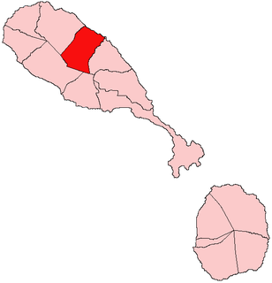
Christ Church Nichola Town is one of 14 administrative parishes that make up Saint Kitts and Nevis. The fifth largest parish on Saint Kitts, it is located on the east coast of the main island of Saint Kitts. The parish capital is Nichola Town and its largest town is Molyneux.

Windhill and Wrose is a ward within the City of Bradford Metropolitan District Council in the county of West Yorkshire, England, named after the districts of Windhill and Wrose around which it is drawn.

Monreal del Llano is a municipality in located in the province of Cuenca, Castile-La Mancha, Spain. It has a population of 74 (2014).

Morales is a town and municipality in the Cauca Department, Colombia.
The Elk Valley Rancheria are:...
The Holiday Pacific and Southern Tower was a 468.7 meters tall guyed mast for FM- and TV-broadcasting located in Holiday, Florida, United States at 28°11'5"N 82°45'37"W. It was built in 1979.

Cedar Point is an unincorporated community in Union Township, White County, in the U.S. state of Indiana.

Pacific is a small unincorporated community in El Dorado County, California. It is located 3.25 miles (5 km) east of Pollock Pines, at an elevation of 3396 feet. It lies along U.S. Highway 50 and is next to the town of Pacific House, California. The ZIP code is 95726. The community is inside area code 530.

Fresh Pond is a small unincorporated community in El Dorado County, California. It is located 3 miles (4.8 km) east of Pollock Pines, at an elevation of 3606 feet. The ZIP code is 95726. The community is inside area code 530. It is nestled along Highway 50 and offers a convenient gas station by the road.

Bono is an unincorporated community in Helt Township, Vermillion County, in the U.S. state of Indiana.
Sidi Hassine is a town and commune in the Tunis Governorate, Tunisia. As of 2004 it had a population of 79,331.
Macedonia is an unincorporated community in Cherokee County, South Carolina, United States. Its elevation is 879 feet (268 m), and it is located at 35°4′14″N81°45′37″W.
Sirgenstein Castle is a ruined castle on rock, over twenty metres high, with a cave inhabited in the Stone Age, the Sirgenstein, between the town of Blaubeuren and hamlet of Schelklingen in Alb-Donau-Kreis in Baden-Württemberg.

Mariebjerg Cemetery is located in Gentofte north of Copenhagen, Denmark. It was laid out between 1926 and 1933 to the design of the landscape architect Gudmund Nyeland Brandt and is considered an important example of European Modernist landscape architecture. Its design has inspired many other cemeteries both in Denmark and abroad.
Wesson is an unincorporated community located in Brunswick County, in the U.S. state of Virginia.
Radley is an unincorporated community in Crawford County, Kansas, in the United States.
South Radley is an unincorporated community in Crawford County, Kansas, in the United States.
Gayville is an unincorporated community in Lawrence County, in the U.S. state of South Dakota.
Kinzer is an unincorporated community in Butler County, in the U.S. state of Missouri.


