
Nicholson is a borough in Wyoming County, Pennsylvania, United States. The population was 767 at the 2010 census.

Buckhorn is a community in Pulaski County, Missouri, United States. It is on Route 17 just south of its junction with Interstate 44 It is also on historic U.S. Route 66. The community is within the Mark Twain National Forest and the northwest corner of Fort Leonard Wood is three miles to the east. Waynesville is six miles to the northeast along Route 44 and Laquey is two miles to the southwest off of Route 17.

The University of California, San Francisco Medical Center is a research and teaching hospital in San Francisco, California and is the medical center of the University of California, San Francisco. It is one of the leading hospitals in the United States and with the UCSF School of Medicine has been the site of various breakthroughs in all specialties of medicine. In 2017, it was ranked as the 5th-best overall medical center in the United States and the #1 hospital in California by U.S. News & World Report.
Zion is an unincorporated community in Central Township in southern Madison County, Missouri, United States. It is located on U.S. Route 67 about ten miles south of Fredericktown. The community is on the banks of Twelve Mile Creek.
Bruce Hurst Field is a stadium in St. George, Utah. It is primarily used for baseball, hosting the Dixie State University baseball team. It was formerly the home field of the St. George Roadrunners of the Golden league. It holds 2,500 people and was opened in 1994. As of 2013, Bruce Hurst Field also serves as the home field for at least one BYU Cougars home series, usually during the month of February or March. It is named after Bruce Hurst, a former major league baseball player who was born in St. George.
Pajarón is a municipality in located in the province of Cuenca, Castile-La Mancha, Spain. It has a population of 90 (2014).

Junggok Station is a station on the Seoul Subway Line 7. It is the closest station to Daewon Foreign Language High School.

Vernon Township is a township in Cowley County, Kansas, USA. As of the 2000 census, its population was 502.
Locust Mount is an unincorporated community in Accomack County, Virginia.
Mount Nebo is an unincorporated community in Accomack County, Virginia.

Szewele is a village in the administrative district of Gmina Bielsk Podlaski, within Bielsk County, Podlaskie Voivodeship, in north-eastern Poland. It lies approximately 5 kilometres (3 mi) north-east of Bielsk Podlaski and 38 km (24 mi) south of the regional capital Białystok.

Municipal Stadium is a multi-use stadium in Sibiu, Romania. It is currently used mostly for football matches and is the home ground of FC Hermannstadt. The stadium holds 14,200 people.
Mount Zion Demonstration State Forest is located in the town of Pine Grove, Amador County, California, United States. It features a ranger lookout station and microwave tower atop Mount Zion, which is accessed via Mount Zion Road from California State Route 88.

The historical buildings and structures of Zion National Park represent a variety of buildings, interpretive structures, signs and infrastructure associated with the National Park Service's operations in Zion National Park, Utah. Structures vary in size and scale from the Zion Lodge to road culverts and curbs, nearly all of which were designed using native materials and regional construction techniques in an adapted version of the National Park Service Rustic style. A number of the larger structures were designed by Gilbert Stanley Underwood, while many of the smaller structures were designed or coordinated with the National Park Service Branch of Plans and Designs. The bulk of the historic structures date to the 1920s and 1930s. Most of the structures of the 1930s were built using Civilian Conservation Corps labor.

Stuffley Knob is the tallest mountain in Johnson County, Kentucky, with a summit elevation of 1,496 feet above sea level. The summit is located about eight miles west of Paintsville at 37°46′59″N82°55′13″W, just off of U.S. Route 460.
Fleming is an unincorporated community in Crawford County, Kansas, in the United States.
Whitfield is an unincorporated community in Hickman County, in the U.S. state of Tennessee.
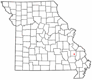
Lyons is an unincorporated community in Laclede County, in the U.S. state of Missouri.
Village Creek is a stream in Madison County in the U.S. state of Missouri. It is a tributary of the Little Saint Francis River.


