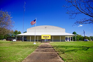
Nebo is a home rule-class city in Hopkins County, Kentucky, in the United States. The population was 236 as of the 2010 census.
Tlalixcoyan is a municipality in Veracruz, Mexico.

Mount Nebo is the southernmost and highest mountain in the Wasatch Range of Utah, in the United States. Named after the biblical Mount Nebo overlooking Israel, which is said to be the place of Moses' death, it is the centerpiece of the Mount Nebo Wilderness, inside the Uinta National Forest.
The Blue Range is a mountain range of the Canadian Rockies, located on the Continental Divide in Banff National Park, Canada. The range was so named on account of its blueish colour when viewed from afar. Mount Byng is the highest point in the range.
Mount Nebo originally referred to a mountain in the present day Western Jordan on which, according to the Bible, the prophet Moses died.

Mount Nebo is a mountain approximately 18 km North West of the Brisbane suburb of The Gap in Queensland, Australia. It is part of the D'Aguilar Range which includes other mountains such as Mount Pleasant, Mount Glorious and Mount Mee. The town of Mount Nebo is named after the mountain on which it is located. The mountain is the source of Enoggera Creek.

The Red Hills, also referred to as Gypsum Hills, is the name of a physiographic region located mostly in Clark, Comanche and Barber counties in southern and central Kansas. This undulating terrain of red-tinted sediments, a product of the underlying geology, does not fit the conventional description of the Great Plains landscape of Kansas.

The Gasconade River is about 280 miles (450 km) long and is located in central and south-central Missouri in the United States.
Mount Nebo is a morainic drift hill in sections 4 and 9 of Stowe Prairie Township in Todd County, Minnesota. This hill was named "for the peak east of the north end of the Dead Sea, from whence Moses viewed the Promised Land." Mount Nebo is located 2 miles north of Hewitt, Minnesota or 8 miles south of Wadena, Minnesota, in the northwest corner of Todd County. Mount Nebo has an elevation of 461 meters or 1,512 feet. Mount Nebo was site to a ski resort in the 1970s and 1980s until it was shut down. Currently Mount Nebo is site of an AT&T tower. The west side of Mount Nebo holds a wind turbine which is owned by a regional electric cooperative.
Santa Cecilia is a municipality and town located in the province of Burgos, Castile and León, Spain. According to the 2004 census (INE), the municipality has a population of 118 inhabitants.

Tri-State Peak is a mountain located in the Cumberland Gap National Historical Park, near the "saddle" of the gap. It gets its name from being on the tripoint of the states of Kentucky, Tennessee, and Virginia.
Locust Mount is an unincorporated community in Accomack County, Virginia.
Mount Zion is an unincorporated community in Accomack County, Virginia.

Lower Forni is an unincorporated community in El Dorado County, California. It is located 3.25 miles (5 km) west-southwest of Upper Forni, at an elevation of 6929 feet.
Sadeq Abad is a city in Galikash County, Golestan Province, Iran. At the 2006 census, its population was 1,617, in 404 families.
Mount Nebo is an unincorporated community in Allegheny County, in the U.S. state of Pennsylvania.

Lista is a ward (barrio) of Madrid belonging to the district of Salamanca.
Joy is an unincorporated community in Dent County, in the U.S. state of Missouri.
Nebo is an unincorporated community in eastern Laclede County, in the Ozarks of southern Missouri. The community lies on Missouri Route 32, approximately five miles northwest of Lynchburg and about fifteen miles southeat of Lebanon. The site is within the Mark Twain National Forest.
French Town is an unincorporated community in Washington County, in the U.S. state of Missouri.


