Isham | |
---|---|
St Peter's Church, Isham 2022 | |
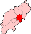
Location within Northamptonshire | |
Population | 771 (2011 census) |
OS grid reference | SP8873 |
Unitary authority | |
Ceremonial county | |
Region | |
Country | England |
Sovereign state | United Kingdom |
Post town | Kettering |
Postcode district | NN14 |
Dialling code | 01536 |
Police | Northamptonshire |
Fire | Northamptonshire |
Ambulance | East Midlands |
UK Parliament | |
Isham is a village and civil parish in Northamptonshire, England. It is on the A509 road, three miles south of Kettering and a mile to the west of Burton Latimer. The River Ise is to the east of the village. Administratively, it forms part of North Northamptonshire. It was previously in the Borough of Wellingborough until 2021. [1] At the time of the 2011 census, the parish's population was 772 people. [2]
The villages name means 'River Ise homestead/village'. [3]
A bypass west of the village is planned by the county council. [4] HMS Isham, a Ham class minesweeper was named after the village in 1954.
Isham has a shop, several churches, [5] the Isham Church of England primary school and a pub ( Lilacs Inn).
Isham Cricket Club, which plays in Division 1 of the Northamptonshire County League, is based on the outskirts of the village between Isham and Orlingbury. [6] Past players have included Stephen Fleming (New Zealand national cricket team captain) and Johann Myburgh (SA Titans). [7] The village is home to a wild bird sanctuary known as Safewings, which cares for injured birds. [8]
Northamptonshire is a county in the East Midlands of England. In 2015, it had a population of 723,000. The county is administered by two unitary authorities: North Northamptonshire and West Northamptonshire. It is known as "The Rose of the Shires".
Wellingborough is a large market and commuter town in the unitary authority area of North Northamptonshire in the ceremonial county of Northamptonshire, England, 65 miles from London and 11 miles (18 km) from Northampton on the north side of the River Nene.
Rushden is a market town and civil parish in North Northamptonshire, England, around 13 miles (21 km) east of Northampton. The parish is on the border with Bedfordshire, 18 miles (29 km) north of Bedford.
Kettering is a market and industrial town in North Northamptonshire, England. It is located 83 miles (134 km) north of London and 15 miles (24 km) north-east of Northampton, west of the River Ise, a tributary of the River Nene. The name means "the place of Ketter's people ".
Burton Latimer is a town in North Northamptonshire, England, approximately 3.1 miles (5.0 km) from Kettering. At the 2011 census, its population was 7,449.
The Borough of Wellingborough was from 1974 to 2021 a non-metropolitan district and borough in Northamptonshire, England. It was named after Wellingborough, its main town, but also included surrounding rural areas.
The River Ise is a river in Northamptonshire, England and a tributary of the River Nene.
Wilby is a suburban linear village and civil parish in the Wellingborough built-up area of North Northamptonshire, England. The suburb is 3 miles south-west of Wellingborough town centre.
Kettering is a constituency in Northamptonshire represented in the House of Commons of the UK Parliament since 2005 by Philip Hollobone, a Conservative.
Bugbrooke is a village and civil parish in Northamptonshire, England, on a ridge overlooking the valley of the River Nene.
Finedon is a town in North Northamptonshire, England, with a population at the 2011 census of 4,309 people. In 1086 when the Domesday Book was completed, Finedon was a large royal manor, previously held by Queen Edith, wife of Edward the Confessor. From the 1860s the parish was much excavated for its iron ore, which lay underneath a layer of limestone and was quarried over the course of 100 years or more. Local furnaces produced pig iron and later the quarries supplied ore for the steel works at Corby. A disused quarry face in the south of the parish is a geological SSSI.
The A509 is a short A-class road for north–south journeys in south central England, forming the route from Kettering in Northamptonshire to the A5 in Milton Keynes, via M1 J14.
Earls Barton is a village and civil parish in Northamptonshire, notable for its Anglo-Saxon church and shoe-making heritage. The village is in North Northamptonshire and was previously in the Borough of Wellingborough until 2021. At the time of the 2011 census, the population was 5,387. Earls Barton is renowned for its remarkable Anglo-Saxon heritage.
Islip is a village and civil parish in North Northamptonshire, England. The village is just west of Thrapston and 7 miles (11 km) east of Kettering. The parish is bounded to the east by the River Nene and to the north by Harpurs Brook, a tributary of the Nene. The 2011 Census recorded the parish's population as 829 people.
Irchester is a village and civil parish in North Northamptonshire, two miles (3 km) south-east of Wellingborough and two miles south-west of Rushden. The population of the village at the 2011 Census was 5,706 and estimated in 2019 at 5,767. Little Irchester and Knuston also lie in the parish.
Collingtree is a village and civil parish in the West Northamptonshire district of Northamptonshire, England. It is part of the Northampton built-up area.
Orlingbury is a village and civil parish in the English county of Northamptonshire. It is between the towns of Kettering and Wellingborough. Administratively it forms part of North Northamptonshire but was in the borough of Wellingborough until 2021. At the time of the 2011 census, the parish's population was 439 people.
Great Harrowden is a village and civil parish in North Northamptonshire, with a population at the 2011 census of 161. The village sits astride the busy A509 running between Kettering and Wellingborough - although a bypass is due to be built shortly. The village forms part of the Orlingbury hundred.
Little Harrowden is a village and civil parish in North Northamptonshire, England. The village is nearly 3 miles (4.8 km) north-west of Wellingborough, off the A509 road. At the 2011 Census, the population of the parish was 892.
North Northamptonshire is one of two local authority areas in Northamptonshire, England. It is a unitary authority area forming about one half of the ceremonial county of Northamptonshire. It was created in 2021. Its notable towns are Kettering, Corby, Wellingborough, Rushden, Raunds, Desborough, Rothwell, Irthlingborough, Thrapston and Oundle. The council is based at the Corby Cube in Corby.
Media related to Isham at Wikimedia Commons