Sywell

Last updated

Sywell
Northamptonshire UK location map (2021).svg
Red pog.svg
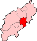
Sywell
Location within Northamptonshire
Population792 (2011 Census)
OS grid reference SP825675
Civil parish
  • Sywell
Unitary authority
Ceremonial county
Region
Country England
Sovereign state United Kingdom
Post town NORTHAMPTON
Postcode district NN6
Dialling code 01604
Police Northamptonshire
Fire Northamptonshire
Ambulance East Midlands
UK Parliament
List of places
UK
England
Northamptonshire
52°17′58″N0°47′21″W / 52.2994°N 0.7893°W / 52.2994; -0.7893
The village sign - Sywell SywellSign.JPG
The village sign - Sywell

Sywell is a village and civil parish in North Northamptonshire, England. At the 2011 Census, the population of the parish was 792. [1]

Contents

The name Sywell is thought to mean "seven wells". [2]

Facilities

The facilities found in the village include:

Other

The Ecton Lane part of the village is built just inside the walls of Overstone Hall; the estate wall is of fine quality and in village folklore is said to be seven feet high, be seven miles long and took seven men seven years to build.

Pevsner on Sywell

The church at Sywell SywellChurch.JPG
The church at Sywell

Church - this has a short tower dating to the 13th century. The pretty stair projection found in the west side of the church is not medieval as it appears. Renovations dating from the 1870s have left the church with an odd feel. There is a stained glass window by Thomas Willement dating from 1839, which is very fine. It uses heraldic glass dating from 1580.

Sywell Hall - the hall has a long straight front with two small and one larger gable ends. The house appears to originally date from Elizabethan times.

Village - many local houses were rebuilt by Lady Overstone in the 1860s - with the (old) school dating to 1861 and the rectory's rebuilding to 1862.

The church's plate dates from 1816 and is the work of Patten.

The airfield hosts an annual concert called "Music in the Air". A combination of classical music and aviation.

Related Research Articles

<span class="mw-page-title-main">Kettering</span> Town in England

Kettering is a market and industrial town in the North Northamptonshire unitary authority area of Northamptonshire, England. It forms a civil parish called Kettering Town. Kettering is located 67 miles (108 km) north of London and 15 miles (24 km) north-east of Northampton, west of the River Ise, a tributary of the River Nene. The name means "the place of Ketter's people ".

Rothwell is a market town in North Northamptonshire, England. It is close to three larger towns, situated 4 miles [6.4km] northwest of Kettering, 7 miles [11km] southeast of Market Harborough and 8 miles [12.8km] southwest of Corby. Rothwell's nearest railway station is at Kettering on the Midland Main Line.

Overstone is a village and civil parish in West Northamptonshire, England. At the time of the 2001 census, the parish's population was 650 people, increasing to 741 at the 2011 Census.

Newnham is a village in West Northamptonshire in England. The village is 2 miles (3.2 km) south of Daventry, 3 miles (4.8 km) west from Weedon Bec, 6 miles (9.7 km) west of junction 16 of the M1 motorway and 11 miles (18 km) west of Northampton. The A45 road runs a mile northwest of the village. The nearest railway station is at Long Buckby, 8 miles (13 km) northeast.

<span class="mw-page-title-main">Moulton, Northamptonshire</span> Human settlement in England

Moulton is a large village in West Northamptonshire. The population of the civil parish at the 2011 Census was 3,454.

Holcot is a village and civil parish in the West Northamptonshire in England. At the time of the 2001 census, the parish's population was 399 people. At the 2011 census this had increased to 438 people, living in 182 households.

Hannington is a village in West Northamptonshire in England. At the time of the 2011 census the parish's population was 251 people.

Sir William Tresham JP was an English lawyer who served as Speaker of the House of Commons until 1450.

<span class="mw-page-title-main">Grendon, Northamptonshire</span> Human settlement in England

Grendon or "Grenrian" as the locals call it, is a small village and civil parish in rural Northamptonshire, England, on the borders of Bedfordshire and Buckinghamshire. Many houses are made of the local limestone and various older thatched houses survive. The name of the village means "green hill" and today the village remains centred on the hill. As with Earls Barton, the village was owned by Judith, the niece of William the Conqueror.

<span class="mw-page-title-main">Stanford-on-Avon</span> Human settlement in England

Stanford-on-Avon is a village in the civil parish of Stanford in West Northamptonshire, England. It lies next to the River Avon, which here forms the county boundary between Northamptonshire and Leicestershire. On the Leicestershire side of the river is Stanford Hall, a historic house. Stanford Reservoir is one mile north of the village. The population is included in the civil parish of Clay Coton.

<span class="mw-page-title-main">Mears Ashby</span> Human settlement in England

Mears Ashby is a village in the county of Northamptonshire, England. It lies between the county town of Northampton and Wellingborough and was in the West ward of borough council of Wellingborough area which also included Sywell prior to local government reform in 2021. At the time of the 2011 census, it had a population of 473.

<span class="mw-page-title-main">Aldenham</span> Human settlement in England

Aldenham is a village and civil parish in the borough of Hertsmere in Hertfordshire, England. The parish includes Radlett and Letchmore Heath as well as Aldenham village itself. The village of Aldenham lies 3.5 miles (5.6 km) north-east of Watford and 2 miles (3.2 km) southwest of Radlett. Aldenham was mentioned in the Domesday Book and is one of Hertsmere's 14 conservation areas. The village has eight pre-19th-century listed buildings and the parish itself is largely unchanged, though buildings have been rebuilt, since Saxon times when the majority of the land was owned by the abbots of Westminster Abbey.

<span class="mw-page-title-main">Ecton, Northamptonshire</span> Human settlement in England

Ecton is a village and civil parish in North Northamptonshire, England. The village is just east of Northampton, just off the A4500 road. It was one of the first villages in Northamptonshire to be given conservation status. The toponym is derived from the Old English words Ecca and tun, meaning "Ecca's farm/settlement."

<span class="mw-page-title-main">Irchester</span> Village in Northamptonshire, England

Irchester is a village and civil parish in North Northamptonshire, two miles (3 km) south-east of Wellingborough and two miles south-west of Rushden. The population of the village at the 2011 Census was 5,706 and estimated in 2019 at 5,767. Little Irchester and Knuston also lie in the parish.

<span class="mw-page-title-main">Gayton, Northamptonshire</span> Human settlement in England

Gayton is a rural village and civil parish in West Northamptonshire, England, 5 miles (8 km) south-west of Northampton town centre. The village is situated on a hill close to the larger villages of Bugbrooke, Milton Malsor and Blisworth, with a linked public footpath network. At the 2011 Census, the population of the parish was 544.

<span class="mw-page-title-main">Wickmere</span> Human settlement in England

Wickmere is a village and a civil parish in the English county of Norfolk, 18.9 miles (30.4 km) north of Norwich, 7.3 miles (11.7 km) south-southwest of Cromer and 132 miles (212 km) northeast of London. The nearest railway station is at Gunton for the Bittern Line which runs between Sheringham, Cromer and Norwich. The nearest airport is Norwich International Airport. In the 2001 census it had a population of 125, which increased to 158 at the 2011 census. For the purposes of local government, the it falls within the district of North Norfolk.

<span class="mw-page-title-main">Rushton, Northamptonshire</span> Human settlement in England

Rushton is a village and civil parish in Northamptonshire. It is about 2 miles (3.2 km) north-east of Rothwell and 3 miles (4.8 km) north-west of Kettering. The parish covers 3,200 acres (1,300 ha) and is situated on both sides of the River Ise. It contains the sites of three deserted settlements, details of which are set out below.

<span class="mw-page-title-main">Rushton Hall</span> Historic site in Rushton, Northamptonshire

Rushton Hall in Rushton, Northamptonshire, England, was the ancestral home of the Tresham family from 1438, when William Tresham, a veteran of the Battle of Agincourt and Chancellor of the Duchy of Lancaster bought the estate. In the 20th century the house became a private school and it has now been converted to a luxury hotel. The estate is about 227 acres (92 ha) of which 30 acres (12 ha) are formal gardens. The River Ise flows from west to east south of the Hall.

<span class="mw-page-title-main">Sywell Aviation Museum</span> Aviation museum in Sywell Aerodrome, Northamptonshire

Sywell Aviation Museum is based at Sywell Aerodrome in Northamptonshire, England. It is sited in the aircraft viewing car park at the aerodrome. It documents the history of flying in Northamptonshire from the early days to the present day with particular emphasis on the Second World War. The museum is run by the Sywell Aviation Museum Trust and is run by volunteers; it is closed during the winter months and reopens each Easter Saturday.

References

  1. Office for National Statistics: Sywell CP: Parish headcounts Retrieved 16 July 2015.
  2. "Key to English Place-names". University of Nottingham . Retrieved 25 April 2021.
Aviation Museum at Sywell AviationMuseum.JPG
Aviation Museum at Sywell