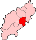
Redhill Grange

Last updated

Redhill Grange
Northamptonshire UK location map (2021).svg
Red pog.svg
Redhill Grange
Location within Northamptonshire
OS grid reference SP8839170147
Unitary authority
Shire county
Region
Country England
Sovereign state United Kingdom
Post town WELLINGBOROUGH
Postcode district NN9
Police Northamptonshire
Fire Northamptonshire
Ambulance East Midlands
UK Parliament
List of places
UK
England
Northamptonshire
52°19′20″N0°42′16″W / 52.322317°N 0.70454657°W / 52.322317; -0.70454657

Redhill Grange or (Redhill) is a purpose-built settlement in Wellingborough, Northamptonshire. It is situated just north from the Redwell area in the market town and eleven miles from the county town Northampton, forming part of the district authority of the borough of Wellingborough, now in North Northamptonshire.

Contents

History

Redhill Grange is a small private housing area of just under 400 homes, located approximately a mile and a half north of the centre of Wellingborough. The site is predominantly surrounded by farmed land, although there are also adjacent areas of woodland and hedgerows. The Great Harrowden Brook runs along the southern edge of the side whilst to the east there is an area of farmland followed by the Finedon Road industrial estate.

Redhill Grange was slowly developed over the period between the late 1960s and the late 1990s by a number of different developers and properties range from two bedroom semi-detached to five bedroom detached houses

However, in 2006 a speculative property development was announced by Bee Bee Developments which planned for the construction of some 4,000 homes, and which included the building of two local centres with office space, retail units, a 50-room hotel and retail units surrounding Redhill Grange.

In November 2006 the residents of Redhill Grange formed the Redhill Grange Community Association to respond to Bee Bee Developments proposals and provide a platform for residents to voice their concerns. [1]

In November 2007 Bee Bee Developments submitted a planning application to the Wellingborough Borough Council ( Application WP2007/7050) for the construction of Upper Redhill, a development of 3,000 homes which would surround Redhill Grange. [2] At 4 February 2009 Extraordinary Meeting of the Borough Council of Wellingborough, councillors voted by 18 votes to 7 votes to refuse the Upper Redhill planning application submitted by North Northants LLP (Bee Bee Developments).

Subsequently the Developers lodged an appeal and in June 2009 a Public Inquiry was held. Following this Inquiry the then Secretary of State for Communities and Local Government granted the Developers outline planning permission in February 2010.

Amenities

A small shopping unit exists in the adjacent Redhill Farm estate with a Co-operative Group supermarket, several takeaway shops, an automotive parts store, bicycle repair store and a children's nursery. The 'ock n Dough was the only public house in the community, owned by Greene King Breweries, until recently when a new ale house opened called Ale Hub opposite.

Transport

Road

Redhill Grange is located on east of the A509 road which links Kettering with Wellingborough, and is to the north of the northern ring road Northern Way and Niort Way (A510 road), accessible from the A45 road.

Bus

Connect Wellingborough W6 buses link the area to the town centre, while route 24 link the area to Kettering. The Stagecoach Midlands X4 bus service can be caught from Harrowden Road, connecting the area to Kettering, Northampton and Peterborough.

Train

East Midlands Railway operate direct trains to London St Pancras from the railway station in the east of the town, departing every 30 mins, with an average journey time of 55 mins. The railway line also connects Wellingborough with Bedford, Luton, Kettering, Corby, Leicester, Nottingham, Derby, Sheffield and Leeds.

See also

Related Research Articles

<span class="mw-page-title-main">Northampton</span> Town in Northamptonshire, England

Northampton is a town and civil parish in Northamptonshire, England. It is the county town of Northamptonshire and the administrative centre of the unitary authority of West Northamptonshire. The town is situated on the River Nene, 60 miles (97 km) north-west of London and 50 miles (80 km) south-east of Birmingham. Northampton is one of the largest towns in England; the population of its urban area was recorded as 245,899 in the 2021 census.

<span class="mw-page-title-main">Northamptonshire</span> County of England

Northamptonshire is a ceremonial county in the East Midlands of England. It is bordered by Leicestershire, Rutland, and Lincolnshire to the north, Cambridgeshire to the east, Bedfordshire, Buckinghamshire, Oxfordshire to the south, and Warwickshire to the west. Northampton is the largest settlement and the county town.

<span class="mw-page-title-main">Daventry</span> Market town and civil parish in Northamptonshire, England

Daventry is a market town and civil parish in the West Northamptonshire unitary authority area of Northamptonshire, England, close to the border with Warwickshire. At the 2021 Census, Daventry had a population of 28,123, making it the sixth-largest town in Northamptonshire.

<span class="mw-page-title-main">Corby</span> Human settlement in England

Corby is a town and civil parish in the North Northamptonshire unitary authority area of Northamptonshire, England. It is located 23 miles (37 km) north-east of Northampton. From 1974 to 2021, the town served as the administrative headquarters of the Borough of Corby. At the 2011 Census, the built-up area had a population of 56,810, while the borough, which was abolished in 2021, had a population of 75,571 in 2021.

<span class="mw-page-title-main">Wellingborough</span> Market town in Northamptonshire, England

Wellingborough is a market town and civil parish in the North Northamptonshire unitary authority area of Northamptonshire, England. It is 65 miles (105 km) from London and 11 miles (18 km) from Northampton, and is on the north side of the River Nene.

<span class="mw-page-title-main">Rushden</span> Human settlement in England

Rushden is a town and civil parish in North Northamptonshire, England, around 18 miles (29 km) east of Northampton. The parish is on the border with Bedfordshire, 12 miles (19 km) north of Bedford.

<span class="mw-page-title-main">Kettering</span> Town in England

Kettering is a market and industrial town and civil parish in the North Northamptonshire unitary authority area of Northamptonshire, England. It is located 67 miles (108 km) north of London and 15 miles (24 km) north-east of Northampton, west of the River Ise, a tributary of the River Nene. The name means "the place of Ketter's people ".

<span class="mw-page-title-main">South Northamptonshire</span> Former local government district in England

South Northamptonshire was a local government district in Northamptonshire, England, from 1974 to 2021. Its council was based in the town of Towcester, first established as a settlement in Roman Britain. The population of the Local Authority District Council in 2011 was 85,189.

<span class="mw-page-title-main">Borough of Kettering</span> Former borough in England

The Borough of Kettering was a local government district and borough in Northamptonshire, England, from 1974 to 2021. It was named after its main town, Kettering, where the council was based. It bordered onto the district of Harborough in the neighbouring county of Leicestershire, the borough of Corby, the district of East Northamptonshire, the district of Daventry and the borough of Wellingborough.

<span class="mw-page-title-main">Borough of Wellingborough</span> Former borough in England

The Borough of Wellingborough was a non-metropolitan district and borough in Northamptonshire, England, from 1974 to 2021. It was named after Wellingborough, its main town, but also included surrounding rural areas.

<span class="mw-page-title-main">Finedon</span> Human settlement in England

Finedon is a town and civil parish in North Northamptonshire, England, with a population at the 2011 census of 4,309. In 1086 when the Domesday Book was completed, Finedon was a large royal manor, previously held by Queen Edith, wife of Edward the Confessor.

<span class="mw-page-title-main">Wellingborough railway station</span> Railway station in Northamptonshire, England

Wellingborough railway station is a Grade II listed station located in the market town of Wellingborough in Northamptonshire, England. It lies on the Midland Main Line and is 65 miles (104 km) from London St. Pancras. The station is operated by East Midlands Railway, which is also the primary operator serving the station with passenger services under the Luton Airport Express brand.

<span class="mw-page-title-main">Kettering railway station</span> Railway station in Northamptonshire, England

<span class="mw-page-title-main">Corby railway station</span> Railway Station in Northamptonshire, England

Corby railway station, owned by Network Rail and managed by East Midlands Railway, is in Corby, Northamptonshire, England. The current station, opened on 23 February 2009, replaces an earlier one dating from 1879, first closed on 18 April 1966 but reopened between 1987 and 1990.

<span class="mw-page-title-main">Collingtree</span> Village in Northamptonshire, England

Collingtree is a village and civil parish in the West Northamptonshire district of Northamptonshire, England. It is part of the Northampton built-up area.

<span class="mw-page-title-main">North Northamptonshire</span> District in England

North Northamptonshire is one of two local government districts in Northamptonshire, England. It is a unitary authority area forming about one half of the ceremonial county of Northamptonshire. It was created in 2021. Its notable towns are Kettering, Corby, Wellingborough, Rushden, Raunds, Desborough, Rothwell, Irthlingborough, Thrapston and Oundle. The council is based at the Corby Cube in Corby.

<span class="mw-page-title-main">Northamptonshire Football Association</span> Governing body of association football in Northamptonshire

The Northamptonshire Football Association, also simply known as the Northamptonshire FA, is the governing body of football in the English county of Northamptonshire.

<span class="mw-page-title-main">Stagecoach Midlands</span> British bus company

Stagecoach Midlands operates most bus routes in Northamptonshire and Warwickshire; the legal name for the company is Midland Red (South) Ltd.The company was previously split into Midland Red in Warwickshire and United Counties Omnibus in Northampton; however, the two were merged together under the Midland Red identity in 2021.

<span class="mw-page-title-main">Stagecoach Gold bus route X4</span>

Stagecoach Gold bus route X4 is a bus route in England that links Northampton and Peterborough via Wellingborough, Kettering and Corby. This service is operated by the Stagecoach Midlands bus company.

References

  1. Redhill Grange Accessed 31 January 2010
  2. Wellingborough North: The Master Plan Accessed 31 January 2010