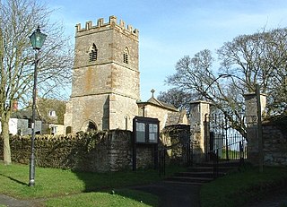
Turweston is a village and civil parish in north-west Buckinghamshire, England. The village is beside the River Great Ouse, which bounds the parish to the north, west and south. Turweston is the most northwesterly parish in Buckinghamshire: the Ouse here forms the county boundary with Northamptonshire to the north and west and Oxfordshire to the south. Across the river, the Northamptonshire market town of Brackley is just west of Turweston, with the town centre about 1 mile (1.6 km) west of the village. The parish has an area of 1,295 acres (524 ha) and had a population of 211 at the 2011 Census.

Wollaston is a village and civil parish in North Northamptonshire, England, about 3 miles (5 km) south of the market town of Wellingborough. The 2011 census recorded the population of the parish, including Strixton, as 3,491.

Staverton is a village and civil parish in the south-west of Northamptonshire, England. It is 2.3 miles west of Daventry, 7.9 miles east of Southam and 15.3 miles east of Leamington Spa. It straddles the A425 road from Daventry to Leamington. The Jurassic Way long-distance footpath between Banbury and Stamford passes through the village.

Charwelton is a village and civil parish about 5 miles (8 km) south of Daventry in Northamptonshire, England. The 2011 Census recorded the parish's population as 220.

Grendon or "Grenrian" as the locals call it, is a small village and civil parish in rural Northamptonshire, England, on the borders of Bedfordshire and Buckinghamshire. Many houses are made of the local limestone and various older thatched houses survive. The name of the village means "green hill" and today the village remains centred on the hill. As with Earls Barton, the village was owned by Judith, the niece of William the Conqueror.

King's Sutton is a village and civil parish in West Northamptonshire, Northamptonshire, England in the valley of the River Cherwell. The village is about 4.1 miles (6.6 km) south-east of Banbury, Oxfordshire.

Catmore is a civil parish and village in West Berkshire about 5+1⁄2 miles (9 km) southeast of Wantage. Catmore is in the Berkshire Downs and the centre of the village is about 575 feet (175 m) above sea level.
Ascott-under-Wychwood is a village and civil parish in the Evenlode valley about 4.5 miles (7 km) south of Chipping Norton, Oxfordshire, England. The 2011 Census recorded the parish's population as 560.

Quinton is a village and civil parish in West Northamptonshire, England. It is about 5 miles (8.0 km) south of Northampton town centre along the road from Wootton to Hanslope, near Salcey Forest.
Blakesley is a village in the West Northamptonshire, England. It is about 5 miles (8 km) west of Towcester. It is about 400 feet (120 m) above sea level according to Ordnance Survey. North-west of Blakesley, and now contiguous with it, is the hamlet of Quinbury End.
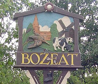
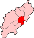
Bozeat is a village and civil parish in the postal district of Wellingborough, North Northamptonshire, England, about 6 miles (10 km) south of Wellingborough on the A509 road, near Wollaston. At the time of the 2011 census, Bozeat's population was 2,052.
Thenford is a village and civil parish about 5 miles (8 km) northwest of the market town of Brackley in West Northamptonshire, England, and 4 miles (6.4 km) east of Banbury in nearby Oxfordshire. The 2001 Census recorded the parish population as 74. At the 2011 Census the population of the village remained less than 100 and is included in the civil parish of Middleton Cheney.

Drayton St. Leonard is a village and civil parish on the River Thame in Oxfordshire, about 8 miles (13 km) southeast of Oxford.
Greatworth is a village in the civil parish of Greatworth and Halse about 4 miles (6.4 km) north-west of Brackley, West Northamptonshire, England. The parish also includes the hamlet of Halse. In 2011, the settlement had a population of 708. The 2011 Census recorded the parish population as 890.

St Margaret's Church is an Anglican church in the Ifield neighbourhood of Crawley, a town and borough in West Sussex, England. It is the ancient parish church of the village of Ifield; the medieval settlement was expanded to form one of the New Town of Crawley's 13 neighbourhoods, and the church's modern parish now serves several other neighbourhoods as well.

St Michael and All Angels Church is a church in Lowfield Heath, a depopulated former village in the Borough of Crawley, West Sussex, England. Built by the Gothic Revival architect William Burges in 1867 to serve the village, it declined in importance as Lowfield Heath was gradually appropriated for the expansion of London Gatwick Airport and of its related development. The last Anglican service was held there in 2004, but the church reopened in 2008 as a Seventh-day Adventist place of worship. The building has Grade II* listed status, which identifies it as a "particularly important building of more than special interest" and of national importance. It is also the only building remaining in the former village from the era before the airport existed: every other structure was demolished, and the church now stands among warehouses, depots and light industrial units.
Radstone is a hamlet and civil parish in West Northamptonshire, about 2 miles (3 km) north of Brackley. The 2001 Census recorded a parish population of 54. At the 2011 Census the population of the hamlet remained less than 100 and was included in the civil parish of Whitfield.
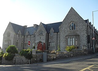
Citibase Brighton is a complex of serviced offices on a prominent elevated position in the Round Hill area of Brighton, part of the English city of Brighton and Hove. The large Gothic Revival building, by two architect brothers from London, has had three greatly different uses since its construction at the edge of Brighton parish in 1854: for its first 85 years, it trained Anglican schoolmistresses; then it became a military base and records office; and in 1988 it opened as a multipurpose business centre and office complex. The elaborate flint exterior is finely detailed in the Gothic style, especially around the windows. English Heritage has listed it at Grade II for its architectural and historical importance.

St Leodegar's Church is the Anglican parish church of Hunston, a hamlet in the Chichester district of West Sussex, England. The dedication—rare in England and unique in Sussex—has also been spelt St Ledger historically. A ruinous church dating from the 12th century was dismantled and rebuilt by prolific ecclesiastical architect Arthur Blomfield in 1885, but some old features were retained. The building, an Early English Gothic Revival structure of stone, was criticised by architectural historian Nikolaus Pevsner but was built on a "generous" budget and has some elaborate structural features such as a double belfry.

St Giles' Church is the parish church of Skelton, a village in the rural northern part of the City of York.